SORRY, THIS PROPERTY HAS BEEN SOLD!
Enormous 36 acre tract located just a few miles from Bryant Creek in Ozark County, Missouri. This private acreage is located between the towns of Ava, West Plains and Gainesville, Missouri.
This wooded tract has County Road frontage along its entire east side, power DIRECTLY on the property, excellent views and dozens or private sites for building, camping and hunting. A named creek (Hurricane Creek) runs directly across the property. Hurricane Creek flows into Bryant Creek, just a couple of miles to the east. Bryant Creek is one of the most popular rivers/creeks in the Ozarks for fishing, floating, swimming and canoeing.
Hurricane Creek itself is a very small creek and is not a “year around” creek, although it may have pools of water in it throughout the year.
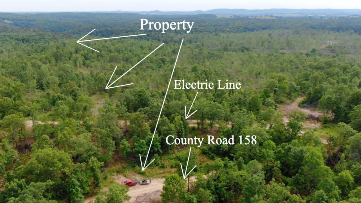
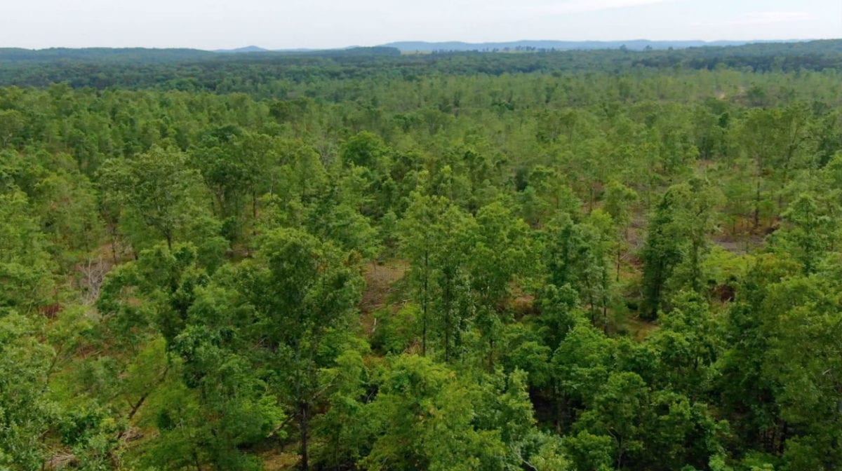
This huge private tract is 36 acres in size. In the aerial photo above we are looking southwest over the property. The truck is parked on the property, just off of the County Road. A couple of hundred feet behind the truck you can see the power line which runs directly across the property, giving you access to power if you ever need it.
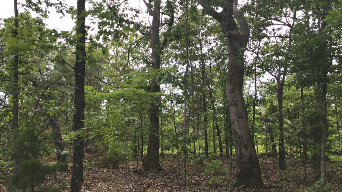
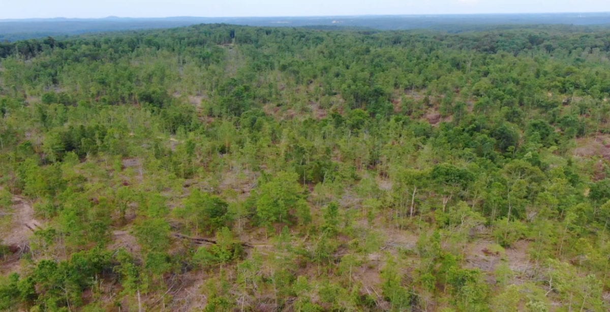
This property was logged within the last year but it was not “clear cut” and there are thousands of trees remaining. The aerial video, ground video and pictures in this listing are very recent and they do show the property accurately.
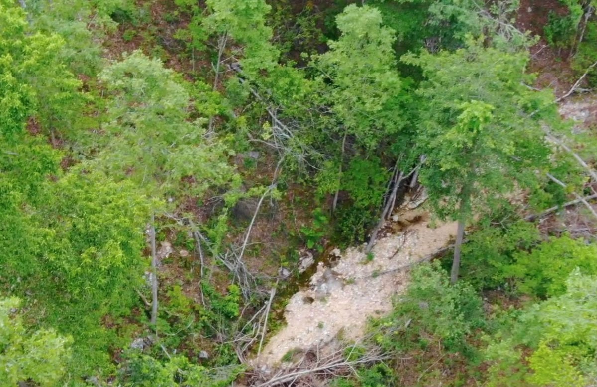
In the aerial photo above we are looking down on Hurricane Creek. It is a true Ozark creek with a mixture of rock and gravel base. Although it does not flow year around, it may have pools of water in it throughout the year. In this photo it actually appears as though the creek has some water flowing through it, along the side of the gravel. As you may know, it is very hard to find land with a named creek/creek bed on it!
The sales price on this 36 acres is $64,500. With $500 down the monthly payments will be $680. This is about a 15 year payment schedule and an annual interest rate of 9 3/4%. With $1,500 down the interest rate drops to 7 3/4% and the payment drops to $595 a month. With $2,500 down the interest rate drops to 6 3/4% and the payment drops to $550 a month. With $5,000 down the interest rate drops to 5 3/4% and the payment drops to $495 a month. These payments are all based on about a 15 year payment schedule. Property taxes are only about $85 a year and are current. There are no prepayment penalties, no hidden fees and no balloon payments.
PLEASE NOTE that you have a full 12 months to ADD to your down payment in order to reduce your interest rate and payment amount!
On this listing page you will find numerous videos, maps and pictures of the property. To explore the property and the area please check out the interactive map below!
Please refer to the interactive map above for additional property views and information. Please note that the boundary lines and measurements are approximate. This interactive map is fairly new for us and if you have a chance we would love to have your feedback on it. Is it awesome? Is it great? Is it confusing? We would like to know!
Also, please note that on the interactive map it seems to work best if you click the “View Full Screen” option. Once you are in the “Full Screen” option you can select “Topo” to see a topographic map which does a good job of showing how the property is situated.
We can actually email you a link for this specific “MapRight” interactive map of the property. You just need to download the free “MapRight” app to your phone or tablet and then we can email you the link for this specific map. This is VERY nice for driving to the property as you will know right where you are as well as where the property boundaries are located. If you download the free app and we email you the link, then not only will you have the interactive map on your phone or table, but there will be a colored dot to indicate right where you are. It is VERY useful the first time you drive to the property and also for exploring the property. You MUST download the free “MapRight” app and then contact us to email you the link for this specific map, otherwise the colored dot will not appear on your map and it will be much less useful when visiting the property.
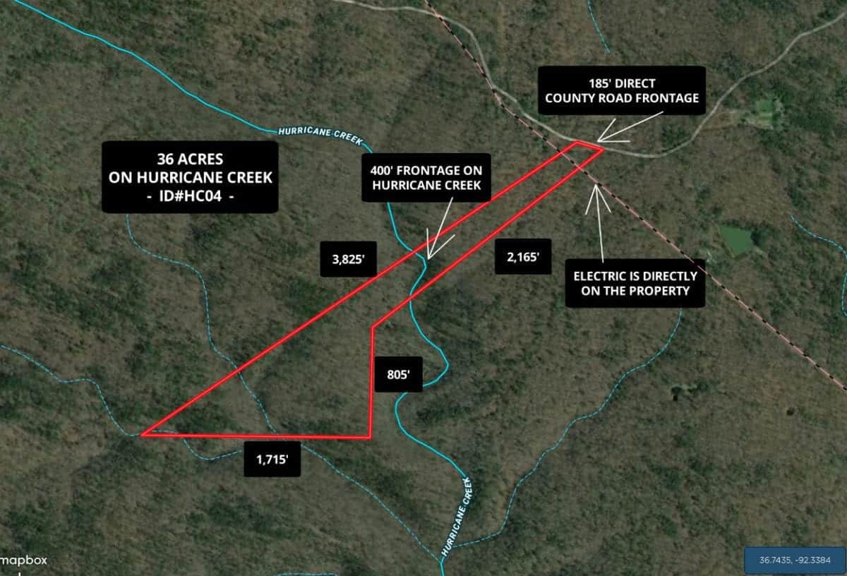
This aerial map above shows the approximate dimensions of the 36 acres, which is Tract 4 at “The Tracts At Hurricane Creek”. This large acreage borders the county road for about 185 feet along its entire east side. You are welcome to create a private driveway coming off of the county road. You will find several trails on this large tract but in order to really improve the value of the property you could create a new trail leading from the county road back toward the west end of the property.
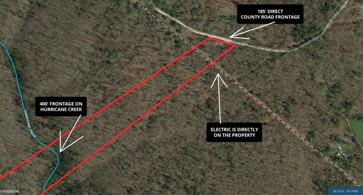
Although this tract could be excellent for hunting, camping and recreation it can also be used for building a home or a cabin, as electric is already directly on the property (shown as the dashed line on the map above). As you can see on the maps, Hurricane Creek flows directly across the property and you actually own BOTH sides of the creek bed.
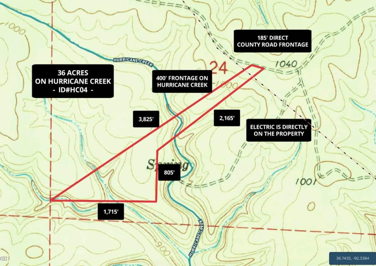
The topo map above shows how the property lays. It is the highest on its east side by the county road. As you go to the southwest from the county road the land stays fairly level for several hundred feet, it then slopes down (steeply in some areas) as you move toward the creek bed. As you continue west across the creek bed the land slopes back up and then it levels off toward the middle, with a very large flat area. It then slopes down again to another creek bed (un-named creek bed) and then rises up one last time, leveling off at the west end.
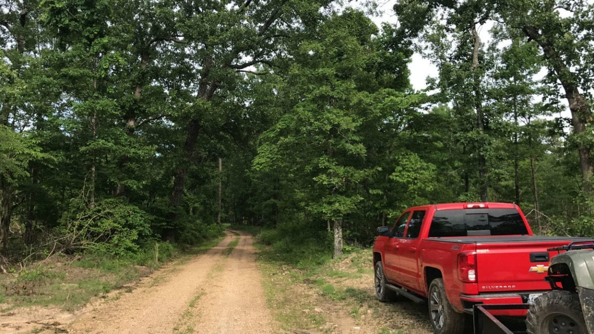
In the photo above we are parked on the property and looking east down the county road.
This tract is part of a very small rural development called “The Tracts At Hurricane Creek”. There are only about 8 tracts in this small development and this is Tract #4. These tracts were logged within the last year and although they were not “clear cut” there are quite a few open areas on the property. See the very recent drone video and ground video in this listing to see exactly how the property looks.
As these tracts have been recently logged we have reduced the purchase price well below what it would be if the property had not been logged. The fact that the tracts have been logged actually opened up some stunning views that were not available prior to the logging. It also opened up several areas that could be turned into pastures, gardens or huge open areas for building and camping. Also, the thousands of mid-sized trees on the property will now grow VERY quickly as they no longer have to compete with the larger timber for sunlight and resources.
This huge property could be amazing for hunting and recreation. This tract has lots of potential!
There are multiple areas on the property that could be suitable for building, camping or hunting.
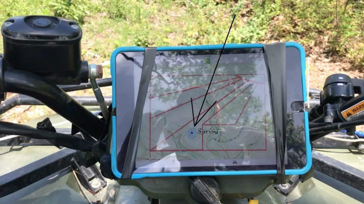
Pictured above is how we use the MapRight app to navigate a property this large. The colored dot indicates right where you are, which makes it easy to explore the property. – If you download the MapRight App (free app) then we can email you the specific link for this tract and you will be all set!
This property is private and secluded with an amazing amount of wildlife. On the property you can expect to find large whitetail deer as well as numerous wild turkeys.
To see an aerial video of the 36 acres at Hurricane Creek please click on the video below:

Owner Financed Land For Sale – 36 Acres on Hurricane Creek in MO – InstantAcres.com – HC04
In the second video below, we use our interactive map software to show the property and surrounding area:

Video Intro HC04
In the video below, we explore the property on foot:
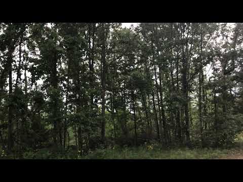
Video Ground HC04
Please click on the photos on the right side of the screen to enlarge them and to get a short description of each photo.
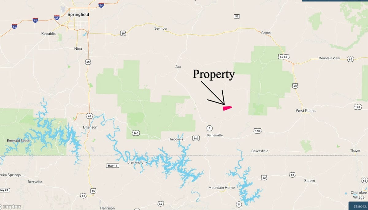
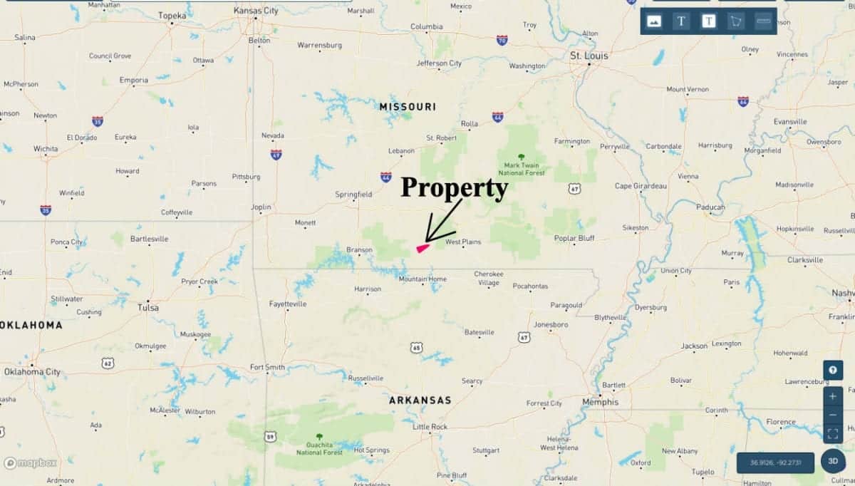
The map above shows the location of the property, within the heart of the Ozarks. Excellent location, about 1 1/2 hours to Springfield, Missouri (largest city in southern Missouri) and even closer to Branson, Missouri. Also only about half a day’s drive to Kansas City and even closer to St. Louis.
This 36 acre tract represents an excellent opportunity for building a home or cabin as there are no building permits required in this area. You and your friends/family can build your own cabin without permits or inspections.
This tract is part of a rural development and is subject to the 6 basic restrictions as shown on our website (no mobile homes, etc.). Homes or cabins built on the property must have a minimum concrete foundation size of 600 square feet (a simple 20 X 30 cabin would meet this requirement).
To see the standard Deed Assurances please click here.
This 36 acres could be great for camping, hunting, building, recreation, or all of the above!
This large tract is a nice mixture of wooded areas and open areas. After just a couple of years the limbs left by the loggers will have rotted away, which can improve the value of the property. In the meantime, you can purchase it at a discount because of the recent logging.
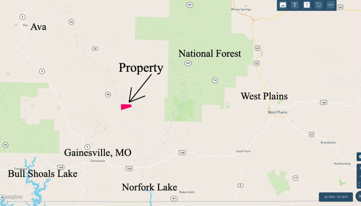
The map above shows the location of the property within the Ozarks. Ava, Missouri is about 20 miles northwest, West Plains, Missouri is about 20 miles east and Gainesville, Missouri is about 15 miles south. Within about 20 miles you will find two of the most popular lakes in the Ozarks (Bull Shoals Lake and Norfork Lake).
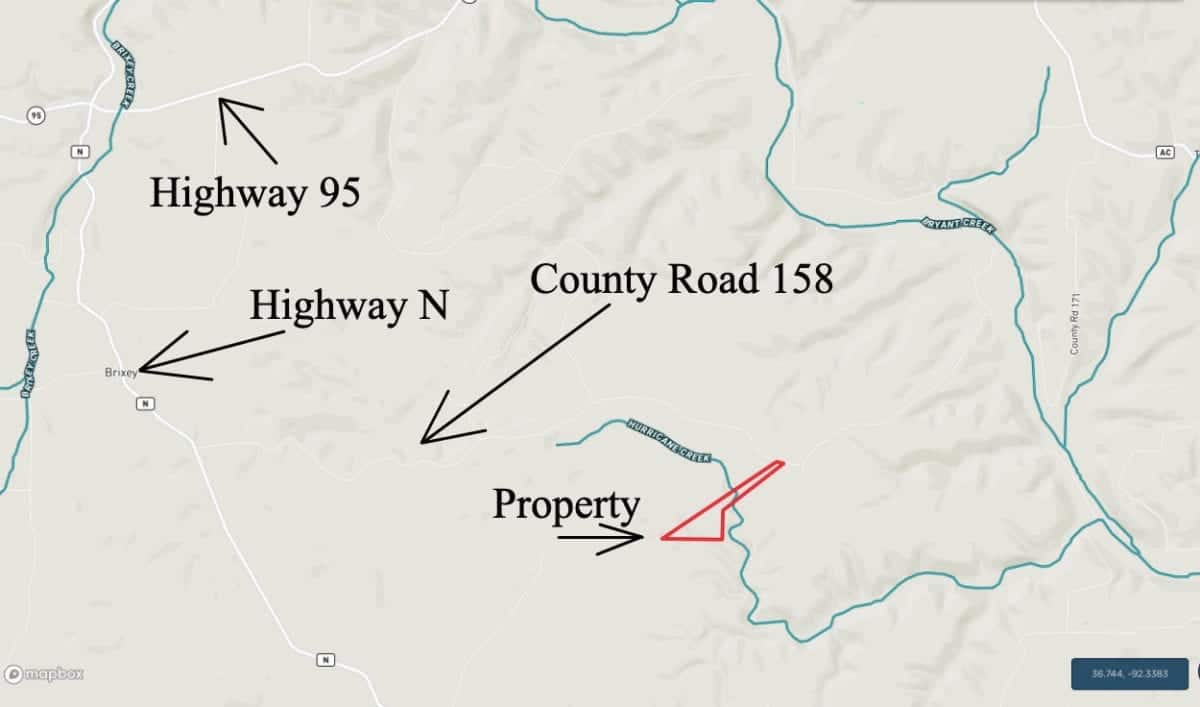
Directions to the property: To get to the property from Springfield, Missouri you will go east on Highway 60 to the town of Mansfield. Then, go south on Highway 5. You will pass through the town of Ava along the way. Go a total of about 30 miles on Highway 5 and then go east onto Highway 95. Go about 9 miles east on Highway 95 and then go south onto Highway N. Now go a little over 2 miles on Highway N and look for County Road 158 going to the east (gravel road). Take County Road 158 to the east for about 3 1/2 miles and you will see the property on the right side (south side) of the county road.
Feel free to bring your four wheeler or your side-by-side as it will take you quite a while to explore this huge tract of land.
As we mentioned earlier, it will make your first trip much easier if you download the free “MapRight” app and then ask us for the MapRight Link for this tract (which we will email to you). Please call us in the office with any questions about this as it can be a little confusing, especially the first time you get it set up. – Even if you do not download the MapRight, you may want to at least print out the maps/directions from this listing prior to driving to the property.
This tract is well located within the very heart of the Ozarks. It is VERY private but is still within half-day’s drive to numerous large cities.
The sales price on this 36 acres is $64,500. With $500 down the monthly payments will be $680. This is about a 15 year payment schedule and an annual interest rate of 9 3/4%. With $1,500 down the interest rate drops to 7 3/4% and the payment drops to $595 a month. With $2,500 down the interest rate drops to 6 3/4% and the payment drops to $550 a month. With $5,000 down the interest rate drops to 5 3/4% and the payment drops to $495 a month. These payments are all based on about a 15 year payment schedule. Property taxes are only about $85 a year and are current. There are no prepayment penalties, no hidden fees and no balloon payments.
PLEASE NOTE that you have a full 12 months to ADD to your down payment in order to reduce your interest rate and payment amount!
The above payments are all based on about a 15 year payment schedule. Pay extra any time or pay off the property in full at any time with NO prepayment penalty.
In the aerial photo above we are over the southwest side of the property and we are looking northeast. The county road is way off in the distance. This is a large, private tract!
If this is the property for you then please choose your initial down payment amount in the box below and you can pay with any debit or credit card. Also please feel free to send us an email or give us a call and we can answer any questions or complete the transaction over the phone. Our number in the office is 417-882-3400 or you can reach us anytime by email at [email protected].


