
Large 58 acre tract available at ELK RIDGE! Great access, great views, great hunting, building and recreational opportunities. This development is prime hunting and recreational land with multiple areas on each tract for building and camping. Only a short drive from Eminence, Missouri, and thousands of acres of National Forest. The area is full of whitetail deer, turkey and is only a few miles west of where the Department of Conservation has released a large herd of elk! It’s centrally located with SO much to do in the area including trail rides, fishing and floating in the Current River and the Jack’s Fork River and so much more – this large tract is a rare find!
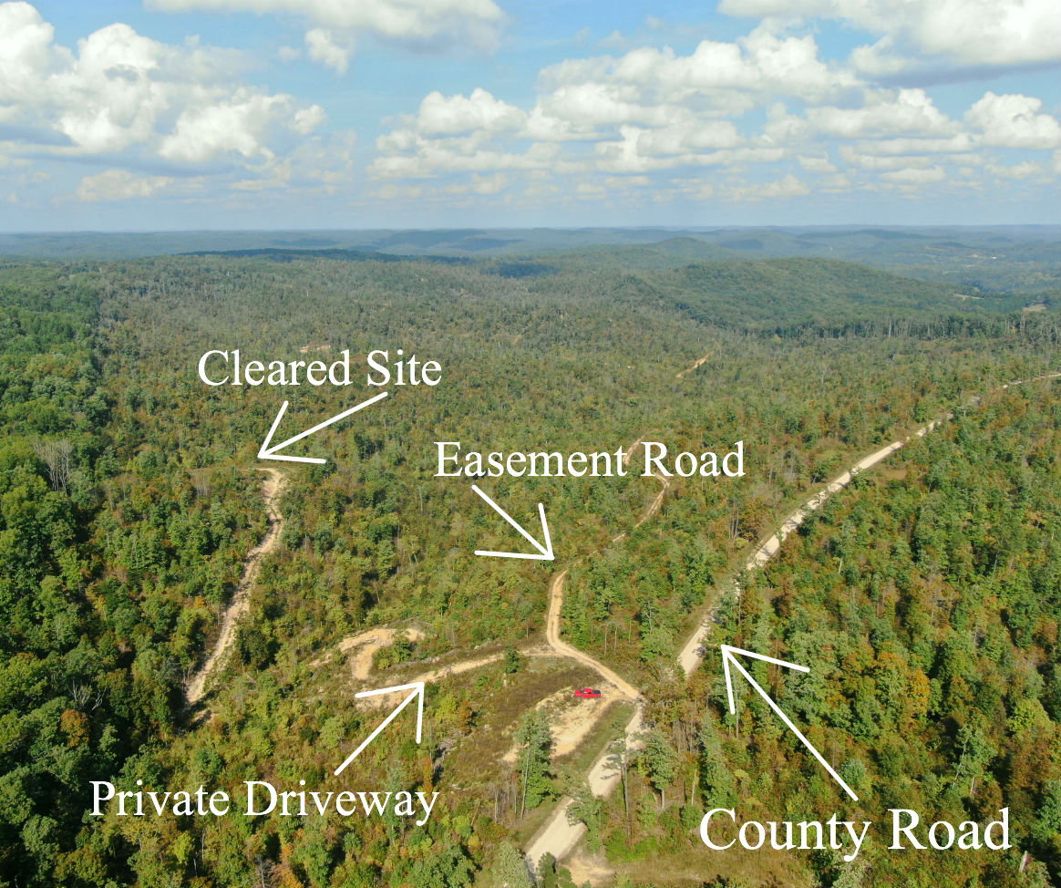
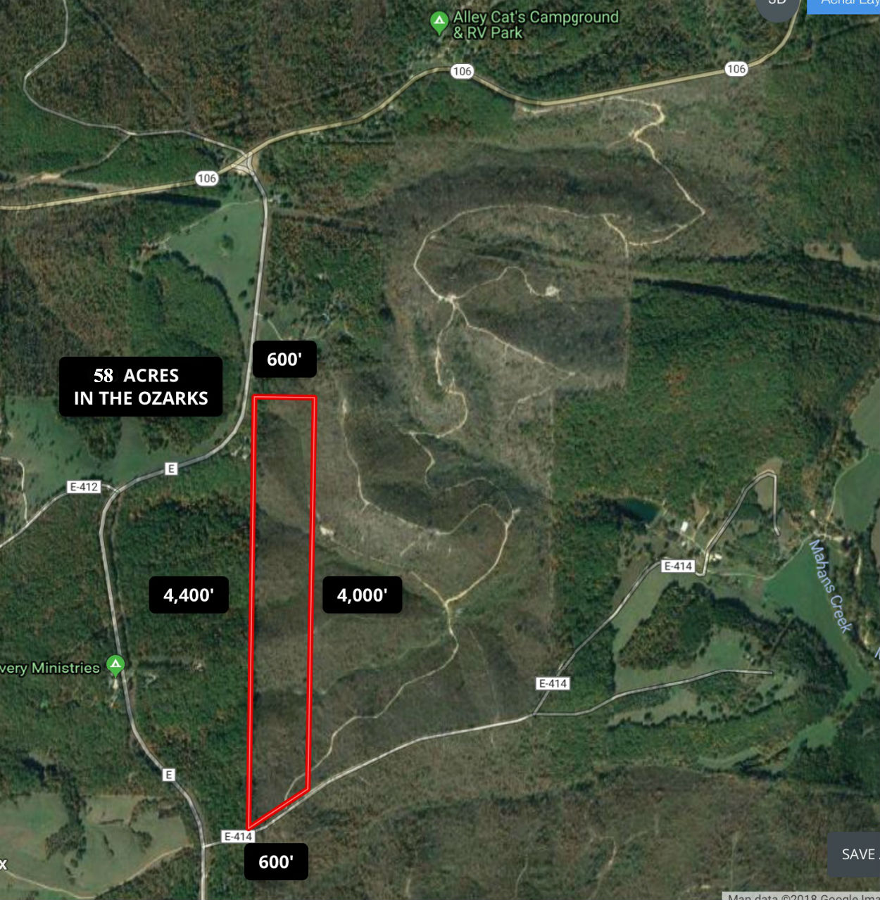
The aerial photo above gives you a great look at how the property is situated.
The full sales price for the entire 58 acre tract is $69,500. With $500.00 down the monthly payment will be $735 with an annual interest rate of 9 3/4%. Taxes are only about $85 a year and are current. There are no prepayment penalties, no hidden fees and no balloon payments.
Please note that a larger down payment will substantially reduce your interest rate and monthly payment amount. With $1,500 down your rate drops to 7 3/4% and your monthly payment drops to $640. With $2,500 down your rate drops to 6 3/4% and your payment drops to $595. With $5,000 down your rate drops to 5 3/4% and your payment drops to $540. Also please note that you have a FULL YEAR to add to your down payment in order to reduce your interest rate and payment amount!
In the video below we check out the 58 acres from the air with our drone:
If the video is not showing up please copy and paste the web address below into your browser.
Elk Ridge is limited to about 15 tracts so the area will never be crowded. There are miles of trails running through Elk Ridge which are ONLY for use of the property owners and their guests. Although EVERY tract at Elk Ridge does have frontage on a public road, each property owner has use of the existing network of trails to access different areas of their properties. These trails are for four wheelers, side-by-sides (Razors) and foot traffic. Electric/phone are on the north side of Elk Ridge and are also about 1/4 mile west of the south side of Elk Ridge. We had good cell service at the county road on the south side of Elk Ridge and on the higway on the north side of Elk Ridge.
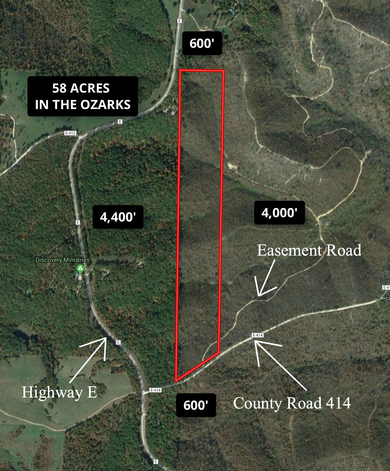
The photo above is an aerial of the 58 acres. It appears fairly long and thin but it is actually 600 feet wide, giving plenty of room for your choice of dozens of building and/camping sites. You can see one of the trails at Elk Ridge which starts near the southeast corner of the 58 acres. This trail goes down the hill to the east. These interior trails are NOT made for cars/trucks and are VERY rough. They are designed for four wheeler access or foot access. The interior trails are not public roads, they are only for the use of Elk Ridge property owners and their guests, making for a very private setting.
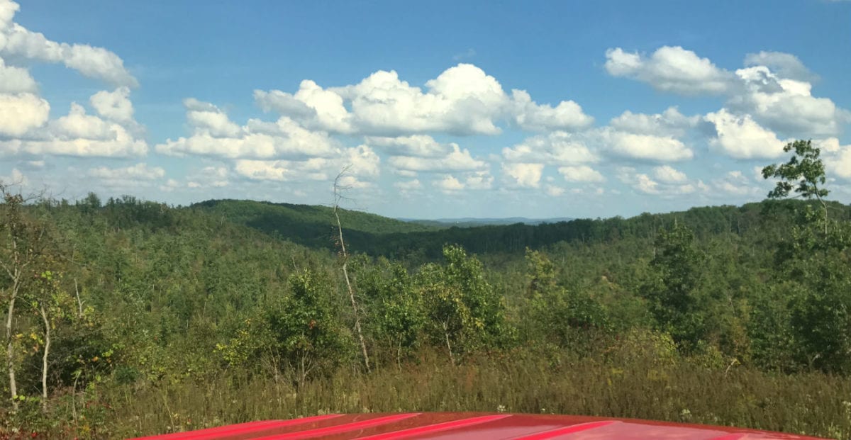
A view to the east from a private clearing on the property.
Please refer to our interactive map above for additional property views and information. Please note that the boundary lines and measurements are approximate. This interactive map is BRAND NEW for us and if you have a chance we would love to have your feedback on it. Is it awesome? Is it great? Is it confusing? We would like to know! Please keep in mind that most of the aerial maps are about 3-4 years old so they were taken pretty recently after the property had been logged (they are the newest maps we could get). Within those 3-4 years thousands of small trees have started/continued to grow and a recent aerial would reflect that fact and would show a lot more “greenery” (which you can see when you watch the recent drone video toward the top of the listing). Please note that on the interactive map it seems to work best if you click the “View Full Screen” option. Once you are in the “Full Screen” option you can select “Topo” to see a topographic map which shows how the property is situated. It slopes down off of the county road and then back up to a nice ridge, then back down and back up several more times as you continue to go to the north on the property.
The interactive map was created with a program called “MapRight”. If you download the free MapRight app to your smartphone or tablet then we can email you the link for this specific interactive map. This is VERY USEFUL when visiting the property because when you click on the link that we can email you (and then open the link within the MapRight app) then the Interactive Map will open on your device AND there will be a colored dot to indicate right where you are. It is useful for getting to the property and even more useful for walking around the property. We can help you with any of this as it can be confusing the first time you use MapRight.
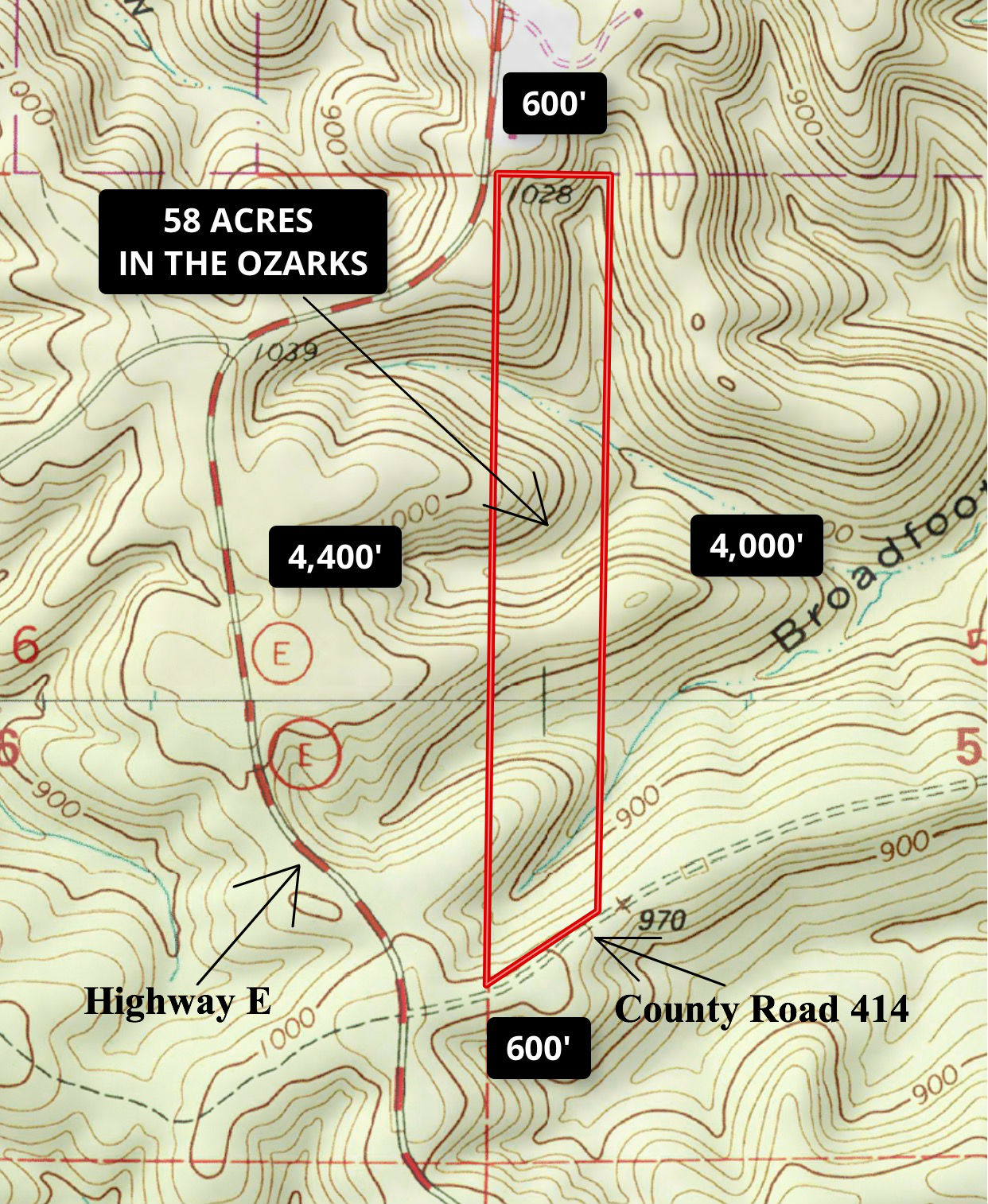
The above topo map shows how the property lays.

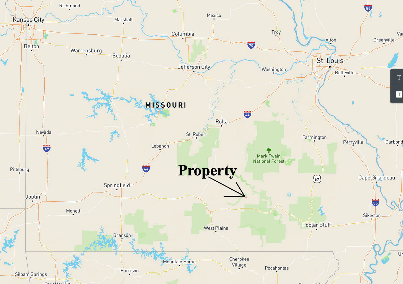
The map above shows the network of trails within Elk Ridge. These are not public roads, these are ONLY for the use of property owners and their guests. These existing roads can be used to access different areas of your property. These are VERY primitive roads (and they always will be). They are designed to be used for foot traffic, four wheelers or side-by-sides (Razors). These roads are permanent easements for property owners and their guests. When we were out at the property taking videos sections of the trails were VERY rough (we had a tremendous amount of rain just before taking the videos). Although we were able to make it through with a four wheeler, it was still pretty rough. The trail system connects to County Road 414 on the south end and goes all throughout the property finally connecting with Highway 106 on the north side of Elk Ridge. The property is located about 4 miles southwest of Eminence, Missouri. The property is private and secluded (with an amazing amount of wildlife) but is also within about 5 minutes of Eminence, Missouri. Even though this huge tract will keep you busy exploring, hunting and camping you may be interested to know that within 10 miles of the property you will find over 10,000 acres of National Forest and State Lands upon which you can also hunt, camp, trail ride and play!
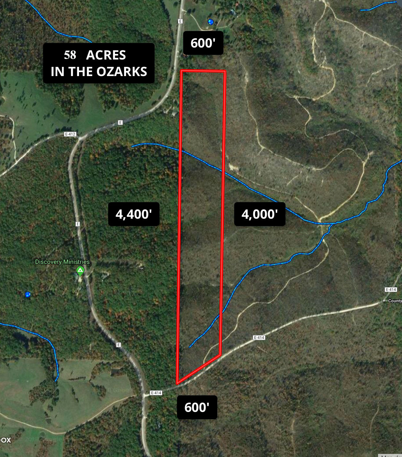
Aerial map showing the property andthe small creeks which can be found in the valleys on the property. These would likely be seasonal creeks.
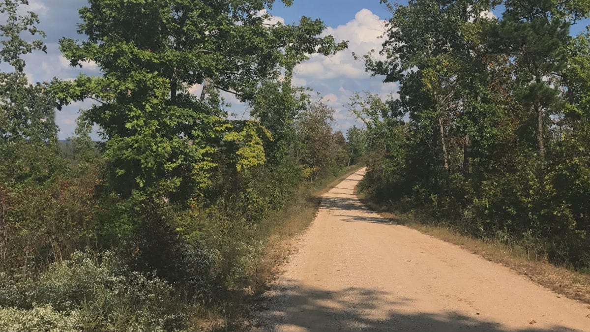
Looking east on County Road 414. The property is on the left side (north side) of the road.
The Property was logged about 4-5 years ago. It was logged heavily. Although there are a few larger trees left, much of the property is covered with thousands of young oak, pine and hickory trees (as well as many other species).
In the “overview” video below use our interactive map (MapRight), to check out the property and surrounding area:
If the video is not showing up please copy and paste the web address below into your browser.

Video Intro ID#ER01A
In this last video, we explore the property from the ground and check out the private driveway which leads to the cleared site:
If the video is not showing up please copy and paste the web address below into your browser.

58 acres in Missouri Ozarks for $500 down! Long private driveway! ID#ER01A
This tract is subject to the 6 basic restrictions as shown on our website (no mobile homes, etc.). Homes or cabins built on the property which are to be used as a residence must have a minimum concrete foundation size of 600 square feet (a simple 20 X 30 cabin would meet this requirement).
To see the standard Deed Assurances please click here.
The area is full of deer and wild turkey and even some elk sightings. Perfect for hunting and recreation!
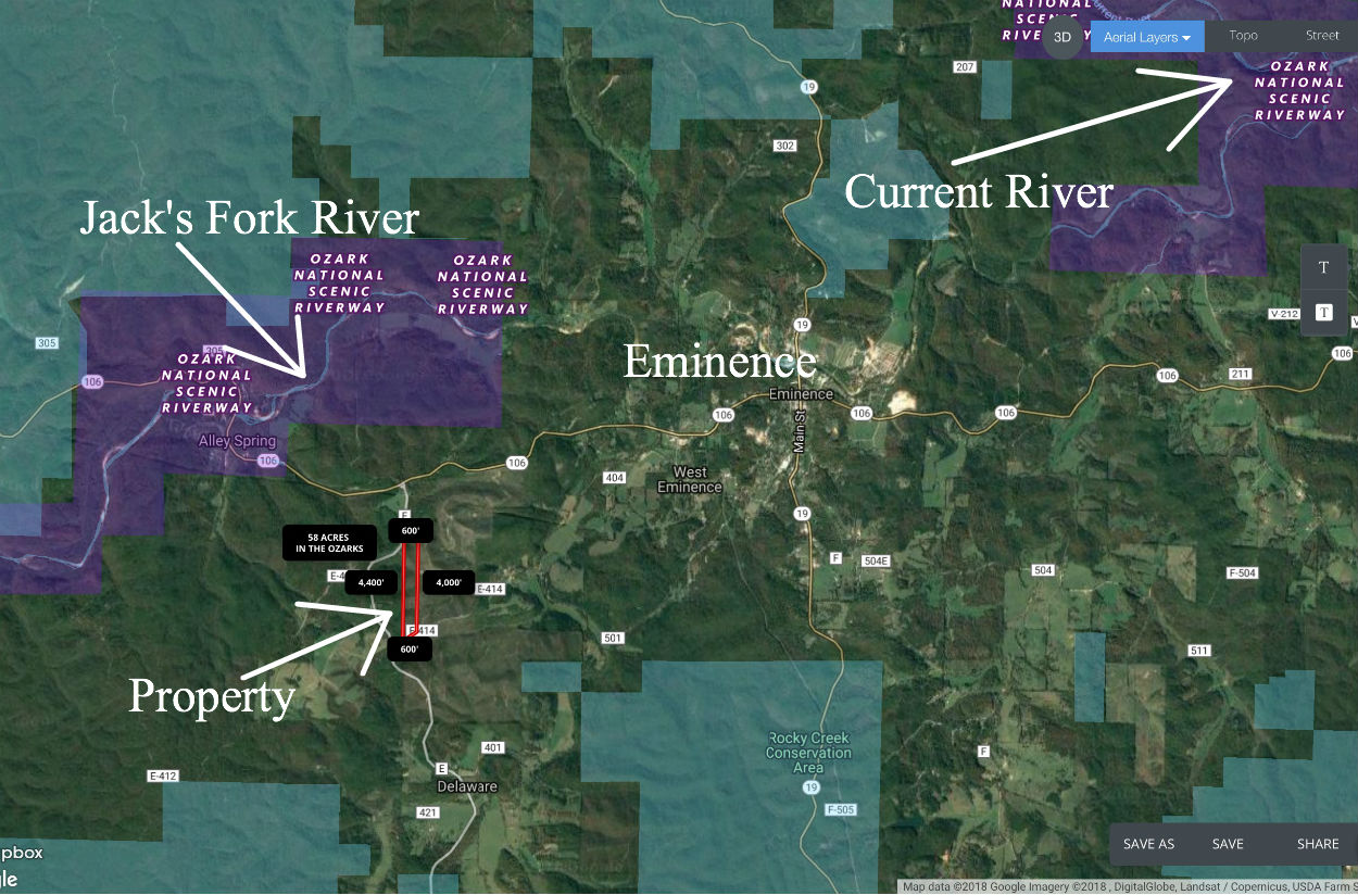
The map above shows some of the rivers as well as public land on the immediate area.
The property is in an excellent location, only a short drive from Eminence MO. The property borders a county maintained road along its entire south side so you can drive to the property all year around in basically any type of vehicle. The well known Jacks Fork River is within about 3 miles of this property and is one of Missouri’s wildest and most scenic rivers. On the Jacks Fork River you will find excellent fishing (specifically small mouth bass but also many other species) as well as great areas for floating, canoing and kayaking.
![]()
In the photo above we are parked in the private clearing on the property.
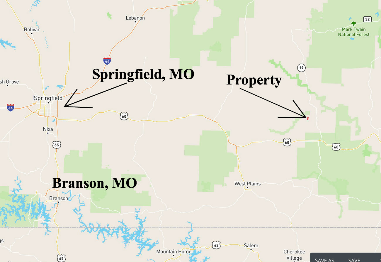
Excellent location in the heart of the Ozarks. Only about 1 1/2 hours to Springfield (which is the largest city in southern Missouri) and also close to Branson.
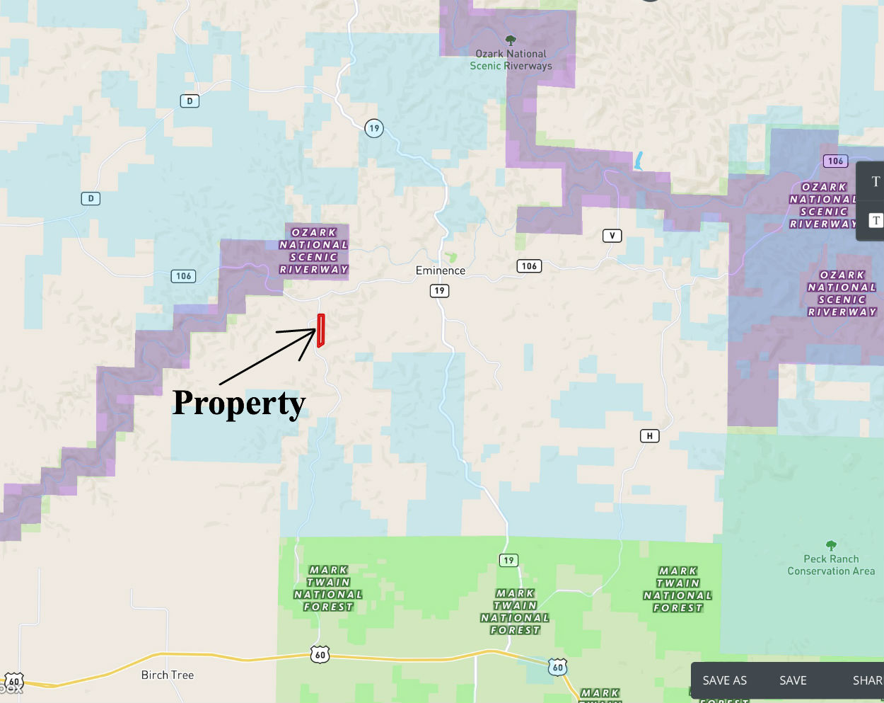
The shaded areas on the map above show some of the rivers and public land in the area. So much to do around here!
To get to the property from Eminence take Highway 106 to the west for about 3 miles then go south onto Highway E. Stay on Highway E for about 1.5 miles and then go east (left) onto Shannon County 414. Now go just a few hundred yards and you will see the property on the left side of the road. To get to the property from Springfield, Missouri just go east on Highway 60 to the town of Birch Tree. Keep going east past Birch Tree for a few miles and then go north (left) onto Highway E. Stay on Highway E for about 9 1/2 miles and then go east (right) onto Shannon County 414. Proceed a few hundred yards to the property which will be on the north side (left side) of the road. Shannon County Road 414 ends about a mile after the property making it a VERY private setting!
For an easier way (potentially) to get to the property, you can use your GPS to get to Crystal Creek Ranch which is nearby at Co Rd E-414, Eminence, MO 65466. Crystal Creek Ranch is just about 1 mile east of the property.
This 1000 acre ranch also offers a lot of activities, making a great added feature for nearby property owners! For more information you can visit: crystalcreekranch.com
This is a LARGE property so please be sure to print out the maps from this listing so that you can really explore the acreage. The drive may be a little tricky on your first visit but if you have all of the maps and directions it will make it much easier. We will be happy to email you the maps/directions if you would like, just let us know.
The full sales price for the entire 58 acre tract is $69,500. With $500.00 down the monthly payment will be $735 with an annual interest rate of 9 3/4%. Taxes are only about $85 a year and are current. There are no prepayment penalties, no hidden fees and no balloon payments.
Please note that a larger down payment will substantially reduce your interest rate and monthly payment amount. With $1,500 down your rate drops to 7 3/4% and your monthly payment drops to $640. With $2,500 down your rate drops to 6 3/4% and your payment drops to $595. With $5,000 down your rate drops to 5 3/4% and your payment drops to $540. Also please note that you have a FULL YEAR to add to your down payment in order to reduce your interest rate and payment amount!
If this is the property for you then please choose your initial down payment amount in the box below. Also please feel free to give us a call and we can answer any questions or complete the transaction over the phone.


