SORRY, THIS PROPERTY HAS BEEN SOLD!
It truly is hard to put into words just how special this property is…
Bryant Creek is one of the most popular rivers/creeks in the Ozarks for fishing, floating and canoeing. It is VERY hard to find property with ANY direct frontage on the Bryant Creek. We know because we have been looking for years to find some! Not only does this property have about 275 feet of DIRECT Bryant Creek frontage, it also has frontage on Hunter Creek AND it contains the junction point of Bryant Creek and Hunter Creek which is simply one of the most beautiful areas we have ever seen.
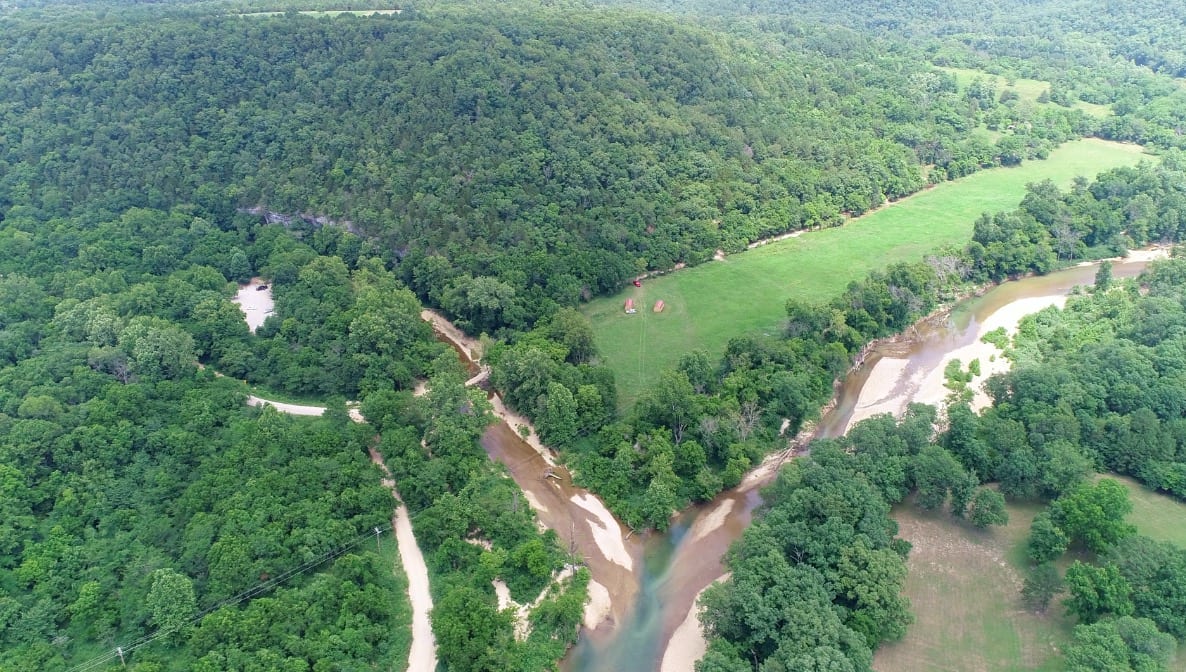
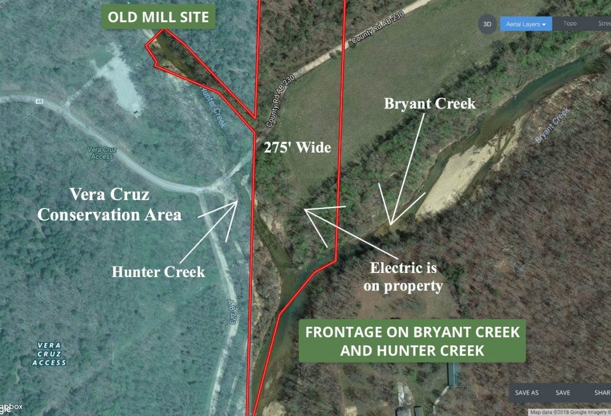
In the aerial photo (above) we are looking northerly over the property, which sits between Bryant Creek (on the right) and Hunter Creek (on the left).
This property was leased out for quite some time and we have now decided to put it on the market. In this listing you will see videos/pictures taken in the winter and videos/pictures taken in the summer. Most of the winter pics/videos were taken before the property had been leased out and most of the summer pics/videos were taken very recently.
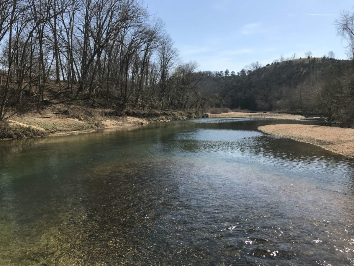
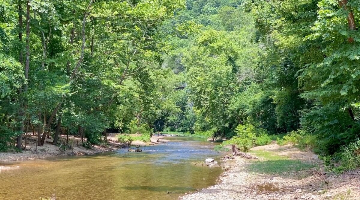
The winter-time photo above was taken directly on the property. We are looking south, on the left side of the photo is Bryant Creek and on the right side you can see Hunter Creek flowing into Bryant Creek.
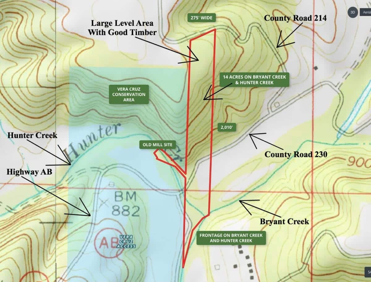
Now…in addition to the river frontage, this property DIRECTLY borders the Vera Cruz Conservation Area along most of its west side. The Conservation Area is about 80 acres in size and contains additional access points to the Bryant Creek as well as Hunter Creek. The Conservation Area also offers primitive campsites as well as bathrooms. Although you will find the hunting and fishing to be excellent on the 14 acres, the Conservation Area is open for hunting, fishing and camping as well.
We’re still not done…many, many years ago there was a mill on Hunter Creek and a large stone dam over the creek that would be used to power the mill. At the east side of the dam there was a “mill race” which was basically a large sluice which the additional water would run through. Although you can’t see the original mill, you can still see the rock/concrete “mill race” which extends to Hunter Creek. This 14+ acre tract INCLUDES the area around the old “mill race” which apparently was not turned over to the State when the Vera Cruz Conservation Area was developed. You can still see the old concrete walls of the mill race extending out from the west side of the property into the Conservation Area (see the map for a better idea of this). Very cool.
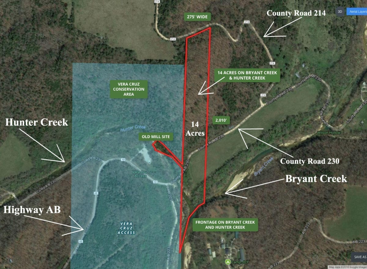
The aerial map above shows the property’s boundaries as well as the approximate dimensions. The Vera Cruz Conservation Area is outlined shaded in green. For more detail see the “close-up” aerial map farther down in this listing.
TERMS OF SALE
The full sales price for this absolutely unique 14.07 acre tract of river-front land with County Road access and power ON-site is $229,500 and we offer INSTANT owner financing with just $2,500 down.
With your $2,500 down payment you will automatically get our reduced interest rate of 6 3/4% and the monthly payments will be $2,018.75. This is about a 15 year payment schedule and an annual interest rate of 6 3/4%.
With a $5,000 down payment the interest rate drops to 5 3/4% and the payment drops to $1,874.28 a month. These payments are all based on about a 15 year payment schedule. Property taxes are only about $120 a year and this is already included in the monthly payment amount(s). There are NO prepayment penalties and NO hidden fees.
PLEASE NOTE that you have a TWELVE MONTHS to ADD to your down payment in order to reduce your interest rate and payment amount! We want to give ALL of our buyers the opportunity to achieve the lowest interest rate and payment amount possible!
ALSO, if you pay off your property (your loan to us) at any time within the next 5 years you will get a 10% DISCOUNT off of the purchase price of the property! On this property that would save you $22,950 for an early payoff!
STILL not done…On November 7th, 1862 a Civil War Battle took place just to the north/east of the 14 acres. It was called the Battle Of Clark’s Mill (you can google it to find out all of the information). The actual Core Battlefield Area (where the fighting took place) appears to be just a few hundred feet from the property and the property itself is apparently located within the Battlefield Study Area (where artifacts from the battle can be found).
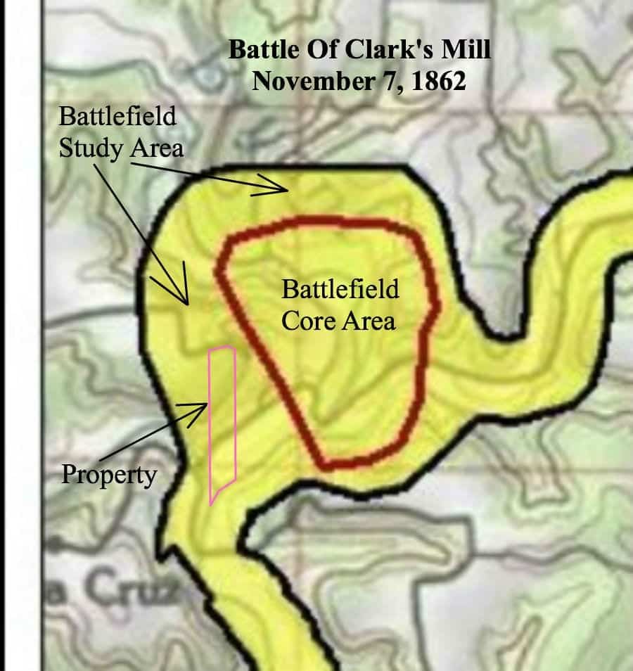
The map above appears to show the approximate location of the Battle of Clark’s Mill. We have outlined the location of the 14 acres on the map. Feel free to bring your metal detector and see what you can find! We located this map online from an organization that studies Civil War Battles. We have since heard that the battle was about 1/2 a mile north of what is shown on this map. Either way, there were definitely troops coming through this area as they would have been VERY interested in the mill. In fact, the entire area around this property used to be the town of Vera Cruz, Missouri and was once the county seat of Douglas County.
Of course, this 14 acres also has big mature timber, county road frontage, power and phone on site, a beautiful open meadow and views for miles. Yup, this is a nice one.
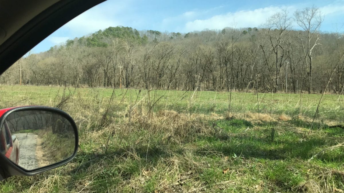
In the winter-time photo above we are parked in the open meadow on the south side of the property. We are looking north across County Road 230 to where the land begins to rise up.
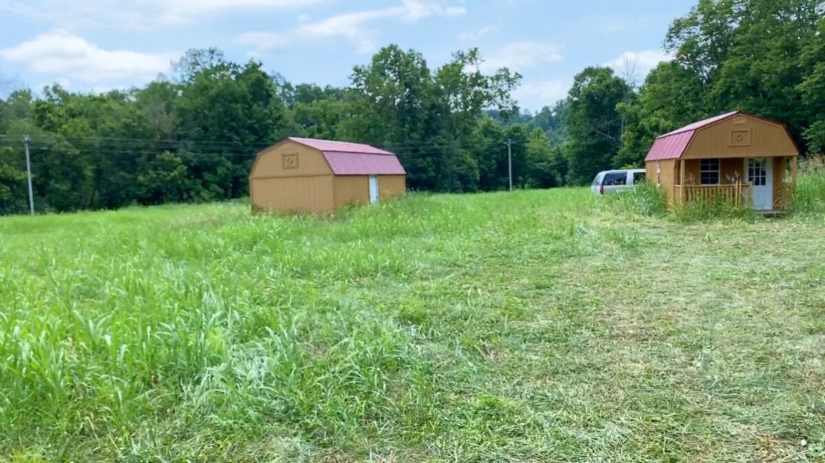
You may notice in a couple of the videos that when the videos were taken there were two portable buildings in the meadow on the property. These little buildings were owned by the person who was leasing the property and they have now been removed from the property.
The topo map above shows the terrain on the property. It is basically flat on the south side of County Road 230, going to the Bryant Creek. On the north side of County Road 230 it rises up sharply and then levels off again on the north side of the property. The property has frontage on County road 214 along its north side BUT you would need to have a driveway cut in on the north side in order to drive onto the property there, as it sits several feet above the road. The land south of County road 230 is in the flood zone (like basically all open meadows adjacent to a major river/creek). Although you can build in the flood zone you would need to elevate your structure substantially.
The photo above shows a close-up look of the south side of the property. Just north of County Road 230 on the east side of the property there is an area where you could potentially build a home/cabin and be out of the flood zone. As you go north from this potential building site the land rises up steeply. There are multiple building sites on the north side of the property but keep in mind you will have to have a driveway cut in to access the north end with a vehicle. The map above also shows the old “mill race” which extends west to Hunter Creek.
Please refer to our interactive map above for additional property views and information. The property boundaries are approximate but it should be very helpful for exploring the property. The property has been surveyed with the corners marked.
To read a detailed description about how to use the free “MapRight” app to locate the property as well as the property’s boundaries, please click on the link below:
Click Here To See A “MapRight” Tutorial
You may want to download the “MapRight” app to your phone or tablet before you visit the property, as it will make things go smoothly on your first trip (just follow the directions in the tutorial).
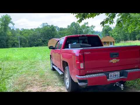
Below we have numerous videos of this special property. Some of the videos were taken a couple of years ago (before the property was leased out) and some of the videos were taken very recently. We decided to just put all of the videos into the listing so that everyone could get a good look at this acreage:
Click on the video below to see a drone video of the property:

Owner Financed Waterfront Acreage for Sale in Missouri Ozarks! InstantAcres.com – ID#BC01 – 14 Acres
Click on the video below to see an introductory video to the 14 acres. This video was done before the property was leased out and I believe we mention in the video that there is no driveway/approach on the north side of the property. Well, there now IS a culvert/approach and a driveway that goes onto the north side of the property! Still a useful video…

Owner Financing on 14 acres ON Bryant Creek in Missouri Ozarks! – ID#BC01 – www.InstantAcres.com
Click on the video below to see a video showing the drive into the property as well as part of the south side (the portable buildings have now been removed from the property):
Video Ground Drive and South Meadow to Creek 2020 Done
Click on the video below to see a winter-time video of the south side of the property, including the creeks:

Complete Owner Financing – 14+ Acres ON Bryant Creek in Missouri – www.InstantAcres.com – ID#BC01
Click on the video below to see a winter-time video of the north side of the property (taken a couple of years ago before the property was leased out, but still a good video):

Instant Owner Financing – North Part of 14 Acres on Bryant Creek – ID#BC01
We found one more video! In the video below we check out the north side of the property by pulling onto the private driveway:
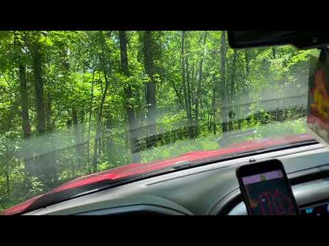
Video Ground BC01 North End with Driveway Done
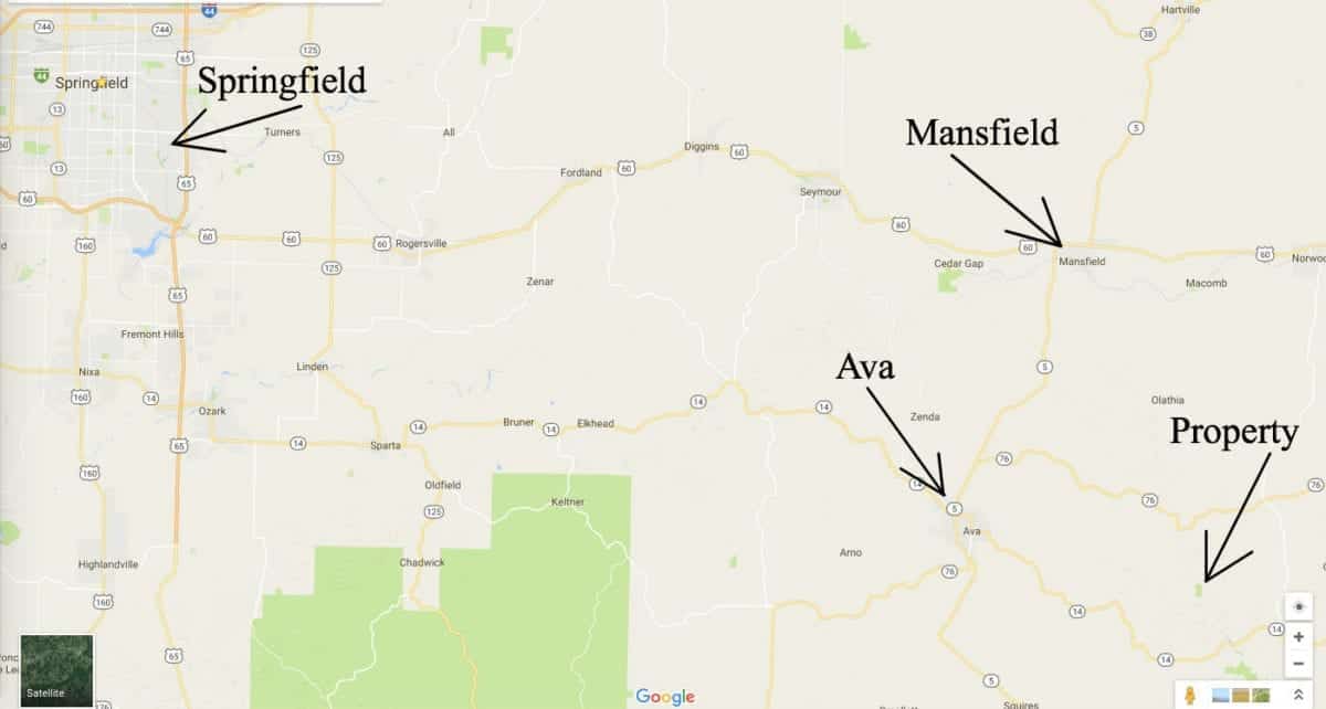
The property is centrally located in the Missouri Ozarks. It is just over an hour to Springfield which is the largest city in southern Missouri. Also, you will find over 10,000 acres of National Forest in the area which can be used for hunting, camping and trail riding.
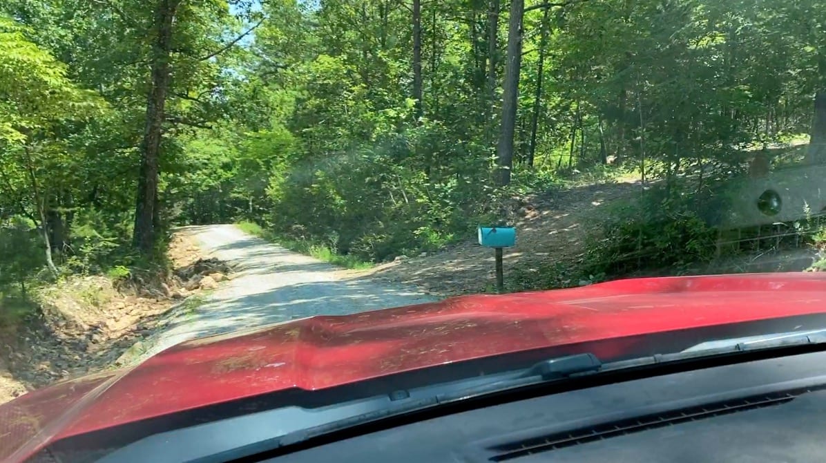
The photo above was taken while looking east on the County Road which borders the north side of the property (the land is on the right). You can see a mailbox as well as an approach/driveway which leads into a clearing on the north side of the property.
This tract is subject to the basic Property Covenants as shown on our website (no mobile homes, etc.). Homes or cabins built on the property to be used as a residence must have a minimum concrete foundation size of 600 square feet (a simple 20 X 30 cabin would meet this requirement).
To See The basic Property Covenants Please Click Here
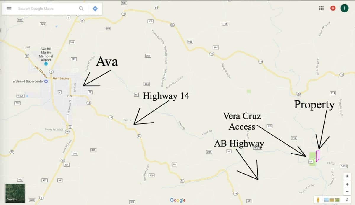
To get to the property from Springfield, Missouri go east on Highway 60 to the town of Mansfield. Then go south on Highway 5 to the town of Ava. From Ava, go east on Highway 14 for about 9 miles and then go left on “AB Highway”. Stay on AB Highway for about 3 1/2 miles and at the bottom of the hill the highway will turn to gravel and you will immediately come to a fork in the road. You are now in the Vera Cruz Access Area. Go left at the fork and you will cross an old concrete bridge which goes over Hunter Creek, you are now on County Road 230. As soon as you go a few feet past the bridge you will be on the west side of the property. If you look to your left you will see the old “mill race” which extends to Hunter Creek. To get to the north side of the property continue going east on County Road 230 for roughly 1/4 mile and take your first left (this will be County Road 214). County Road 214 winds its way up the hill to the north side of the property.
Please feel free to go and check out the property. Feel free to bring your fishing pole and your four wheeler!
In the photo above we are looking north up Hunter Creek. The property is on both sides of the creek and in this location is it surrounded by the Conservation Area. If you look REALLY closely at the left side of Hunt Creek you can see part of the concrete wall that formed the Mill Pond at the old mill (this is part of the property).
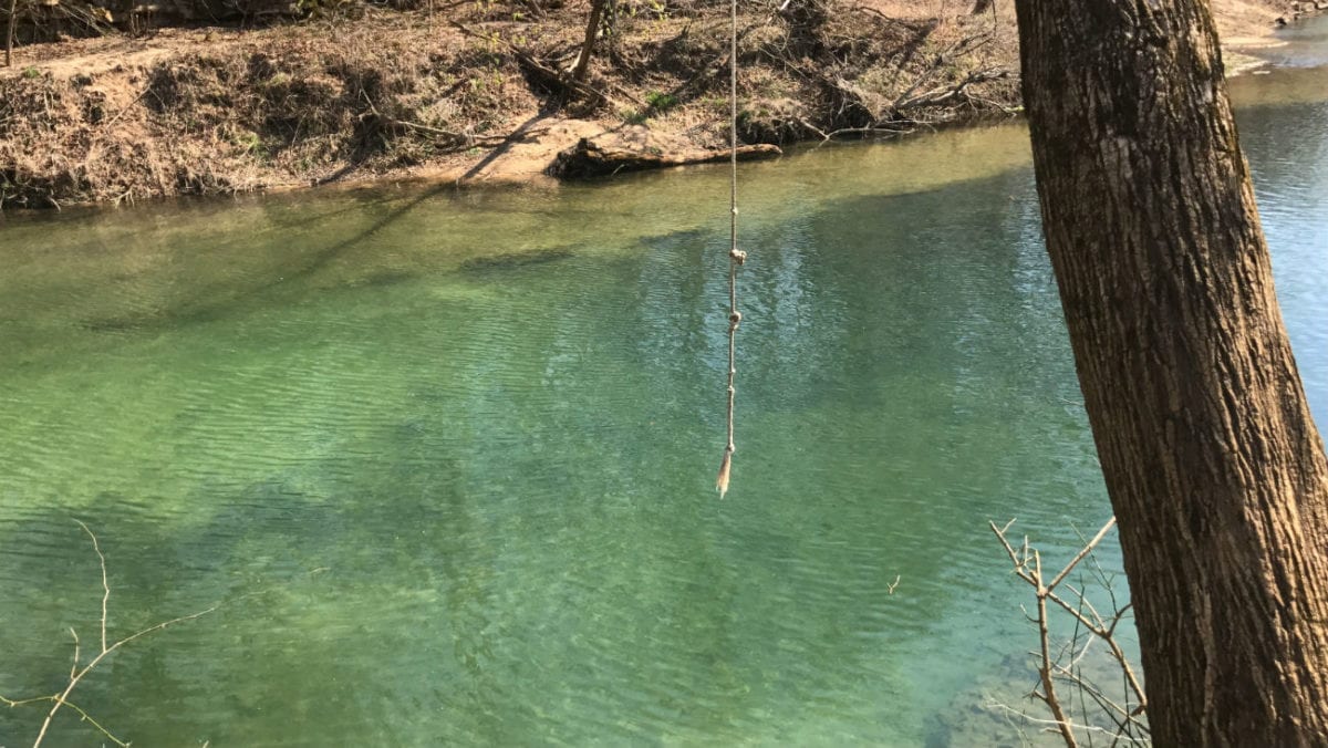
In the photo above we are standing on the property looking at Bryant Creek. The rope swing looks fun! The water is so clear in this spot that you can stand on the bank and count the fish.
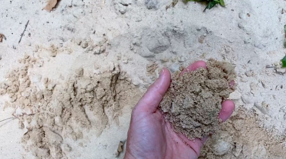
We did not expect to see pure sand in the Ozarks! This photo was taken just south of the meadow on the property. You’ve got your own private beach!
TERMS OF SALE
The full sales price for this absolutely unique 14.07 acre tract of river-front land with County Road access and power ON-site is $229,500 and we offer INSTANT owner financing with just $2,500 down.
With your $2,500 down payment you will automatically get our reduced interest rate of 6 3/4% and the monthly payments will be $2,018.75. This is about a 15 year payment schedule and an annual interest rate of 6 3/4%.
With a $5,000 down payment the interest rate drops to 5 3/4% and the payment drops to $1,874.28 a month. These payments are all based on about a 15 year payment schedule. Property taxes are only about $120 a year and this is already included in the monthly payment amount(s). There are NO prepayment penalties and NO hidden fees.
PLEASE NOTE that you have a TWELVE MONTHS to ADD to your down payment in order to reduce your interest rate and payment amount! We want to give ALL of our buyers the opportunity to achieve the lowest interest rate and payment amount possible!
ALSO, if you pay off your property (your loan to us) at any time within the next 5 years you will get a 10% DISCOUNT off of the purchase price of the property! On this property that would save you $22,950 for an early payoff!
If this is the property for you then please choose your initial down payment amount in the box below (if it is still available) and you can pay with any debit or credit card. Also please feel free to send us an email or give us a call and we can answer any questions or complete the transaction over the phone. Our number in the office is 417-767-2223 or you can reach us anytime by email at [email protected].


