SORRY, THIS PROPERTY HAS BEEN SOLD!
It’s right around the end of the year and to make our Board of Directors happy we need to sell just a few more properties. If you’ve been waiting for the perfect time to grab a very special property then you may have just found it! The original sales price on this unique Bryant Creek property is $189,500. For a VERY LIMITED TIME we are offering a $60,000 price reduction which brings to TEMPORARY REDUCED SALES PRICE all the way down to $129,500! With our $1,500 Down Payment option you will receive our reduced annual interest rate of 7 3/4% and the payment will be $1,214.84 a month.
Read the “Terms Of Sale” a little further down in this listing page for more details and to see how you can get an even lower interest rate!
Please Note – This property had been leased out for quite some time and we have now decided to make it available for sale. In order to update this listing page we recently visited the property and we got several “updated videos” which we have added below (within this grey box).
The remainder of the listing page (after this grey box) is pretty much the same as it was when the property was originally leased out, several years ago. We left most of the “original” listing because it does contain some cool videos as well as some useful maps and information. As always, we want to give our customers every bit of available information we have on a property!
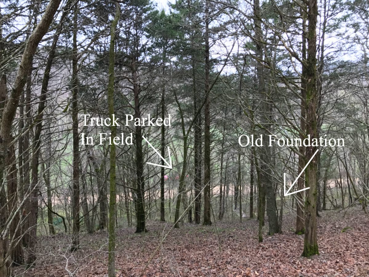
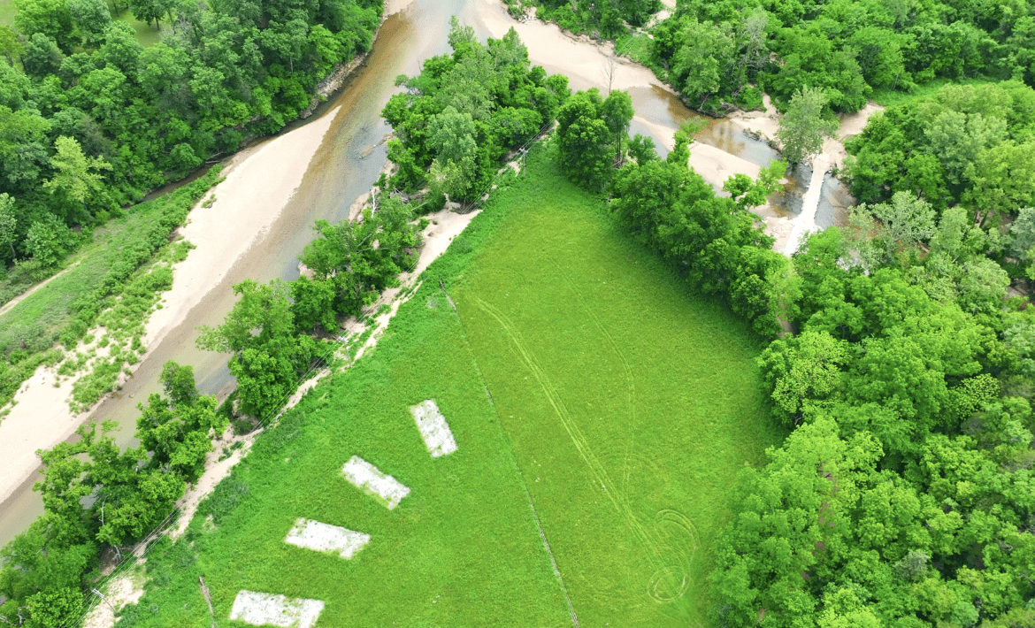
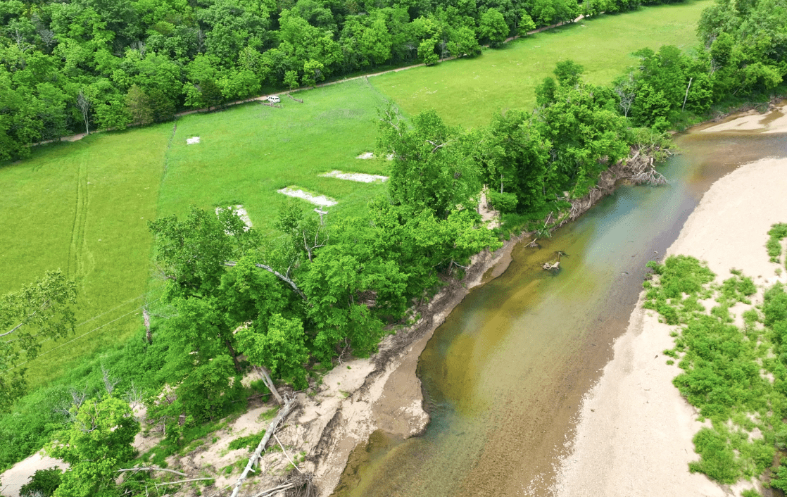
The only real “change” we could see that has been made to the property is that the person who was leasing it had moved several portable buildings into the meadow area, near the river. He used these buildings for family vacations and when he removed the buildings you can now see the gravel “pads” that were under the buildings.
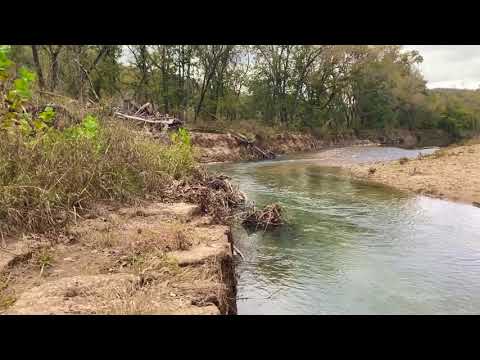
Updated Drone Video (below):
Video Drone BC02 2025 Update Narrated Done
Updated Ground Video showing old rock homestead (below):
Video Ground BC02 2025 Narrated Done
Updated Intro Video, with original Intro Video attached at the end (below):
Video Intro BC02 in 2025 Full Done
We have left much of the original Listing Page intact (below), because the existing videos and pictures also give you a good look at many different parts of this special property. If you have any questions please let us know.


This is a truly amazing property – we have never had anything like it!
Direct creek frontage, a historic homesite, well, access to power/phone, county road frontage in two locations – this property is spectacular.

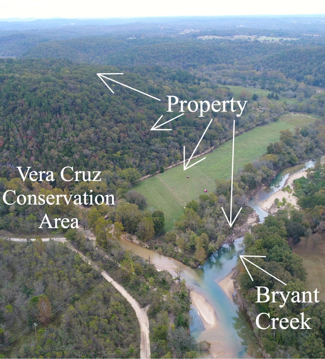
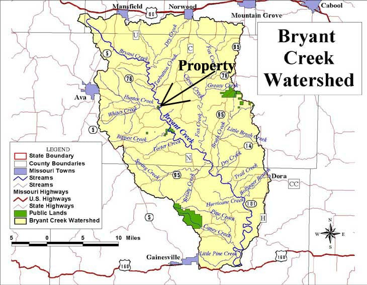
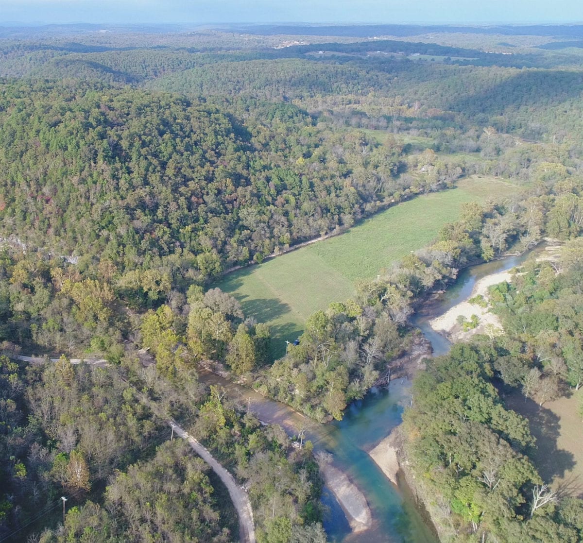
In the aerial photo above we are looking northerly over the property which borders Bryant Creek along its entire south end. The property has direct frontage on Bryant Creek and is just a few feet from where Hunter Creek flows into Bryant Creek. Bryant Creek and Hunter Creek are both spring-fed creeks and the water is generally very clear. In the photo above it almost looks like the water in Hunter Creek is murky or stirred up BUT it is actually crystal clear. It appears “murkey” because we are looking through the clear water at the gravel bottom of the creek, so from the air the gravel looks like water that has been “stirred up”.

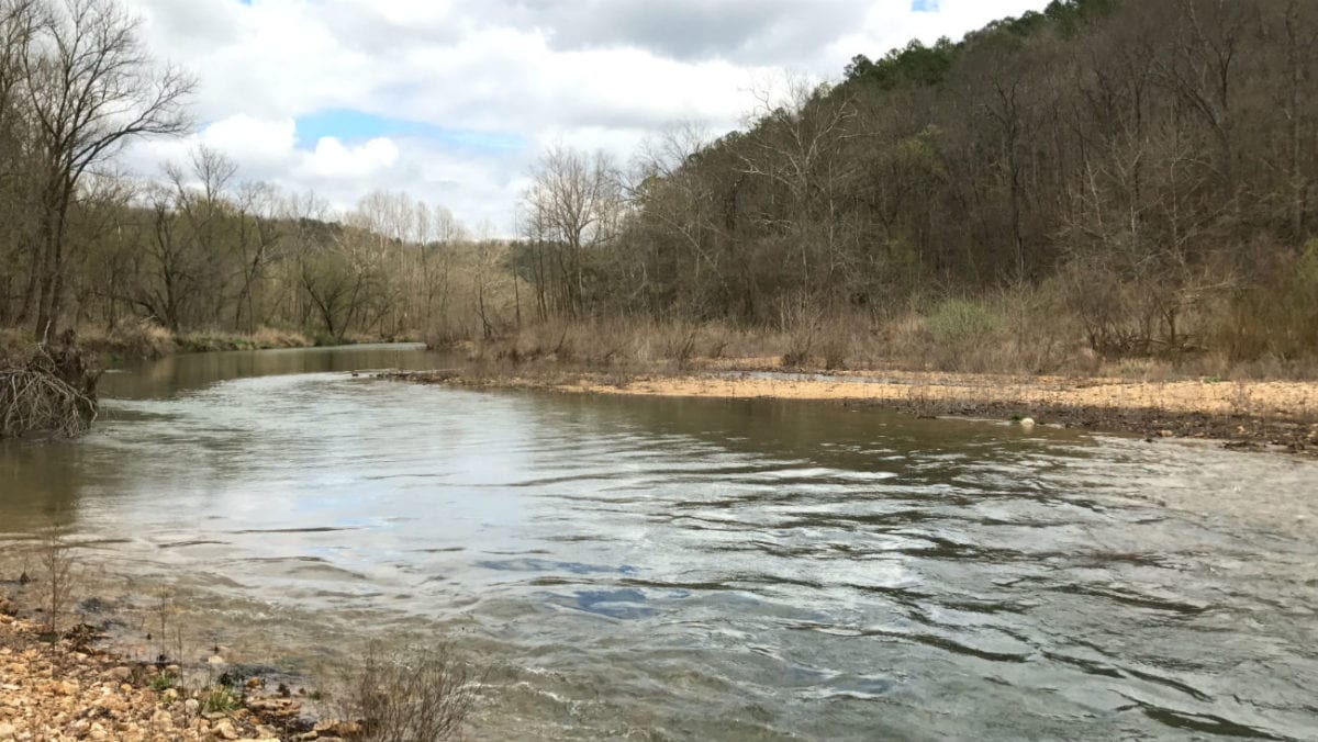
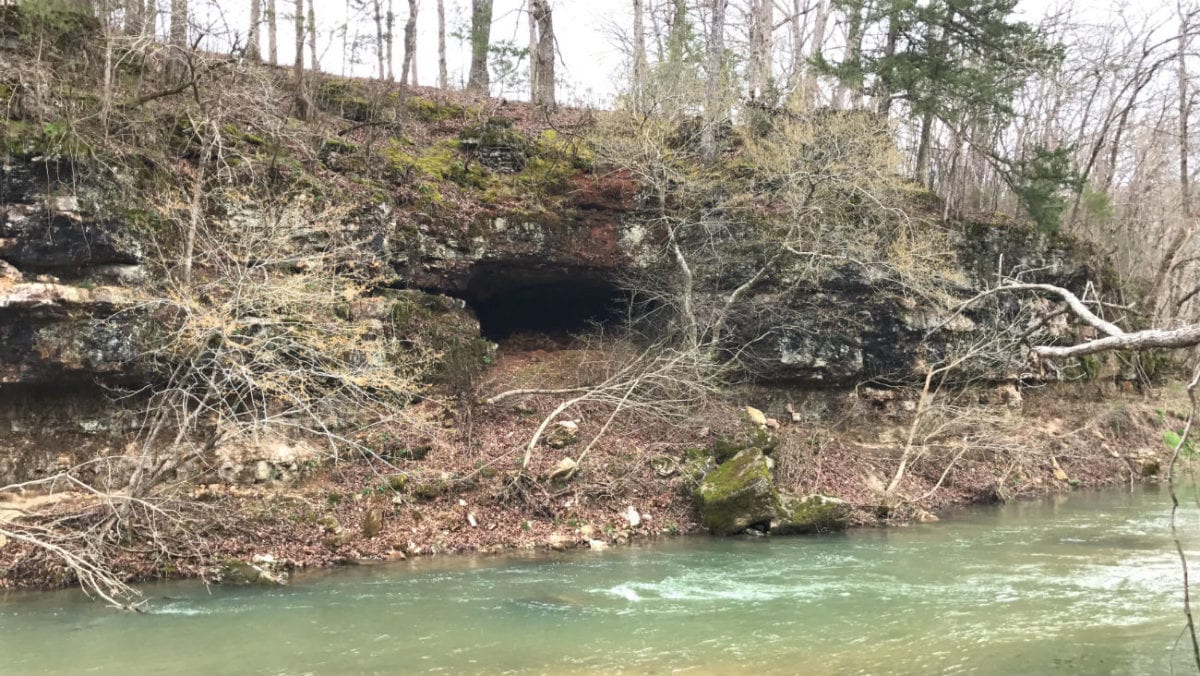
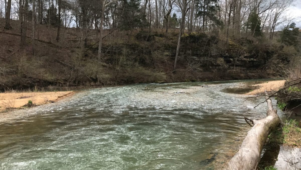
Bryant Creek is one of the most popular rivers/creeks in the Ozarks for fishing, floating and canoeing. It is VERY hard to find property with ANY direct frontage on the Bryant Creek. We know because we have been looking for years to find some! The photo above was taken directly on the property looking at Bryant Creek. There is good access right down to the water. Fish, float and canoe from your own property! Just behind us (not shown in the photo) is Hunter Creek, which runs into Bryant Creek just a few feet from the property.
TERMS OF SALE
The original sales price for this amazingly rare 9.04 acre tract of river-front land with historic building site, County Road access and power on-site was $189,500 but we are currently offering a HUGE LIMITED TIME PRICE REDUCTION in the amount of $60,000 which brings this TEMPORARY sales price all the way down to $129,500.
With this temporary sales price of $129,500 we offer INSTANT owner financing with just your $1,500 down payment.
With your $1,500 down payment you will automatically receive our reduced annual interest rate of 7 3/4% and the payment will be $1,214.84 a month.
With a $2,500 down payment the annual interest rate drops to 6 3/4% and the payment drops to $1,133.84 a month. With a $5,000 down payment the annual interest rate drops to 5 3/4% and the payment drops to $1,043.87 a month.
These payments are all based on about a 15 year payment schedule. Property taxes are billed at $120 a year and this is already included in the monthly payment amount(s) shown above. There are NO prepayment penalties and NO hidden fees or charges.
PLEASE NOTE that you have a full TWELVE MONTHS to ADD to your down payment in order to reduce your annual interest rate and payment amount! We want to give ALL of our buyers the opportunity to achieve the lowest interest rate and payment amount possible!
ALSO, if you pay off your property (your loan to us) at any time within the next 5 years you will receive an ADDITIONAL DISCOUNT in the amount of 10% of the reduced purchase price of the property! On this property that would save you $12,950 for an early payoff!
If this is the property for you then please choose your initial down payment amount in the box below (or on the side of this listing page) and you can pay with a debit or credit card. Please feel free to send us an email or give us a call in the office at (417) 767-2223 and we can answer any questions or complete the transaction over the phone. You can email us at [email protected] anytime.
You are definitely welcome to come and view the property in person before making your down payment (please remember all properties are sold on a first-come, first-served basis). If you want to view the property then it is always a good idea to give us a quick call first. We can verify if the property is available and we can also let you know about road conditions, weather conditions and any special circumstances (gates, detours, etc.) – you can reach us in the office at (417) 767-2223.

This is one of the VERY FEW rivers/creeks we have ever seen that actually has a sandy beach area. The shoreline appears to have areas of gravel, soft black dirt and even pure sand!
Many of the photos/videos we have of this beautiful property were taken on a very cloudy/overcast day. Luckily, you get to see the property at its “worst” with these cloudy day photos. Having also seen this tract on a nice sunny day, we can definitely tell you that the “cloudy day” pictures in this listing do not do the property justice!

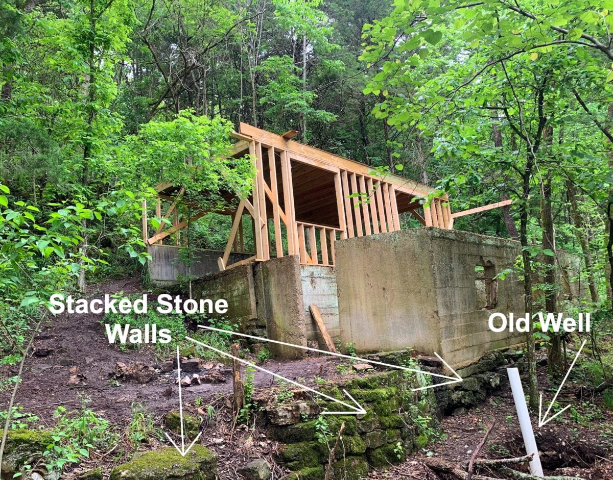
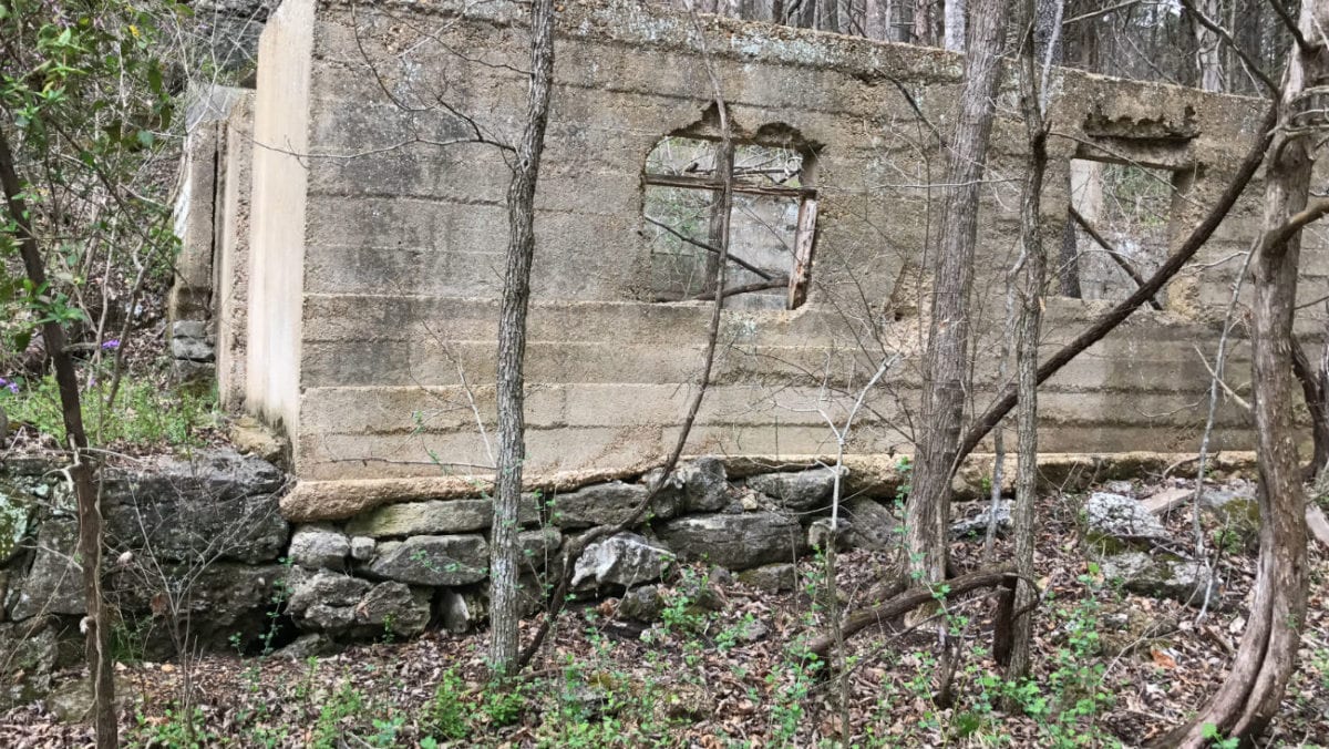
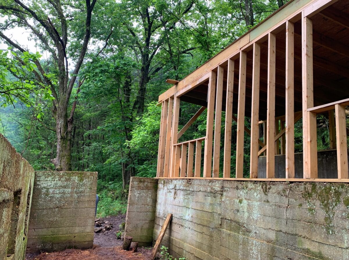
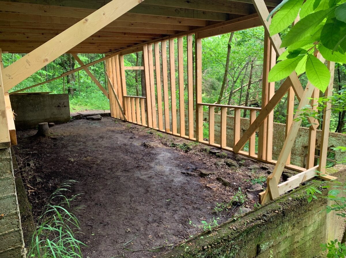
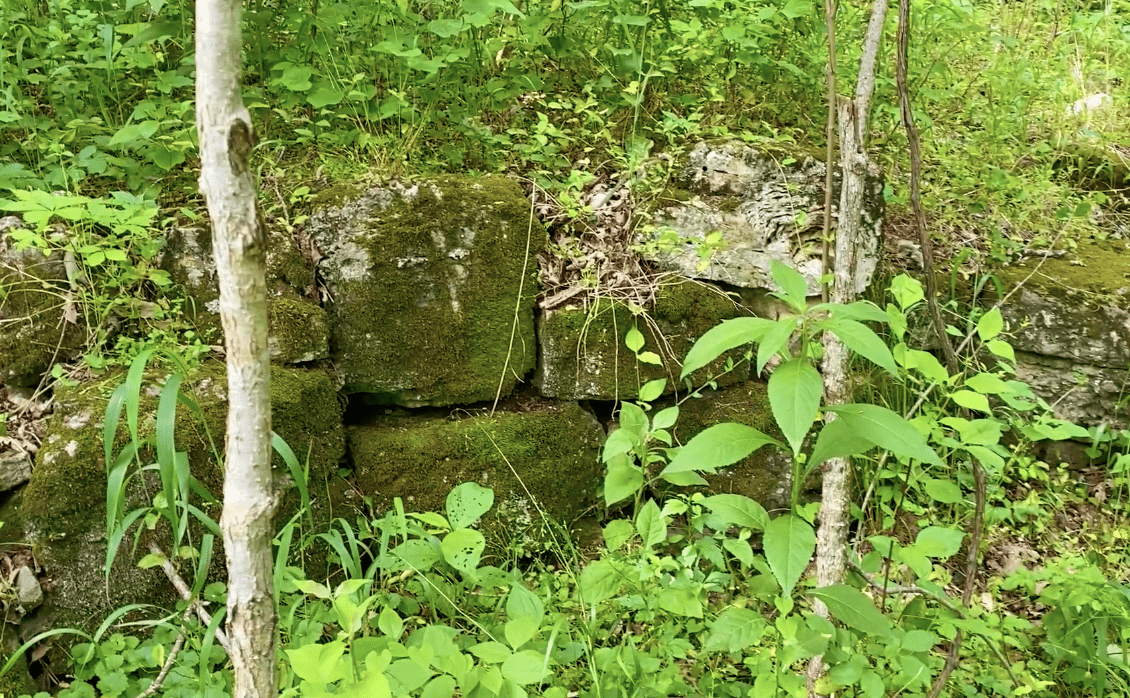
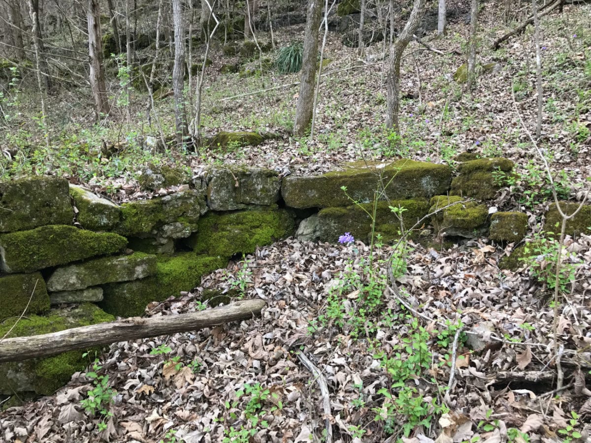
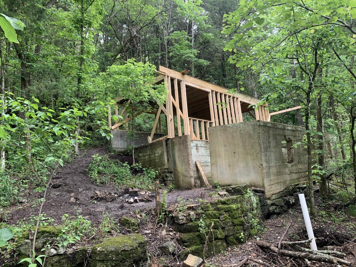
In the photo above you can see part of the old homestead which appears to be a unique “two story” home which was built into the hillside. We found numerous stacked-stone walls as well as other unique features! The photo above was taken a couple of years ago, before we decided to put this rare tract on the market. The property was sold on a long-term lease and the family who purchased the property had planned to build a large cabin on the old foundation. They did complete some of the framing for one level of the cabin, as well as some general clean-up of the yard area (uncovering some of the original stacked-stone walls and paths). Their plans recently changed so we have decided to go ahead and put the tract on our website so that someone else will have the opportunity to own this very special property!
The photos below were taken a while back and they show the wooded framing that was done to the old homestead as well as some of the “excavating” of the old hand-stacked stone walls around the home.

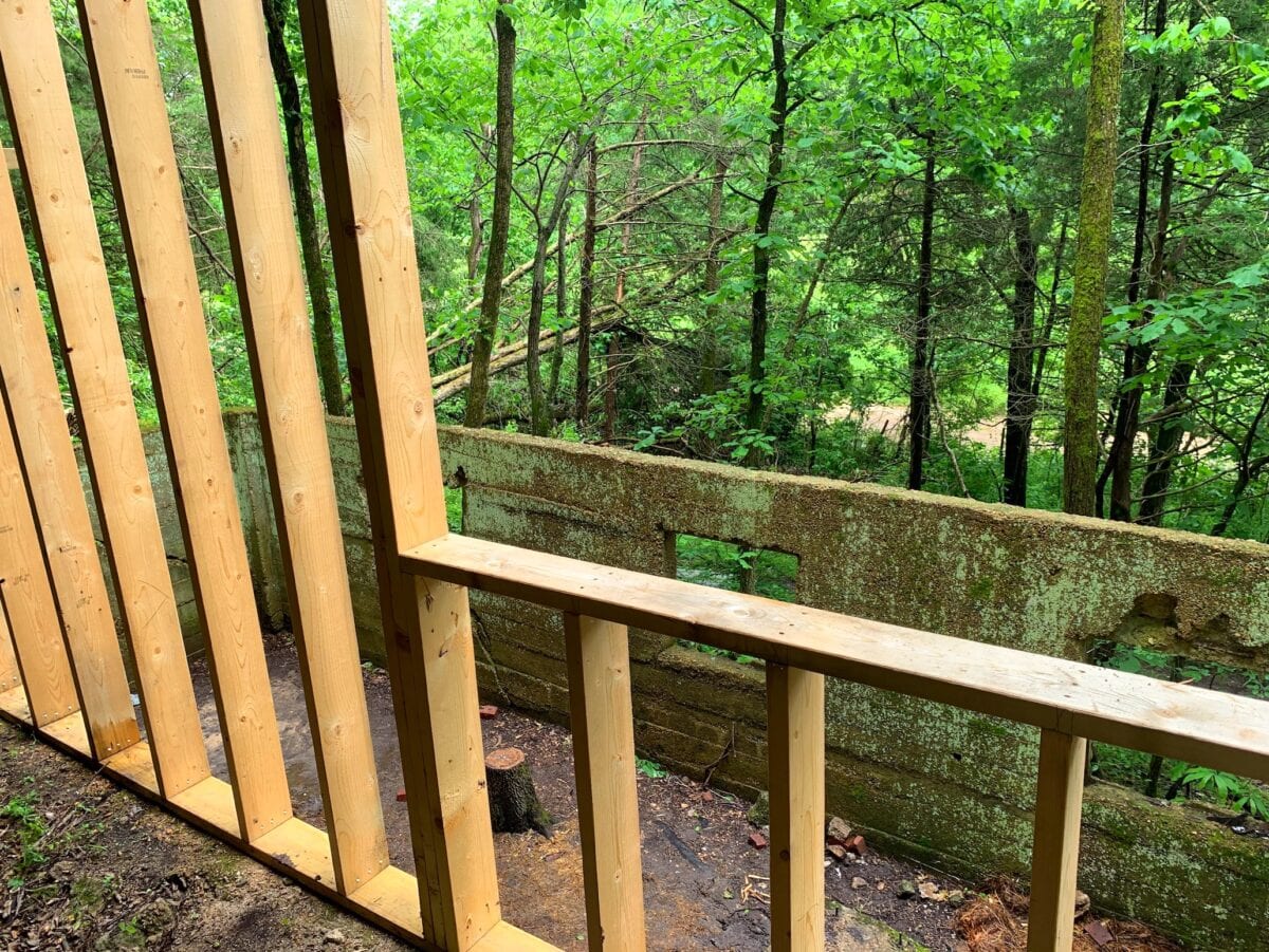
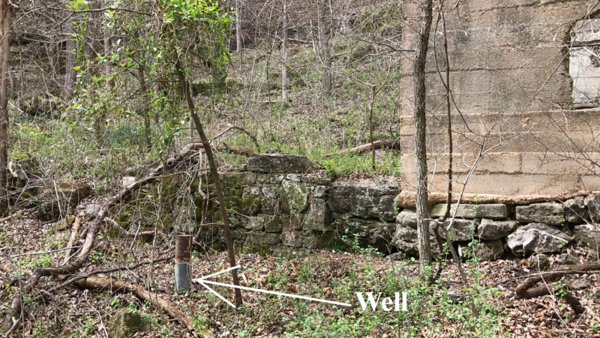
The photo above shows the area that the previous folks had “framed up” into the start of a cabin. The white plastic pipe on the right has now replaced the old metal pipe for the well that was found on the property.
The picture below also shows the wooden framing that was done a couple of years ago.

In the photo above we are standing in the upper level of the old foundation and we are looking southerly toward the County Road.
This was obviously quite a showplace when it was lived in many years ago. You are sure to find some old artifacts on the homestead. As some of the area around the old homestead was cleaned up, it seemed to uncover even more “stacked stone” walls than we had anticipated!
Below, we have a recent photo that shows the old homestead. Since the wooden framing was not completed it was not sided or covered, and it has definitely weathered in the last couple of years:

Above is a recent photo showing the wooden framing has weathered since it was not covered.
This property and homestead was once part of the little town of Vera Cruz, Missouri. Vera Cruz was the original county seat for Douglas County. This homestead is located between the site of the Hunter Creek Mill (which is long gone) and the old Post Office/General Store and it was very possibly lived in by one of the prominent citizens of the town.
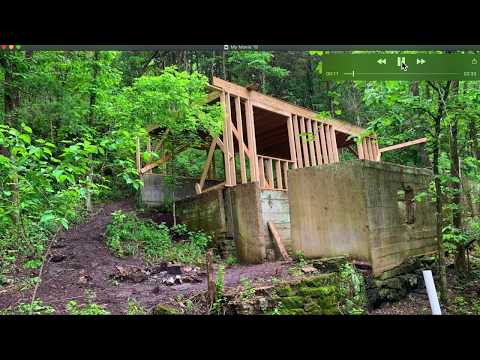
Videos Below: We have several videos below, which show the property. The very first video shows the foundation and yard area and the somewhat recent work that has been done on them. The other videos were taken BEFORE the work was done on the foundation, so you will see that the foundation/yard area looks different in these than it does in the first video.
So, in this first video (which is more of a slideshow) we taken a look at the work that has been done on the old foundation:
In the next video below, we check out the property with out drone:

In the next video, we explore the old homesite on the property. Please keep in mind that this video was taken before the work was done on the foundation and yard area:

In the video below, we visit the river frontage on the property and we find a surprise at the end of the video:
In this video, we walk the meadow on the property (this was before the portable buildings were placed (and then removed) on the proeprty:

In the video below, we explore the northern part of the property which gives you an additional possibility for a building and/or camping site:

The photo above is one section of rock wall at the old homestead. Very cool! The original homestead and rock walls may well date back to the Civil War era, or before.

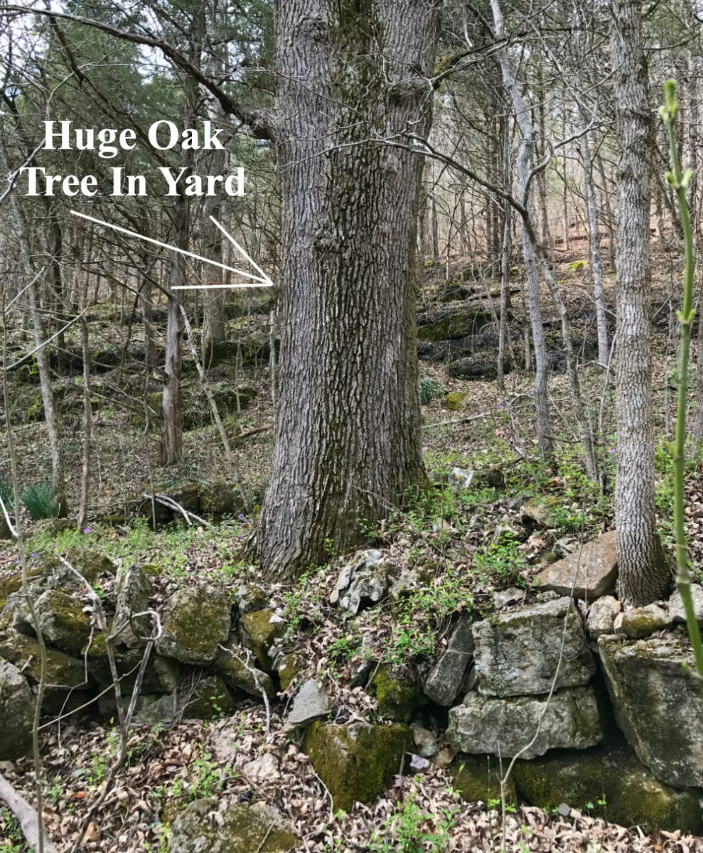
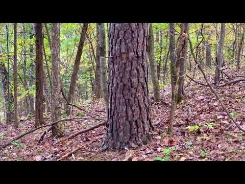
The photo above shows one of the gigantic trees in the yard of the old homestead. Our measurements of this tree (about 40-50 inches in diameter) indicate that it could be 200-300 years old. That would mean that this tree could have been standing to witness the Civil War Battle that took place right by the property (as well as been standing while our country was formed). We found TWO of these giant trees right by the old homesite.
This tract is subject to the basic property covenants as shown on our website (no mobile homes, etc.). Homes or cabins built on the property to be used as a residence must have a minimum concrete foundation size of 600 square feet (a simple 20 X 30 cabin would meet this requirement). Portable buildings are permitted for camping and storage but not for a permanent residence (unless they are at least 600 square feet and permanently attached to a 600 square foot foundation). Please do read through all of the Deed Assurances by clicking on the link below:
To See The Standard Property Covenants Please Click Here
Below, we have an Interactive Map which should be useful for exploring the property and the area (even if you don’t leave your home):
Interactive Map – “Land Id” Map – (formerly MapRight Interactive Map)
The “Land Id” interactive map below (formerly called “MapRight”) is useful for exploring the property and the area. You will probably have to “zoom in” in order to see the property on the map because the labels are likely to look VERY messy until you can zoom in on the property.
It will be helpful if you click on the link toward the top of the Interactive Map that says “Full Screen” (which will open the map within a separate browser tab/window).
You can move the map around and even use different “base layers” to view the property and the surrounding area:
The property boundaries are only approximate on the interactive map but they will be helpful for exploring the property and the area. This property was surveyed a few years ago and we can provide you with the survey map for your records.
About the free “Land Id” app that you can use to help check out this property:
To watch a short video that details how to use the free “Land Id” app to locate the property, as well as the property’s approximate boundaries, please click on the link below:
Click Here To See A “Land Id” (formerly “MapRight”) Tutorial
You will want to download the “Land Id” app to your phone or tablet before you visit the property, as it will make things go smoothly on your first trip (just follow the directions in the tutorial). If you have questions about Land Id please feel free to call us in the office at (417) 767-2223 and we can assist you. “Land Id” seems to be constantly updating their program so it can be a little confusing when you first get started. In fact, until very recently it was called “MapRight” so it is likely you will hear us use that name within the videos in this listing page, because that is the name we have been using for years!
PLEASE NOTE – Recently a few people have told us that they were required to get a “trial subscription” in order to use LandId. This may well be true because their policies do seem to change often. If you get the free trial membership please put a note in your phone/computer to cancel the membership after you have used it, so that you do not get billed for any actual subscription (unless you want the actual subscription, which is handy.
Directions to the property:
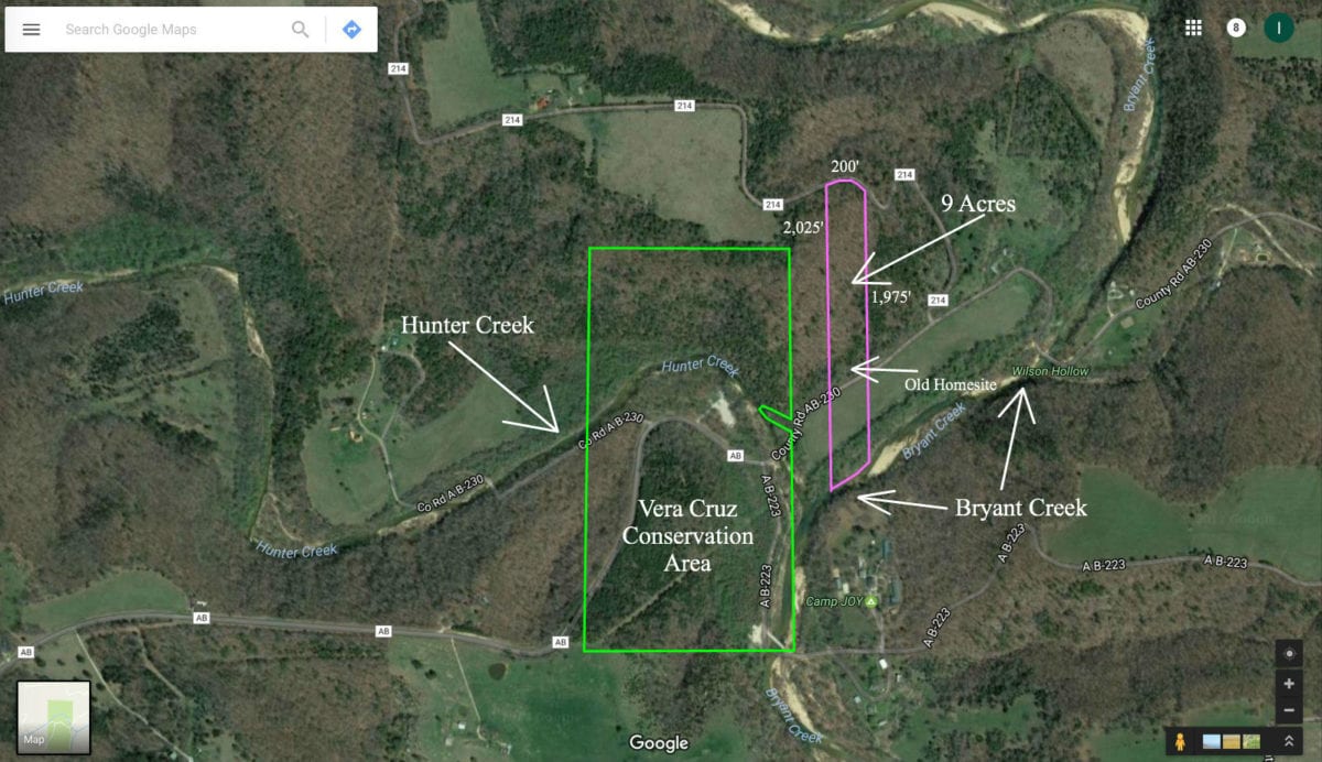
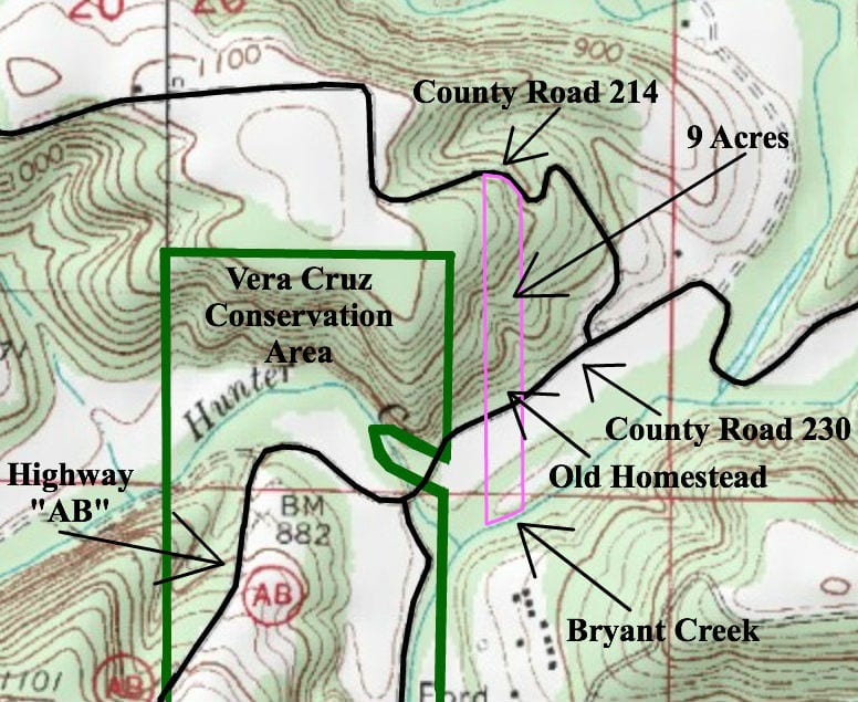
Now…in addition to the river frontage and the old Civil-War era homestead on the land, this property is about 100 yards from the Vera Cruz Conservation Area. The Conservation Area is about 80 acres in size and contains additional access points to the Bryant Creek as well as Hunter Creek. The Conservation Area also offers primitive campsites as well as bathrooms. Although you will find the hunting and fishing to be excellent on the 9 acres, the Conservation Area is open for hunting, fishing and camping as well.

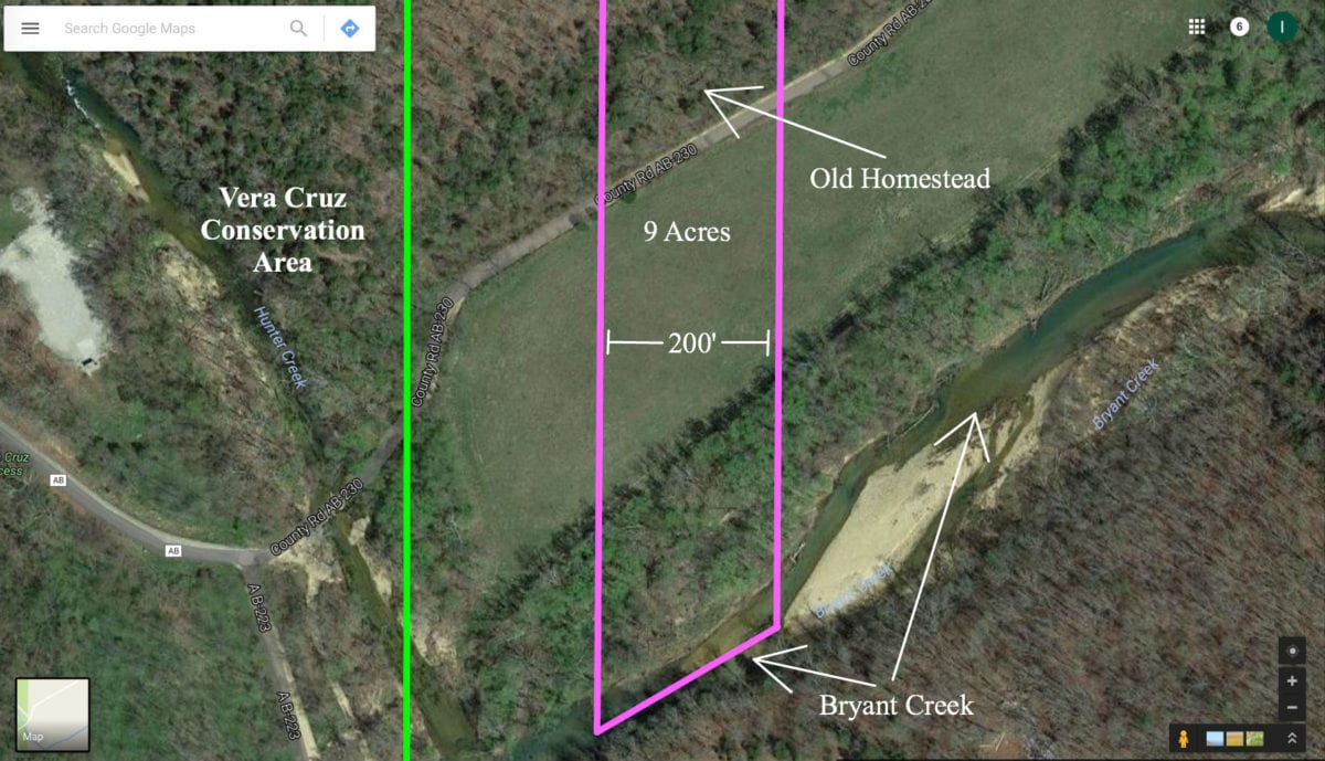
The aerial map above shows the property’s boundaries as well as the approximate dimensions. The Vera Cruz Conservation Area is outlined in green. For more detail see the “close-up” aerial map farther down in this listing.
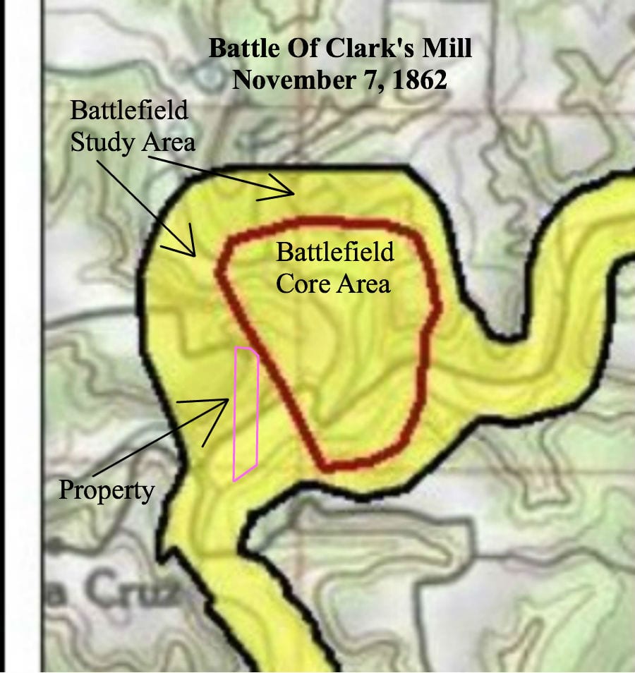
But wait…there’s more…Our research shows that on November 7th, 1862, a Civil War Battle took place just to the east of the 9 acres. It was called the Battle Of Clark’s Mill or the Battle of Vera Cruz (you can google it to find out all of the information). According to this map the actual Core Battlefield Area (where the fighting took place) was just a few feet east of the property and the property itself is located within the Battlefield Study Area (where artifacts from the battle can be found).

The map above shows the location of the Battle of Clark’s Mill. We have outlined the location of the 9 acres on the map. Feel free to bring your metal detector and see what you can find! We did not create the map (we found it online) but we did label it and added the approximate outline of the property.
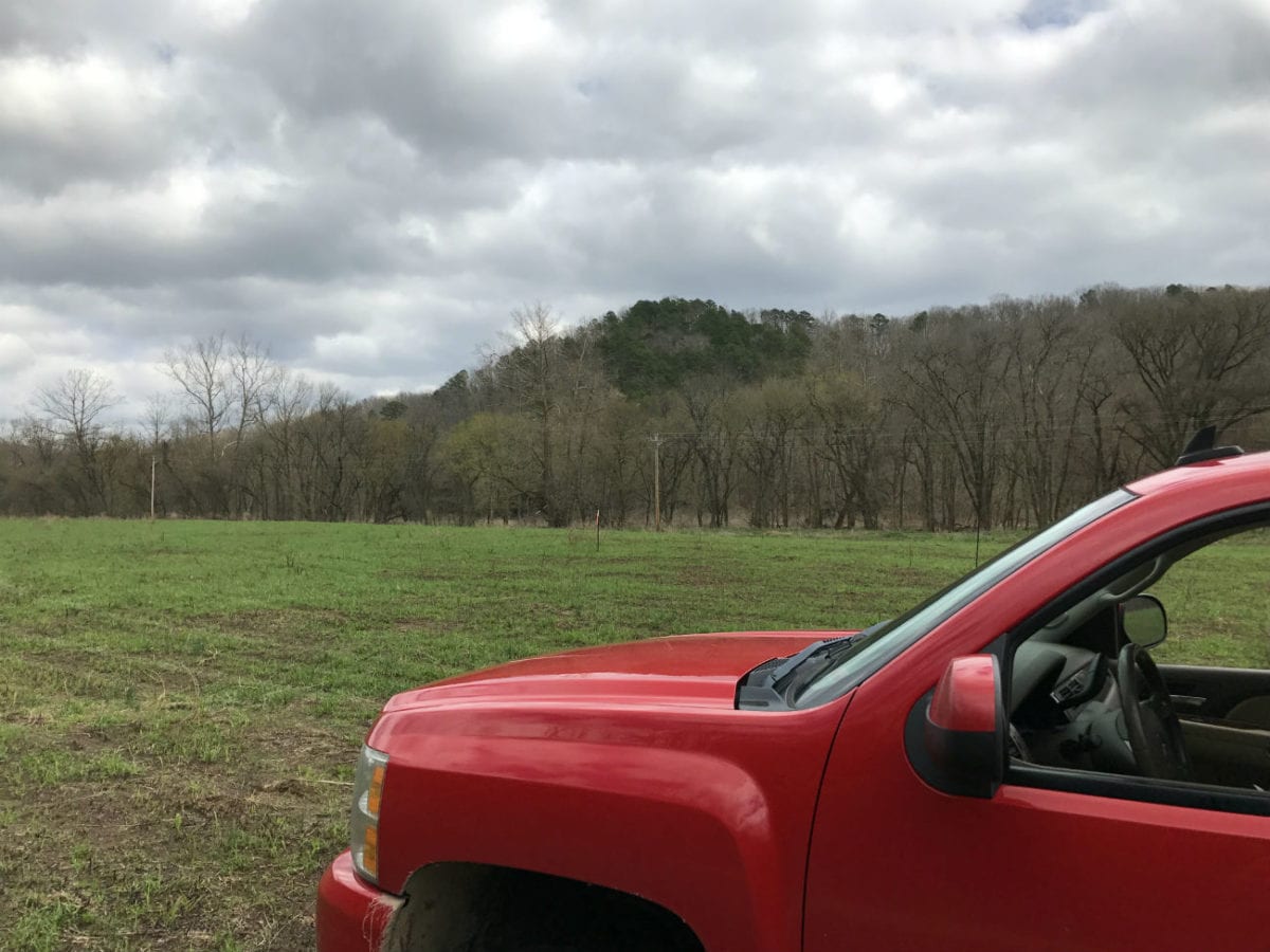
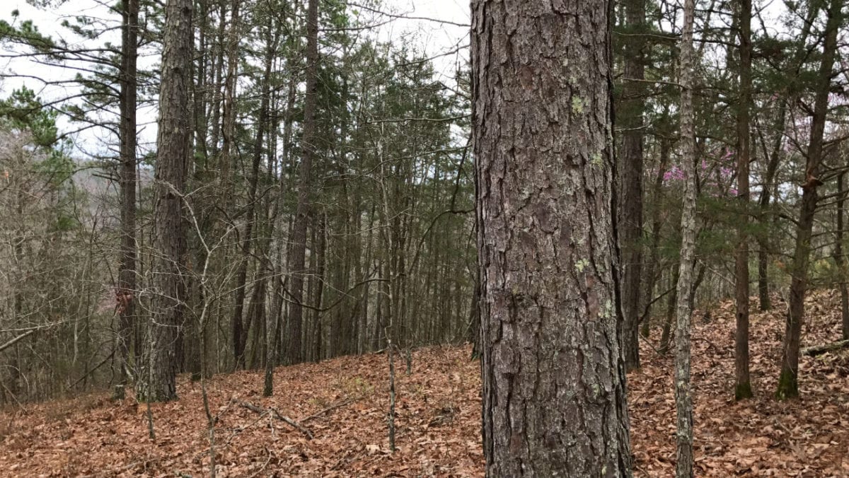
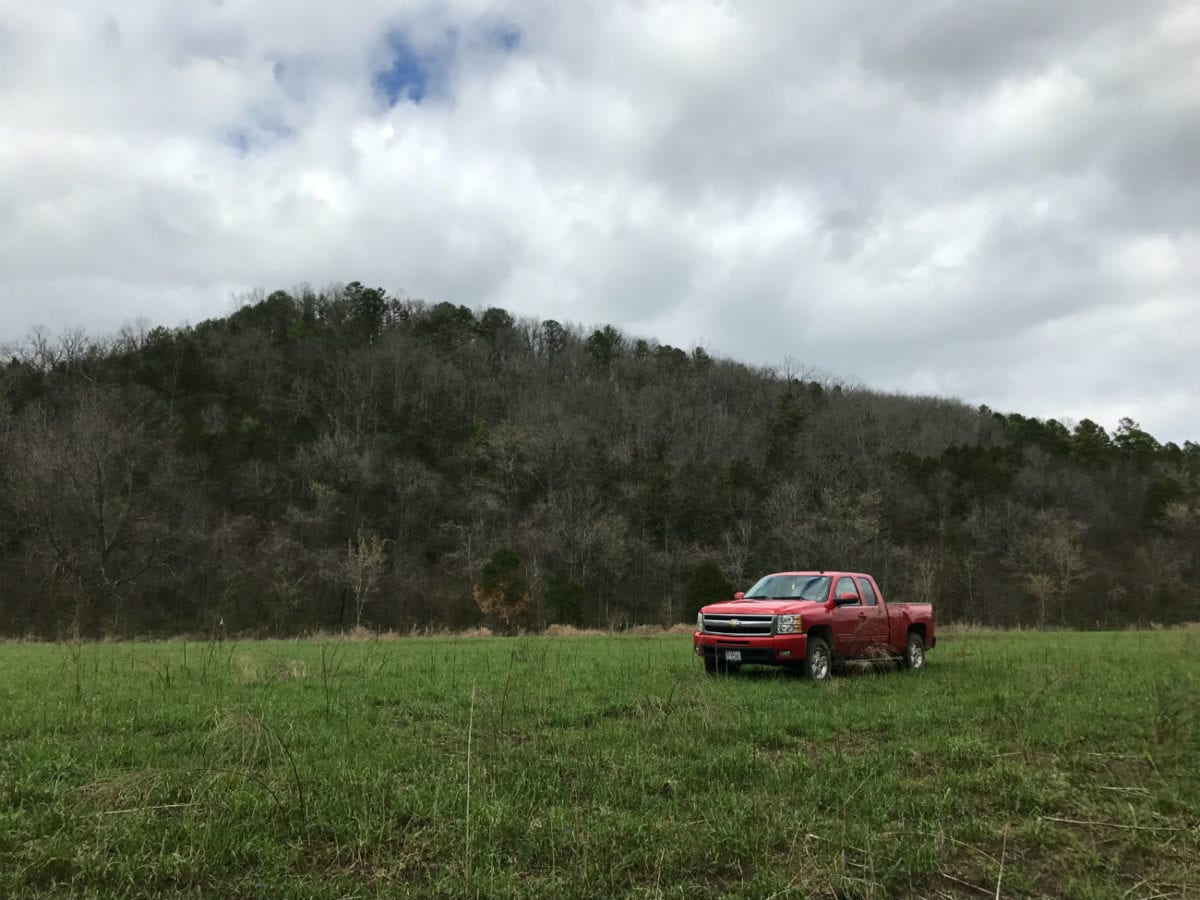
Of course, this 9 acres also has big mature timber, county road frontage, power and phone on site, a beautiful open meadow and views for miles.

In the aerial photo above we are over the meadow area near the river at the south side of the property. We are looking north across County Road 230 toward the old homestead. The land rises up once you cross over the County Road and it continues to rise until you get to the north side of the property. The north side of the property borders another County Road (County Road 214) and has a driveway that has been roughed-in leading onto the north end of the property.


The photo above shows a close-up look at the south side of the property. Just north of County Road 230 is where you will find the old homestead. As you go north from the old homestead the land rises up steeply. There are multiple potential building sites on the north side of the property but keep in mind you will need a four wheel drive truck to pull onto the property on the north side (you could improve the driveway if you wanted to do so).
Below we have some maps and photos of the property:

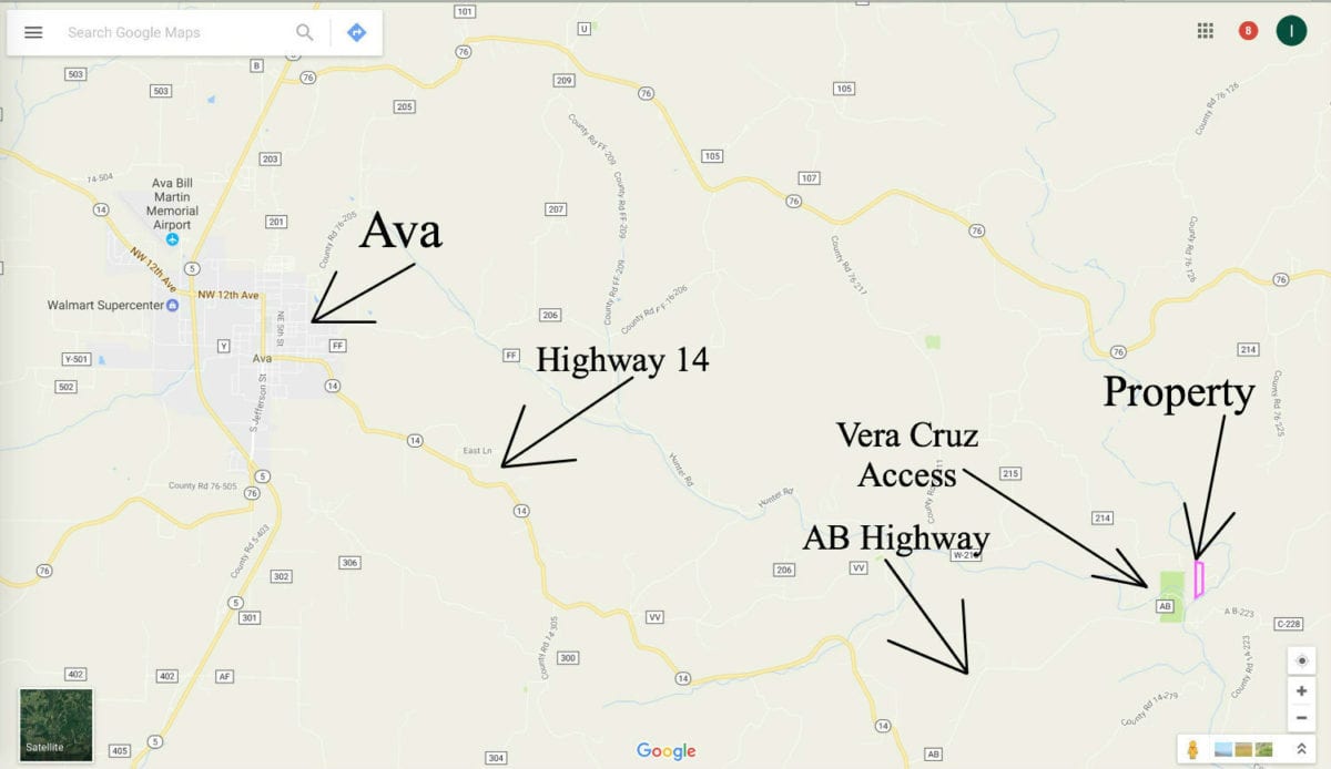
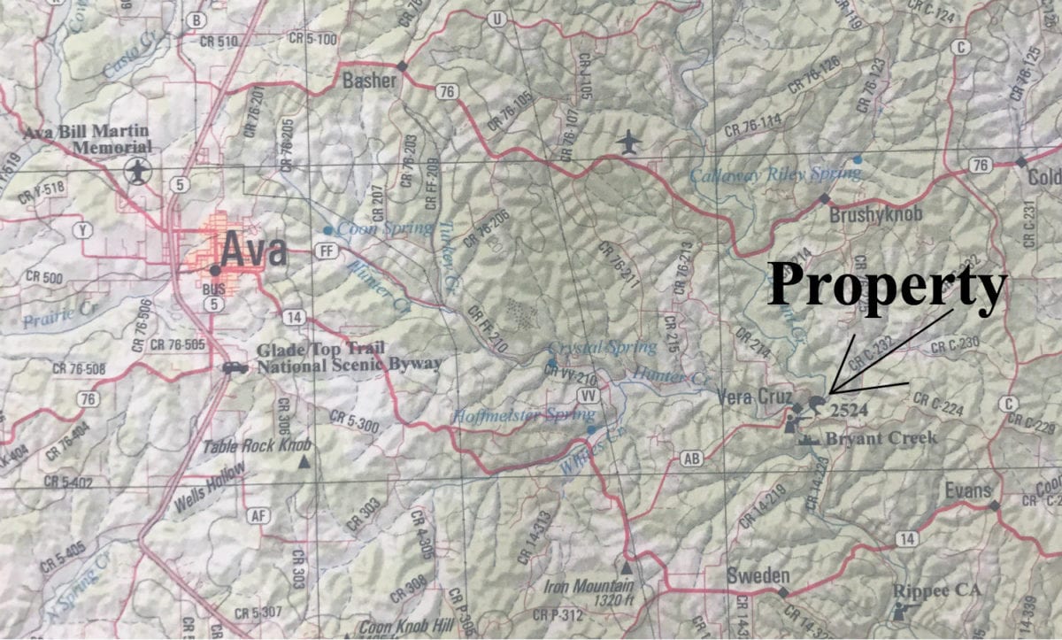
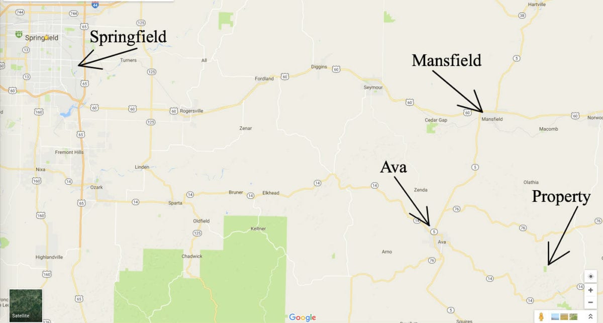
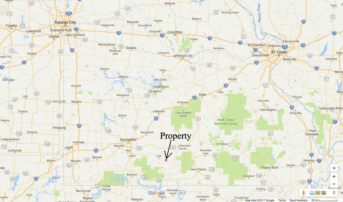
The property is just a short drive from Ava, Missouri. Ava is a medium-sized town with a large Wal-Mart, lumberyard and numerous stores and restaurants. From Ava just take Highway 14 to the east for about 9 miles, then go left onto AB Highway. Go about 4 miles on AB Highway and the road will turn to gravel and you will come to a fork in the road. Go left at the fork (this is County Road 230), cross the small concrete bridge, continue for about 300 feet and you will be at the property. To get to the north side of the property continue going east on County Road 230 for roughly 1/4 mile and take your first left (this will be County Road 214). County Road 214 winds its way up the hill (steep) to the north side of the property.

The property is centrally located in the Missouri Ozarks. It is a little over an hour to Springfield which is the largest city in southern Missouri. Also, you will find over 10,000 acres of National Forest in the area which can be used for hunting, camping and trail riding.
Please feel free to go and check out the property. You will definitely want to print out all of the maps we have provided before visiting the property, as it can be confusing on your first visit. If you would like us to email you all of the maps and pictures just let us know. Feel free to bring your fishing pole and your four wheeler!
TERMS OF SALE
The original sales price for this amazingly rare 9.04 acre tract of river-front land with historic building site, County Road access and power on-site was $189,500 but we are currently offering a HUGE LIMITED TIME PRICE REDUCTION in the amount of $60,000 which brings this TEMPORARY sales price all the way down to $129,500.
With this temporary sales price of $129,500 we offer INSTANT owner financing with just your $1,500 down payment.
With your $1,500 down payment you will automatically receive our reduced annual interest rate of 7 3/4% and the payment will be $1,214.84 a month.
With a $2,500 down payment the annual interest rate drops to 6 3/4% and the payment drops to $1,133.84 a month. With a $5,000 down payment the annual interest rate drops to 5 3/4% and the payment drops to $1,043.87 a month.
These payments are all based on about a 15 year payment schedule. Property taxes are billed at $120 a year and this is already included in the monthly payment amount(s) shown above. There are NO prepayment penalties and NO hidden fees or charges.
PLEASE NOTE that you have a full TWELVE MONTHS to ADD to your down payment in order to reduce your annual interest rate and payment amount! We want to give ALL of our buyers the opportunity to achieve the lowest interest rate and payment amount possible!
ALSO, if you pay off your property (your loan to us) at any time within the next 5 years you will receive an ADDITIONAL DISCOUNT in the amount of 10% of the reduced purchase price of the property! On this property that would save you $12,950 for an early payoff!
If this is the property for you then please choose your initial down payment amount in the box below (or on the side of this listing page) and you can pay with a debit or credit card. Please feel free to send us an email or give us a call in the office at (417) 767-2223 and we can answer any questions or complete the transaction over the phone. You can email us at [email protected] anytime.
You are definitely welcome to come and view the property in person before making your down payment (please remember all properties are sold on a first-come, first-served basis). If you want to view the property then it is always a good idea to give us a quick call first. We can verify if the property is available and we can also let you know about road conditions, weather conditions and any special circumstances (gates, detours, etc.) – you can reach us in the office at (417) 767-2223.
This one will go QUICKLY – we’ve never had a tract like it and we never will again…act fast on this one!