SORRY, THIS PROPERTY HAS BEEN SOLD!
Please Note – This is a very special property that we have owned for several years. We have leased out the property a few times over the years for hunting and to a group of guys who enjoyed fishing and riding jet-skis in the lake. After much thought, we have finally decided to offer the property for sale on our website.
If you have been waiting for a very special property for fishing, hunting, camping, building or for investment then please take a look at this 10 acres at Bull Shoals Lake in Taney County, Missouri!
If you have any questions please let us know.
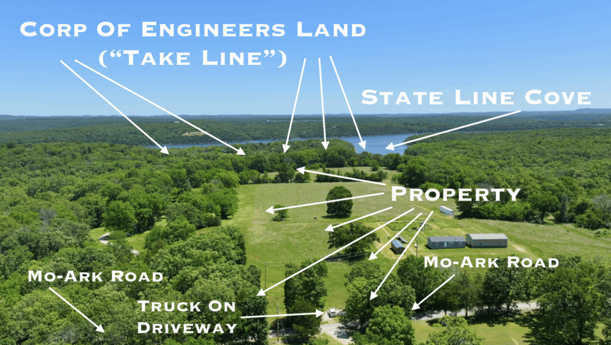
Stunning 10 acre tract with direct access to Bull Shoals Lake as well as a secluded cove! This special property has amazing access to Bull Shoals Lake with over 380 feet of DIRECT “Take Line” frontage! This parcel also has large mature timber, gorgeous open meadow(s), pipe fencing at the paved road frontage AND has access to a private cove on Bull Shoals Lake! Electric and phone are already at the property and you will find multiple sites for building, camping and hunting.
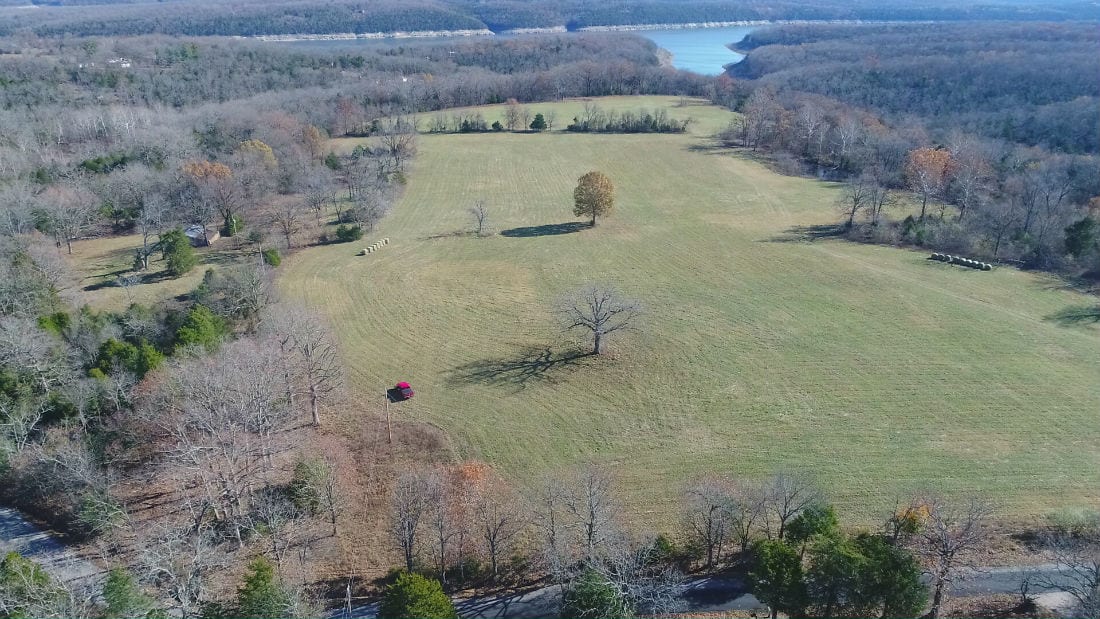
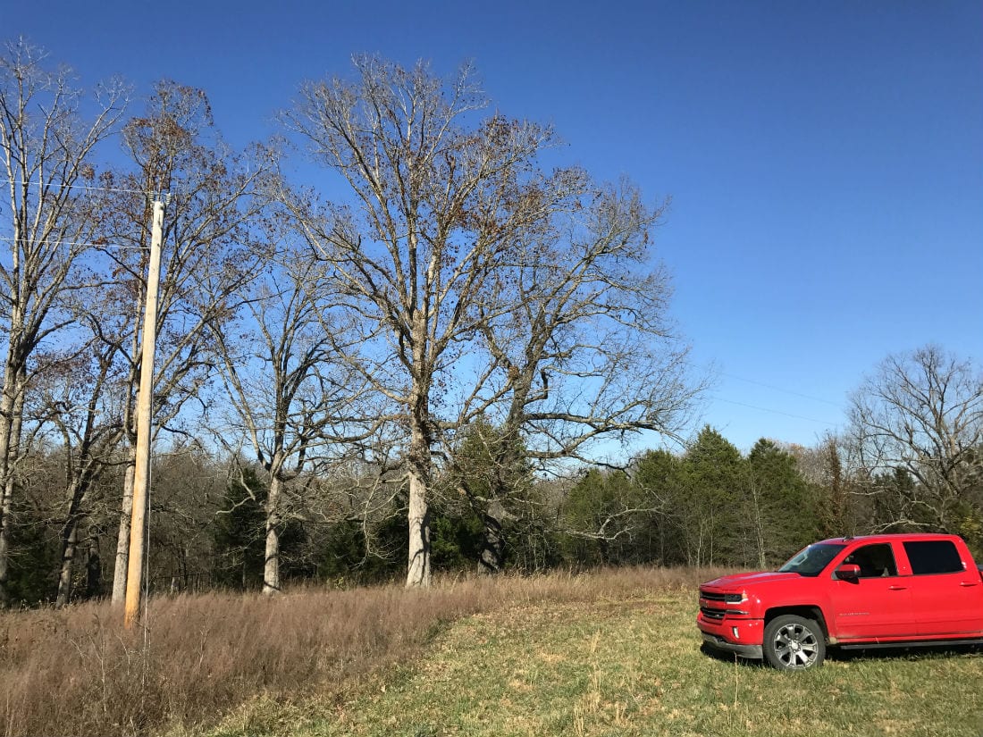
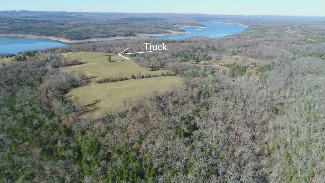
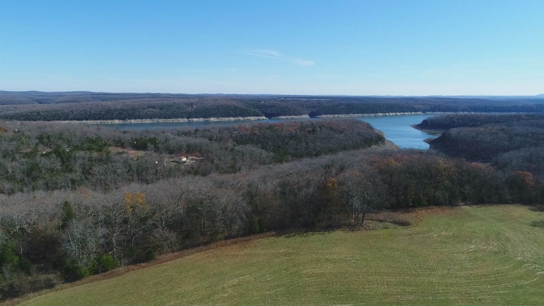
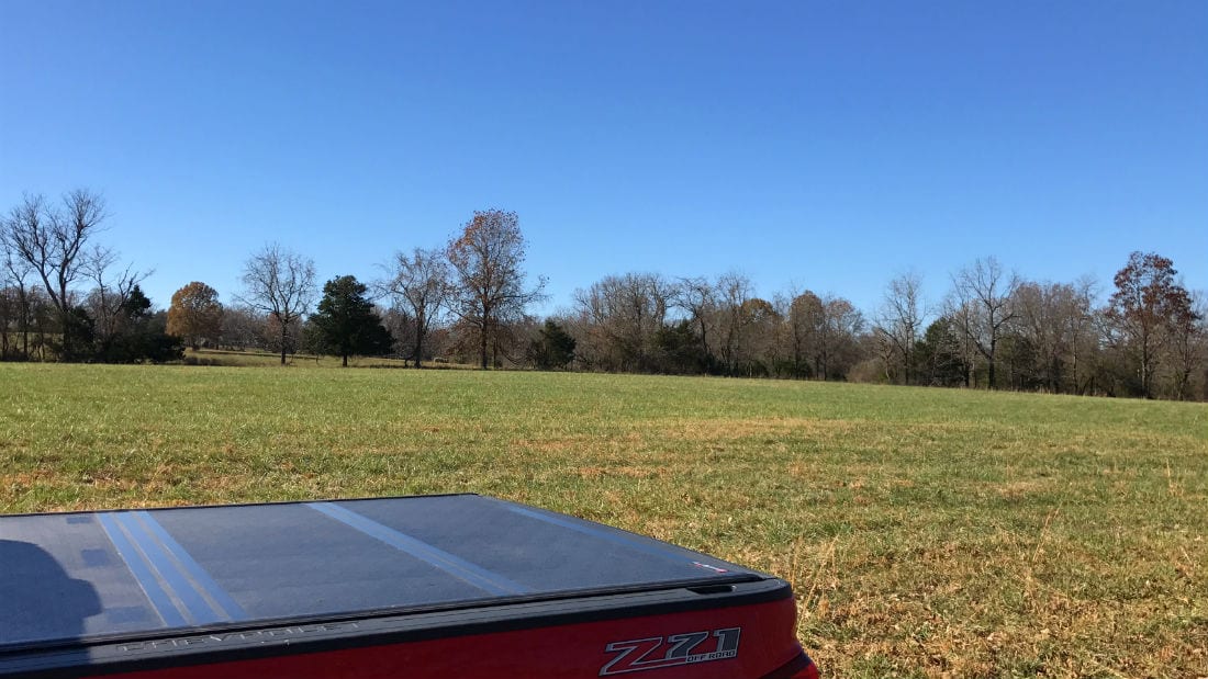
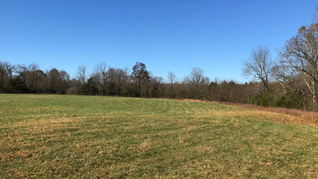
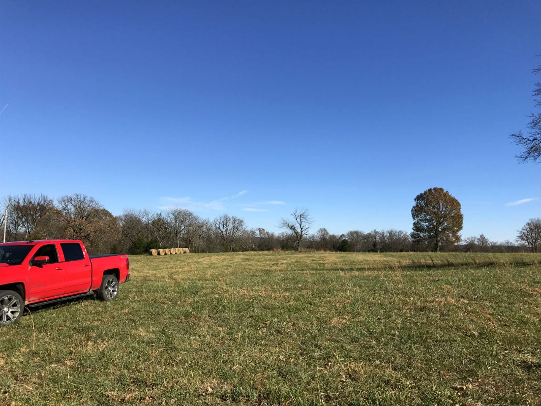
We have used and enjoyed this property many times throughout the years. The winter-time drone photo below was taken several years ago, right after we purchased the property. The drone is facing east and we are looking over Mo-Ark Road at the 10 acres. The red truck is parked on the property.

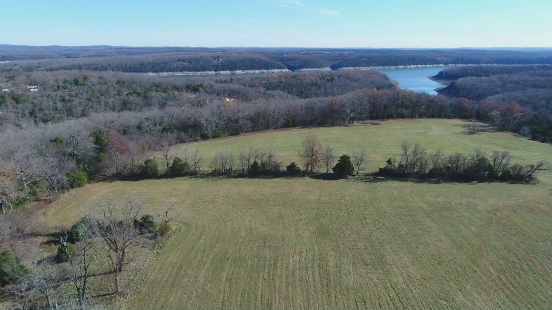
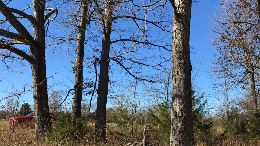
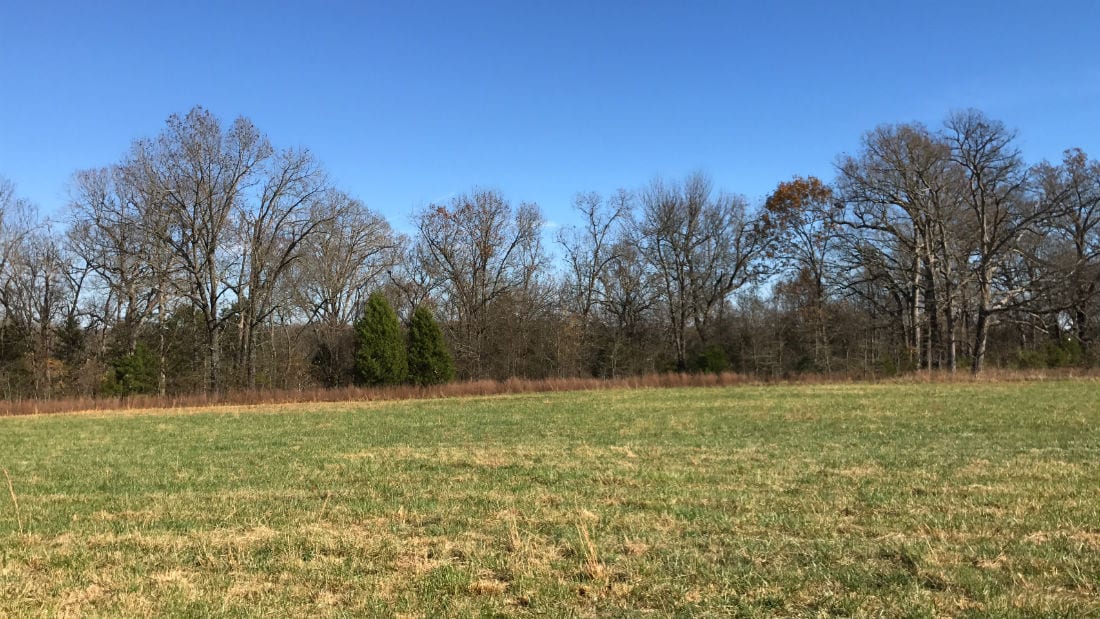
And this next photo (below) was taken just this last summer. Several families have built homes in the area since we purchased the property (which tends to happen in nice areas like this one). In the photo below you can see a small family “farm” to the south of the property (on the right in the photo). Off to the left you can see part of the driveway that someone installed on the property to the north.

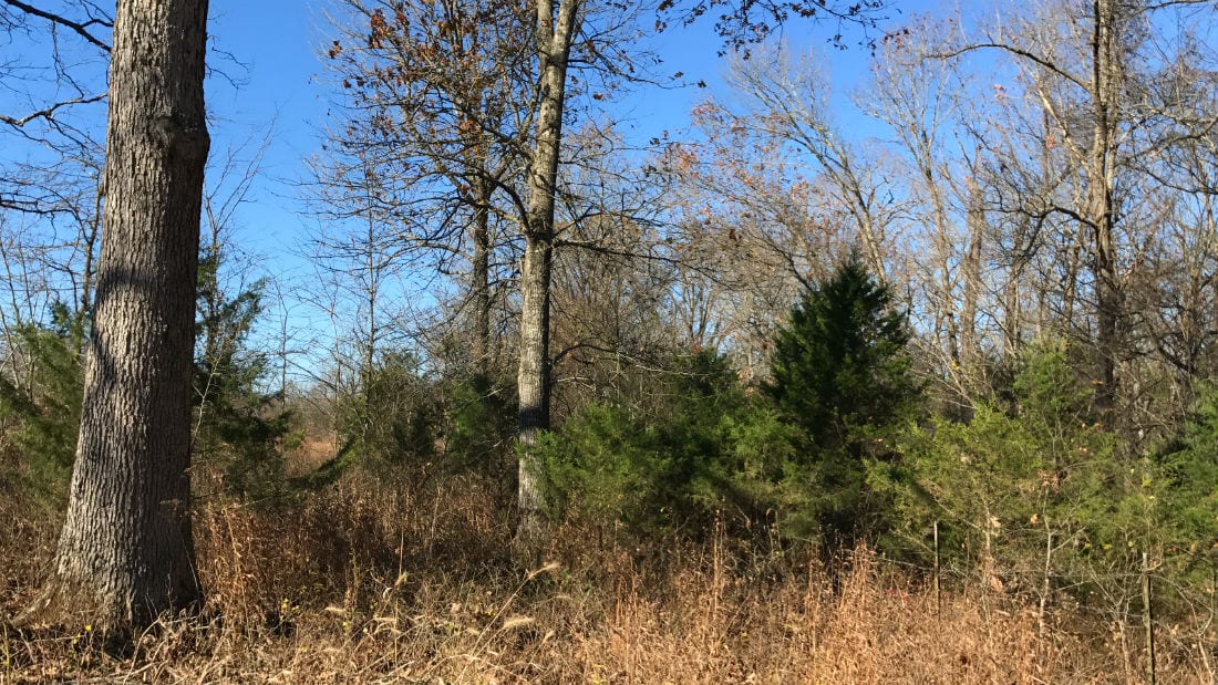
This 10 acre property was specifically designed so that the owner would have the option of maximum privacy if they choose to build a home/cabin. The acres actually gets wider on it’s east side, where it borders the “Take Line” at Bull Shoals Lake. If you look at the photo above you will see a line of trees which crosses the meadow in the distance. There is a second meadow (a “hidden meadow”) on the other side of that row of trees which is where you could build if you wanted “maximum privacy”. Not only would you be about 1/4 mile off of the road, but that row of trees would also provide a nice privacy buffer for the home and yard.
This tract provides world class fishing and boating (and don’t forget about jet-skis) as well as top-notch hunting for deer and turkey! Direct “Take Line” lake frontage, paved frontage and privacy on the dead-end road make this a property you will want to keep for generations.
If you have been waiting and searching for a very special property than take a good close look at this 10 acres at Bull Shoals Lake!
TERMS OF SALE
The full sales price for this VERY SPECIAL 10 acre tract of land at Bull Shoals Lake with over 380′ of direct “Take Line” frontage, electric on-site, paved road frontage, gorgeous open meadows, huge mature timber and more is just $169,500. With your minimum down payment of $2,500 you will automatically receive our reduced annual interest rate of 6 3/4% and the payment will be $1,497.80 a month.
With a $5,000 down payment, the annual interest rate drops to 5 3/4% (our lowest rate) and the monthly payment drops to $1,386.03. These payments are all based on about a 15 year amortization schedule. Property taxes are calculated at $240 a year and this is already included in the monthly payment amount(s). There are NO prepayment penalties and NO hidden fees.
PLEASE NOTE that you have a full 12 months to ADD to your down payment in order to reduce your interest rate and payment amount! We want to give ALL of our buyers the opportunity to achieve the lowest annual interest rate and payment amount possible!
ALSO, if you decide to pay off your property (your loan to us) at any time within the next 5 years you will receive a DISCOUNT in the amount of 10% of the purchase price of the property! On this property that would save you $16,950 for an early payoff!
***This property contains large mature timber (including mature white oak trees and walnut trees). Please note that the timber on the property may not be cut or sold until the property has been paid for in full.***
If this is the property for you then please choose your initial down payment amount in the box below or on the side of the screen (depending on what device you are using to view this listing page) and you can make your payment with a debit or credit card. Feel free to send us an email or give us a call and we can answer any questions or complete the transaction over the phone. Our number in the office is 417-767-2223 or you can reach us anytime by email at [email protected].
There are multiple areas on the property that would be suitable for building, camping and hunting. Because the Corp of Engineers Land is open for public hunting/public use you can actually explore and use hundreds of acres of additional hunting and recreation land which directly adjoin the east side of this property!
We have included a large number of maps, pictures and videos that show this amazing tract of land. There is a lot to see so please take your time and check it all out.

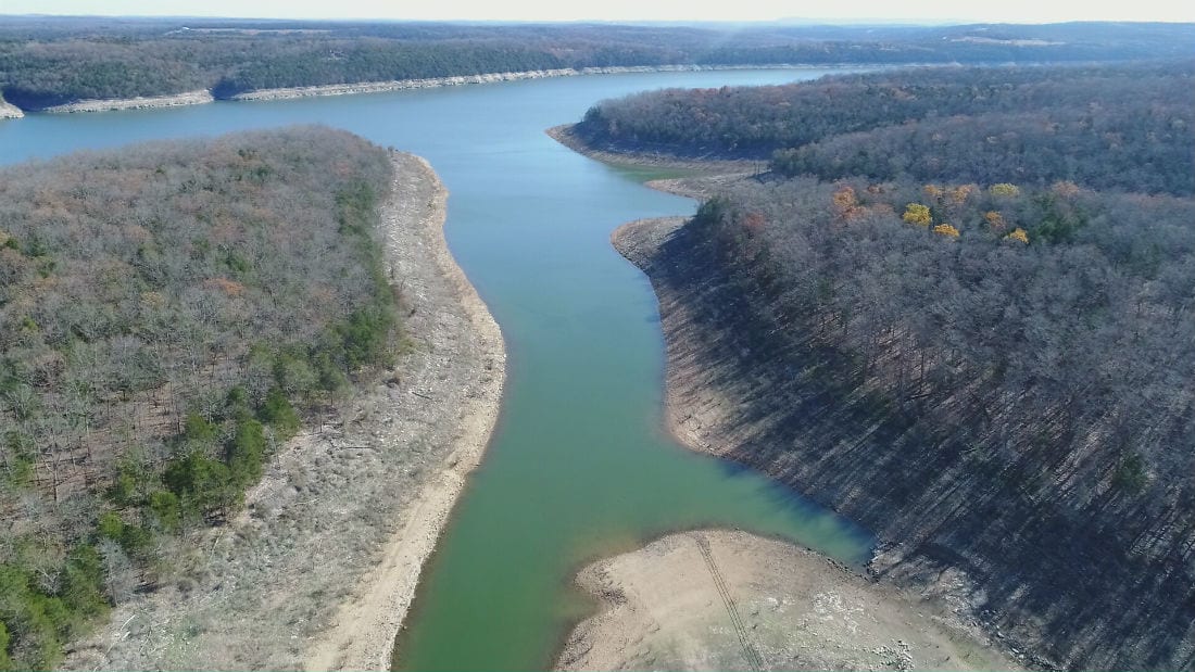
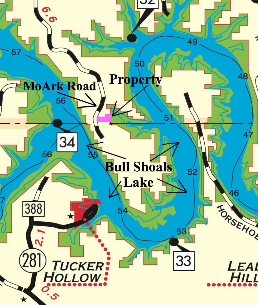
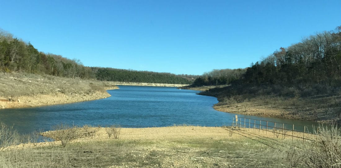
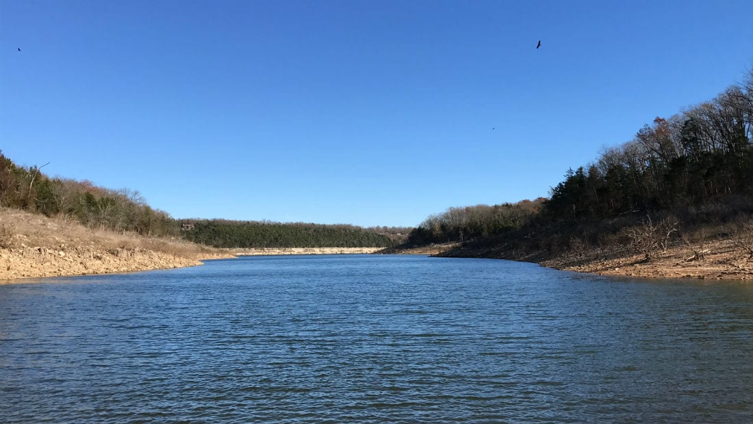
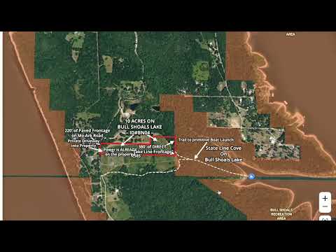
The map above is an aerial map which shows how this unique tract is situated. This 10 acre property is outlined in red on the map. The property sits at the north end of a private peninsula on Bull Shoals Lake. The entire west side of this property borders Mo-Ark Road (a paved road) and the entire east side of the property DIRECTLY borders the “Take Line” on the lake for over 380′, which gives you access to the water (the shaded area is the “Take Line”). Years ago we discovered a road/trail on the east side of the property that takes you right to a beautiful cove on the lake which is called “State Line Cove” (the trail is indicated by the dotted white line on the map above). As the road/trail to State Line Cove is only accessible from only a very small number private tracts, you will be one of the few people in world who can put their boat or jet-skis into the water on this VERY private cove.
This 10 acre tract is Tract 4 within “The Tracts at State Line Cove” which is a small private subdivision in Taney County, Missouri (only 6 tracts within the subdivision).
This area is renowned for its bass fishing, so much so that the B.A.S.S. Elite Series tournament was held here a few years ago. Huge walleye, bass, catfish and many other types of fish can also be found in Bull Shoals Lake. You can fish Bull Shoals Lake year around, giving you unlimited opportunities to land some trophy-sized fish!
Bull Shoals Lake is a “Corp of Engineers” lake which means it was created and is maintained by the Army Corp of Engineers. On all “Corp of Engineers” lakes, the water itself as well as a buffer area around the water is actually owned/controlled by the Corp of Engineers. As a property owner bordering this Corp Of Engineers land, you are able to use this additional land for hunting and recreation as well as to cross over in order to access the water. As no private individuals own the actual water on Bull Shoals Lake, a property that has frontage on the Government “Take Line” in generally considered lakefront. On the map above, the red outlined area is the property and the shaded area is the Corp of Engineers land which is what gives you the excellent access to the water and the additional land for hunting and recreation.
The Army Corp of Engineers is in charge of a large number of lakes but the most well known in this area are Bull Shoals Lake and Table Rock Lake (both of which are near Branson, Missouri).

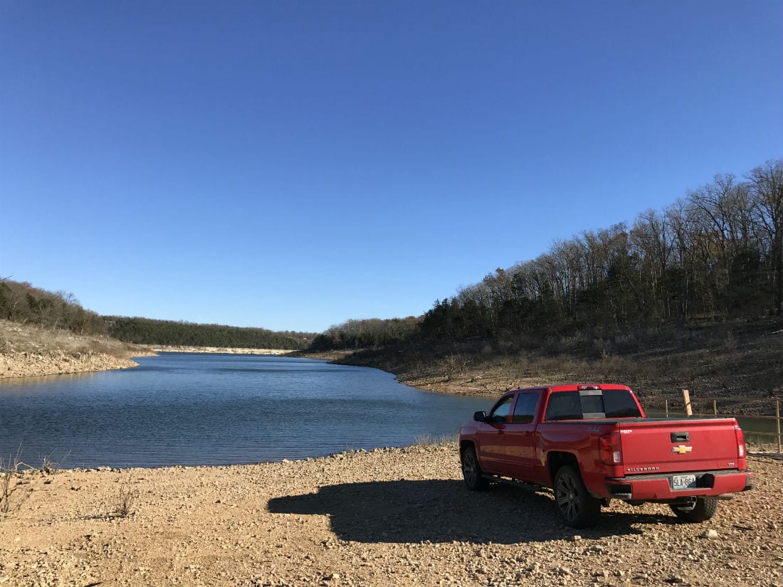
The “winter-time” photo above was taken at “State Line Cove” which is accessible from the property via the trail near the east side of the property. Great for fishing or swimming and we have put a pontoon boat (as well as jet-skis) into the lake from this spot many times!
Speaking of jet-skis…check out the photo below:

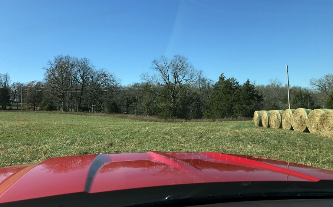
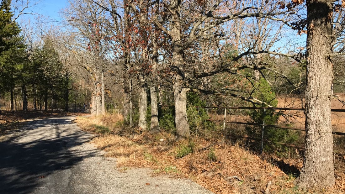
In the photo above, we had just launched two jet skis from the “primitive launch” at State Line Cove. The red truck in the photo above is parked in the same spot as it was in the “winter-time” photo which was above this one. The old fence you see in the photos of State Line Cove is an original “pipe fence” which dates back to when this area was part of a huge buffalo ranch. You will find the same type of pipe fence along the west side of the 10 acres (just off of the paved road).
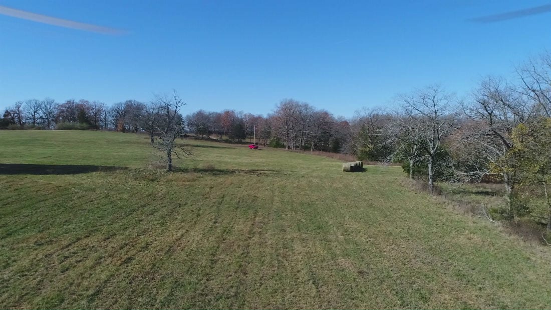
The aerial photo below was taken on another day when we had just launched a couple of jet-skis at State Line Cove. If you look closely you can see the jet-ski trailer attached to the red truck. You can also see the two jet-skis in the cove. They probably played around in the cove for a few minutes before heading out to the main channel to explore the lake. In the photo, the drone appears to basically be over the far east side of the property, but it is hard to tell since we are looking out to the east (and not down).

VIDEOS BELOW!
Below, we have several videos of this unique property. Because we’ve owned this special property for several years we were able to find videos in the file that we had taken at different times of the year. To provide the most information possible, we tried to “combine” the drone videos taken at different times of the year into one video (we did the same thing for the “ground videos”).
So, in the “Drone Video” and the “Ground Video” below you will notice that different parts of the video may have been taken in different seasons. Whenever possible, we narrated the videos to explain as much as we could about the property and about the videos themselves.
The first video is the “Drone Video” in which we fly over the property and the area. The beginning of the video (first half) was taken in the winter-time and the end of the video (second half) was taken in the late summer:

The next video is the “Ground Video” which gives us a pretty good look at much of the property. The beginning and middle parts of this video appears to have been taken before the private driveway into the property was installed and the last part of the video (last 4-5 minutes) shows the property after the private entrance into the property had been completed:

This last video in an “Intro Video” in which we use an interactive map to explore the property and the area. We always try to keep our “Intro Videos” fairly short but in this case we had so much great information about the property that the video ended up being much, much (much) longer then our normal videos. In fact, at over 40 minutes this may be our longest video ever:
Although the videos above do contain a lot of great information, we are always happy to chat about an available tract so feel free to give us a call in the office.
The great access off of the paved road will put you in Branson, Missouri in a little over half an hour. The entire west side of the property fronts the paved road (Mo-Ark Road) for over 220 feet, and much of the road frontage is fenced with pipe fencing (which dates back to when this property was part of a huge buffalo ranch). Because of the paved road access you can drive to this property all year in basically any type of vehicle.

Aerial Map
The photo above is an aerial photo which shows how the property is situated. The east side of this tract directly borders the “Take Line” on Bull Shoals Lake for about 380 feet. The entire west side of the property borders the paved road (Mo-Ark Road) for over 220 feet. There is an approach and driveway which lead into the property at about its southwest corner. Because most of the property is basically level you can drive onto basically any part of the entire 10 acres.
There are numerous spots on the property that would be suitable for building a home or a cabin (or just for camping). But, this large tract was specifically designed to have the prime building site at the east side, near the “Take Line” and the lake. Not only does the property get wider at its east side, but there is also a row of trees which naturally separates the east side from the rest of the property, providing an immense feeling of privacy and seclusion.
AMAZING location for building, hunting, fishing and camping.
This property is located in Taney County, Missouri which has standard zoning. The property is subject to the 6 basic restrictions as shown on our website (no mobile homes, etc.). Homes or cabins built on the property must have a minimum concrete foundation size of 600 square feet (a simple 20 X 30 cabin would meet this requirement).
To see our 6 standard Deed Assurances please click here.
We have priced this tract well below other tracts at Bull Shoals Lake. This is a unique opportunity to own a trophy property with complete owner financing.
Interactive Map – “Land Id” Map – (formerly MapRight Interactive Map)
The “Land Id” interactive map below (formerly called “MapRight”) is useful for exploring the property and the area. You will probably have to “zoom in” in order to see the property on the map because the labels are likely to look VERY messy until you can zoom in on the property.
It will be helpful if you click on the link toward the top of the Interactive Map that says “Full Screen” (which will open the map within a separate browser tab/window).
You can move the map around and even use different “base layers” to view the property and the surrounding area:
The property boundaries are only approximate on the interactive map but they will be helpful for exploring the property and the area. This property was surveyed several years ago and we will be happy to send you a copy of the survey map for your records.
About the free “Land Id” app that you can use to help check out this property:
To watch a short video that details how to use the free “Land Id” app to locate the property, as well as the property’s approximate boundaries, please click on the link below:
Click Here To See A “Land Id” (formerly “MapRight”) Tutorial
You will want to download the “Land Id” app to your phone or tablet before you visit the property, as it will make things go smoothly on your first trip (just follow the directions in the tutorial). If you have questions about Land Id please feel free to call us in the office at (417) 767-2223 and we can assist you. “Land Id” seems to be constantly updating their program so it can be a little confusing when you first get started. In fact, until very recently it was called “MapRight” so it is likely you will hear us use that name within the videos in this listing page, because that is the name we have been using for years!
PLEASE NOTE – Recently a few people have told us that they were required to get a “trial subscription” in order to use LandId. This may well be true because their policies do seem to change often. If you get the free trial membership please put a note in your phone/computer to cancel the membership after you have used it, so that you do not get billed for any actual subscription (unless you want the actual subscription, which is handy).
Topographic Map (topo map) below:

The topo map above shows how the land “lays”. This topo map is a little “grainy” but it does give a fairly good idea of the property’s topography. The majority of this tract is either flat or VERY gently rolling. It slopes at its northeast corner (within the big timber) and it slopes at its northwest side by the paved road. The driveway into the property was installed close to the southwest corner of the property because although much of the paved frontage is sloped the southwest corner offered the best location for a nice approach/entrance.

The aerial photo/map above shows all six tracts at “The Tracts At State Line Cove”. This listing is for Tract 4 which is 10 acres in size. All of the tracts are excellent but Tract 4 probably has the best potential building site which is on the east side of the property where there is a large open meadow as well as mature timber.
The green line (east of the tracts) on the map above shows the “main” trail to State Line Cove. As you already know from watching the videos and looking at the other maps, Tract 4 does have great access to the main trail, simply by heading east off of the southeast side of the tract.
Survey Map Below:

This property is “Tract 4” at “The Tracts at State Line Cove” which is a small rural subdivision in Taney County, Missouri. The survey map above shows all of the tracts within the small private subdivision (there are a total of 6 tracts).
Although it is not shown on the maps above, there is a trail on Tract 6 that starts at Mo-Ark Road and goes east across the entire tract (across Tract 6), linking up with the main trail which goes to State Line Cove.

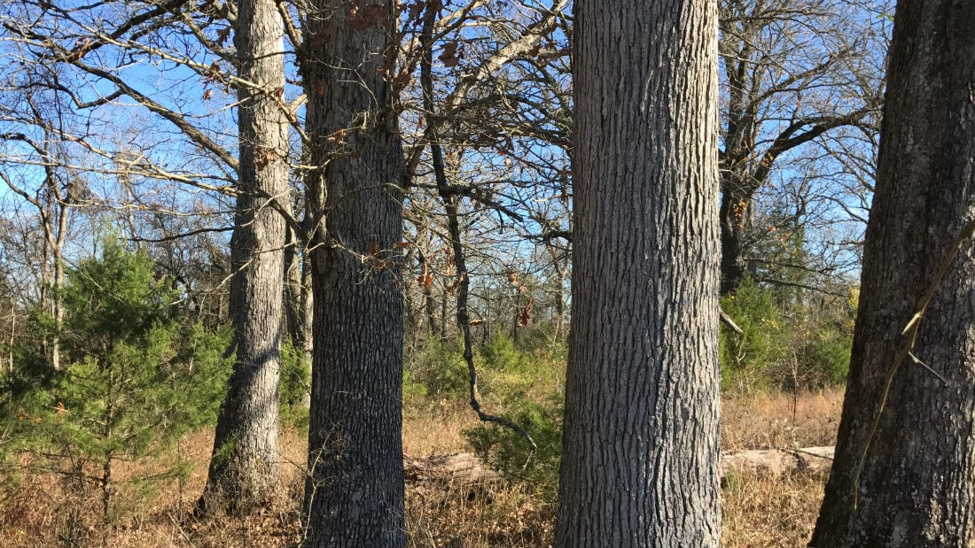
On the east side of the property you will find gorgeous, commercial sized hardwood timber with numerous trees that appear to be well over 100 years old!

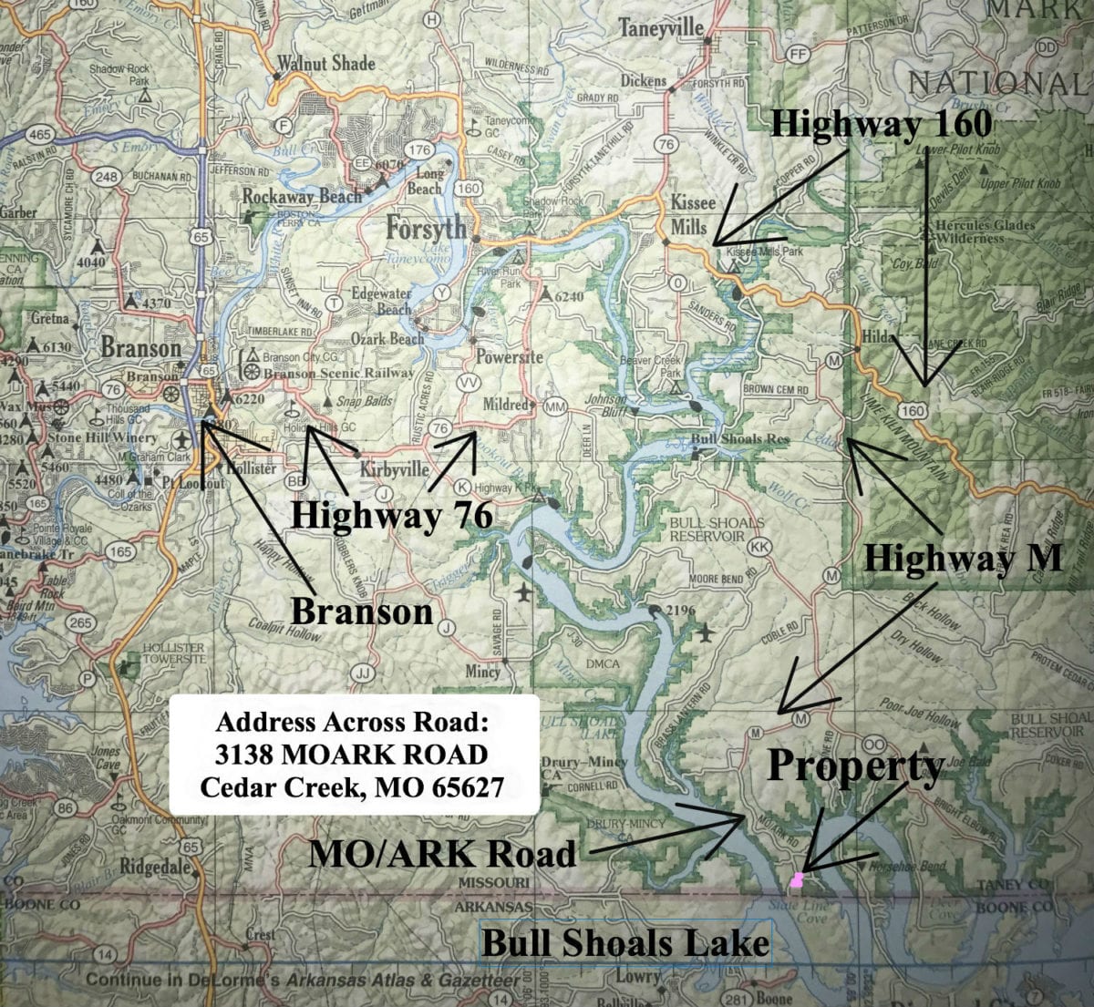
The map above is a road map which which shows the route to the property from Branson, Missouri. The property is actually only about 15 miles southeast of Branson although by road it takes a little over half an hour. If you enter the address: “3138 MOARK Road, Cedar Creek, MO 65627” into your gps/phone it should take you right to the property (this is the address of the neighbor’s house on the other side of the road).
To get to the property from Branson you can go east on Highway 76 until you come to Highway 160. Then go east on Highway 160 to Highway M. Now follow Highway M all the way down to MO/ARK Road. Follow MO/ARK Road to the south and when you see the pipe fencing you are getting close to the property (the pipe fencing starts on Tract 1).
To get to the property from Springfield, Missouri you will go south on Highway 65 (toward Branson), a few miles before Branson you will go east on Highway 160. Stay on Highway 160 through the town of Forsyth and keep heading east (on Highway 160) until you get the Highway M. Go west on Highway M and stay on this road (it heads generally south) until it becomes “Mo-Ark Road”. Now, continue on Mo-Ark Road until you see the property on the left side (east side) of the road. If you get to the end of Mo-Ark Road the pavement will end and you will know that you went just a few hundred feet too far.

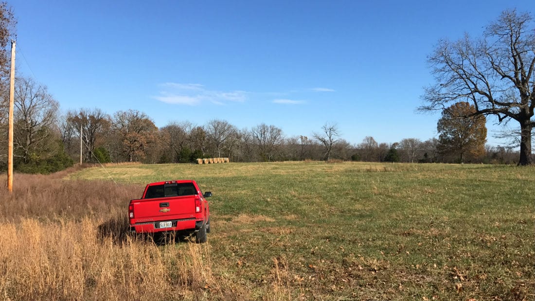
In the photo above the truck is parked on the west side of the property, facing east. There is power directly on-site on this special property.

In the aerial photo above we are looking east toward State Line Cove, which we have found to be a nice place to put a small boat or a couple of jet-skis into the water. You can explore hundreds of miles of shoreline from your boat or just fish and swim from the shore.
Have you been waiting for that “Once In A Lifetime” tract of land? Then you may have just found it!

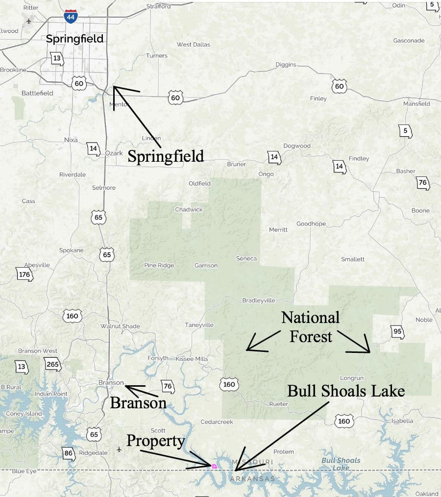
Amazing centralized location. This tract is within half-a-day’s drive to numerous large cities yet is totally private. Springfield, Missouri is a little over an hour to the north. Both Springfield and Branson have airports which makes this property just a plane ride away from anywhere. Fly in to Springfield or Branson and then make the short drive to your unique vacation property! Or, build your home or cabin on the land and spend a lifetime exploring the hundreds of miles of shoreline on Bull Shoals Lake…

In the aerial photo above we are directly over the west side of State Line Cover and we are facing west. In this late-summer photo the water level in the lake has been raised about to its maximum height, but you can still see the area that we use as a primitive boat launch. As we look off to the west we can see the Corp Of Engineers Land as well as part of the meadow on the 10 acres. Way off in the distance we can actually see more of Bull Shoals Lake. Since the property sits on the north end of a peninsula the lake is actually on both sides!
TERMS OF SALE
The full sales price for this VERY SPECIAL 10 acre tract of land at Bull Shoals Lake with over 380′ of direct “Take Line” frontage, electric on-site, paved road frontage, gorgeous open meadows, huge mature timber and more is just $169,500. With your minimum down payment of $2,500 you will automatically receive our reduced annual interest rate of 6 3/4% and the payment will be $1,497.80 a month.
With a $5,000 down payment, the annual interest rate drops to 5 3/4% (our lowest rate) and the monthly payment drops to $1,386.03. These payments are all based on about a 15 year amortization schedule. Property taxes are calculated at $240 a year and this is already included in the monthly payment amount(s). There are NO prepayment penalties and NO hidden fees.
PLEASE NOTE that you have a full 12 months to ADD to your down payment in order to reduce your interest rate and payment amount! We want to give ALL of our buyers the opportunity to achieve the lowest annual interest rate and payment amount possible!
ALSO, if you decide to pay off your property (your loan to us) at any time within the next 5 years you will receive a DISCOUNT in the amount of 10% of the purchase price of the property! On this property that would save you $16,950 for an early payoff!
***This property contains large mature timber (including mature white oak trees and walnut trees). Please note that the timber on the property may not be cut or sold until the property has been paid for in full.***
If this is the property for you then please choose your initial down payment amount in the box below or on the side of the screen (depending on what device you are using to view this listing page) and you can make your payment with a debit or credit card. Feel free to send us an email or give us a call and we can answer any questions or complete the transaction over the phone. Our number in the office is 417-767-2223 or you can reach us anytime by email at [email protected].
If this is the property for you then please choose your initial down payment amount in the box below (or to the side) and you may pay with a debit or credit card. Also please feel free to send us an email or give us a call and we can answer any questions or complete the transaction over the phone. Our number in the office is (417) 767-2223 or you can reach us anytime by email at [email protected] – thanks!
A totally unique property in the southern Missouri Ozarks with frontage on the “Take Line” on Bull Shoals Lake!
In the aerial photo below we are looking east over the property. This rare tract DIRECTLY borders the “Take Line” on Bull Shoals Lake along it entire east side.

This special property had been leased out for several years and we have now decided to offer it for sale. In this listing, we have photo from the summer time as well as from the winter time. Most of the “summer time” photos were taken this summer and most of the “winter photos” were taken 3-4 years ago (before the property was leased out).
In the “winter time” aerial photo below we are looking east over the property. This photo was taken 3-4 years ago and this property now has a private driveway which comes off of Mo-Ark Road and goes easterly onto the property.

This tract provides outstanding opportunities for deer and turkey hunting, world class fishing, camping and building! Paved frontage (with a private driveway), electric on-site, a drilled well, a cool old barn AND direct frontage on the “Take Line” at Bull Shoals Lake make this a property you will want to keep for generations.

The map above is an aerial map which shows how this unique tract is situated. It is at the north end of a beautiful peninsula on Bull Shoals Lake and the east side DIRECTLY borders the “Take Line” on the lake which gives you access to the lake and the Corp Land (the shaded area is the “Take Line”). There is an old trail near the east side of the property that takes you right to a beautiful cove on the lake called “State Line Cove” (indicated by the yellow dashed line on the map above).

The aerial photo above was taken from the “winter-time drone video” of the property that we discovered in our files. It appears to show the trail to the east of the property that runs through the Corp Of Engineers Land and then to State Line Cove.The property has direct frontage on Mo-Ark Road which is a paved County Road. There is a nice
driveway/approach that comes off of Mo-Ark Road and leads into the property. Much of the west side of the property is fenced with “pipe fencing” which was part of the original “buffalo ranch”.

The aerial photo above shows how the property is situated. The entire west side borders Mo-Ark Road (for about 375′) and the entire east side of the property borders the “Take Line” on Bull Shoals Lake (for about 190′). The property is a mixture of meadows and timber. The barn and drilled well are tucked within a hidden clearing toward the west side of the property.
This property is “Tract 3” at “The Tracts at State Line Cove” which is a small rural subdivision in Taney County, Missouri. The survey map above shows all of the tracts within the small private subdivision (there are a total of 6 tracts).

In the aerial photo above we are over the “Corp Of Engineer Land” on the east side of the property. We are looking toward State Line Cove on Bull Shoals Lake.

The map above is a road map which which shows the route to the property from Branson, Missouri. The property is actually only about 15 miles southeast of Branson although by road it takes a little over half an hour. If you enter the address: “3138 MOARK Road, Cedar Creek, MO 65627” into your gps/phone it should take you close to the property (this is the address of a nearby house on the other side of the paved road). UPDATE – This 10 acres now has its own address! It is:
3027 Moark Road
Cedar Creek, MO 65627
To get to the property from Branson you can go east on Highway 76 until you come to Highway 160. Then go east on Highway 160 to Highway M. Now follow Highway M southerly all the way down to MO/ARK Road. Follow MO/ARK Road to the south and when you see the pipe fencing you are getting close to the property (the pipe fencing starts on Tract 1). If you get to the end of Mo-Ark Road then you went about 500 feet past the property.

The photo above is State Line Cove which is accessible through the “Corp Of Engineers Land” on the east side of this special property.

In the winter aerial photo above we are looking down at State Line Cove. The straight line you see is an old “pipe fence” which was part of the “buffalo ranch” and extends directly into the water. In the photo you can see the trail which leads directly into the lake. This is where we have launched a pontoon boat as well as jet-skis. It is a very primitive launch/trail but with a truck we have been able to launch the jet-skis numerous times. The photo above was taken in the winter-time, which is when the Corp of Engineers drops the water level in the lake (which is why it is lower in some photos and higher in others).
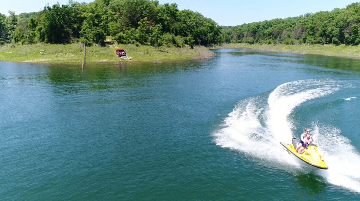
In the photo above we have just put the jet-skis into the water at State Line Cove. We are using the drone to grab a picture of some of the “young folks” speeding around on one of the jet-skis. The pipe fence to the left of the truck is part of the old buffalo ranch and is also the line between Missouri and Arkansas (truck is on the Missouri side). State Line Cove is VERY private and you can even fish right from the shore.
The aerial photo below was likely taken the same day as the “jet-ski” photo above. In the aerial photo was are getting a “bird’s eye view” of State Line Cove and we have just launched two jet-skis into the lake. We played on the jet-skis for quite a while in the cove and then we went and explored a few miles of the shoreline in the main channel. So much fun!

Good quality properties in the Ozarks have been an excellent investment for many decades. Although we can certainly locate a “cheaper” property for you, it is unlikely that we can find a property that is a better value for your money. The numerous features that this 10 acre tract offers makes it one of the most special tracts of land that we have ever had the pleasure to offer. We get calls every week from people searching for a property with frontage on the “Take Line” at Bull Shoals Lake and we seldom have anything to offer. This unique tract not only offers direct “Take Line” frontage but it is adjacent to State Line Cove, has paved road frontage, power directly on-site, the cool old barn, the drilled well, mature timber, open meadows AND it is one of the most level tracts we have ever been able to offer.
If you have been waiting and searching for a very special property then take a good close look at this 10 acres at Bull Shoals Lake!
A property like this will sell FAST! Give us a call or send us an email if you have any questions about the very special property. All tracts are sold on a “First-Come, First-Served” basis and this one could go at any time…