SORRY, THIS PROPERTY HAS BEEN SOLD!
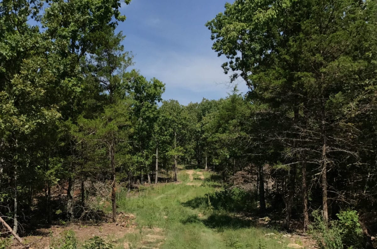
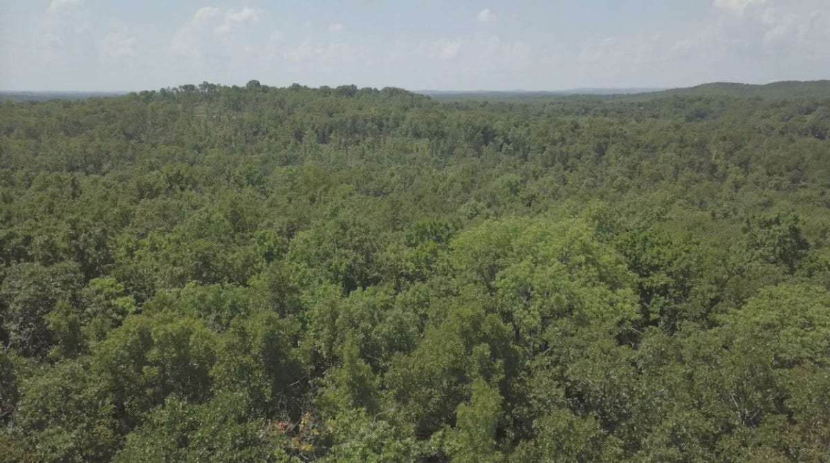
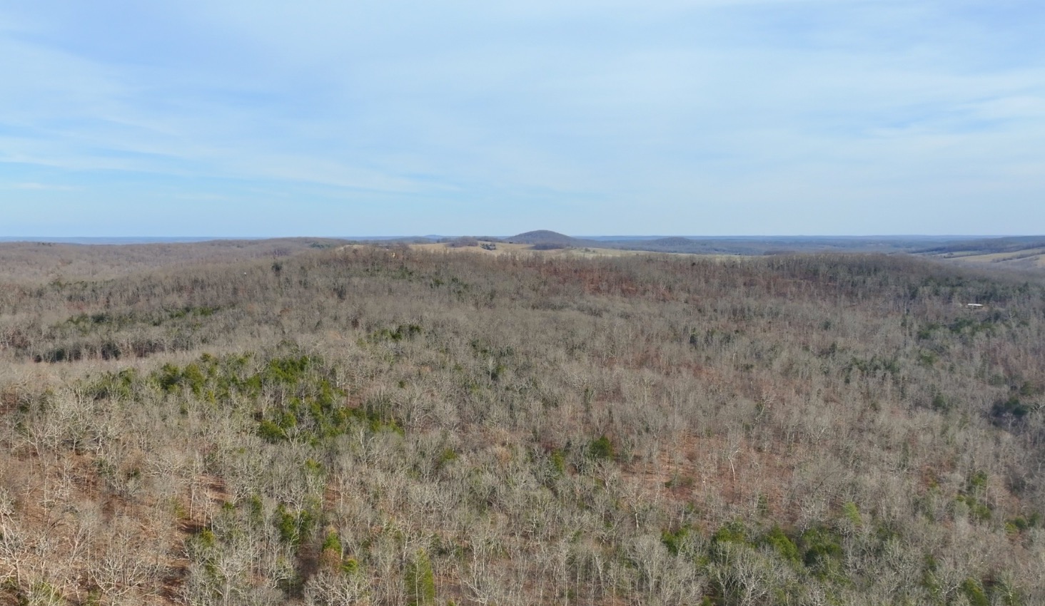
Located toward the end of the gravel easement road, this beautiful acreage offers mature timber and an excellent mixture of gently sloping and level ground which could be very suitable for building, camping and hunting.
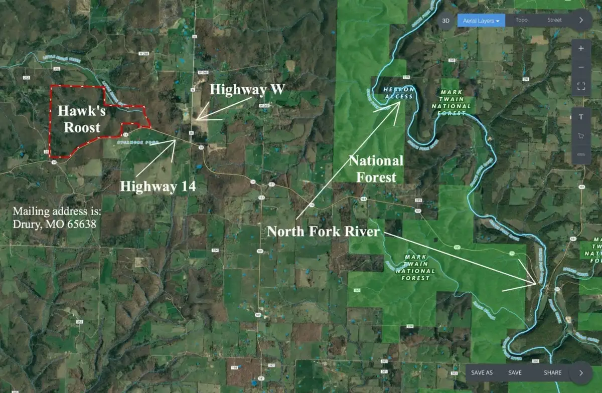
Excellent 8.585 acre tract at Hawk’s Roost in Douglas County, Missouri. The small Rural Development of Hawk’s Roost is located within about 5 miles of the North Fork river for fishing, swimming and canoeing and even closer to the Mark Twain National Forest which offers over 50,000 acres of PUBLIC LAND that can be used for additional hunting, camping, trail riding and exploring!
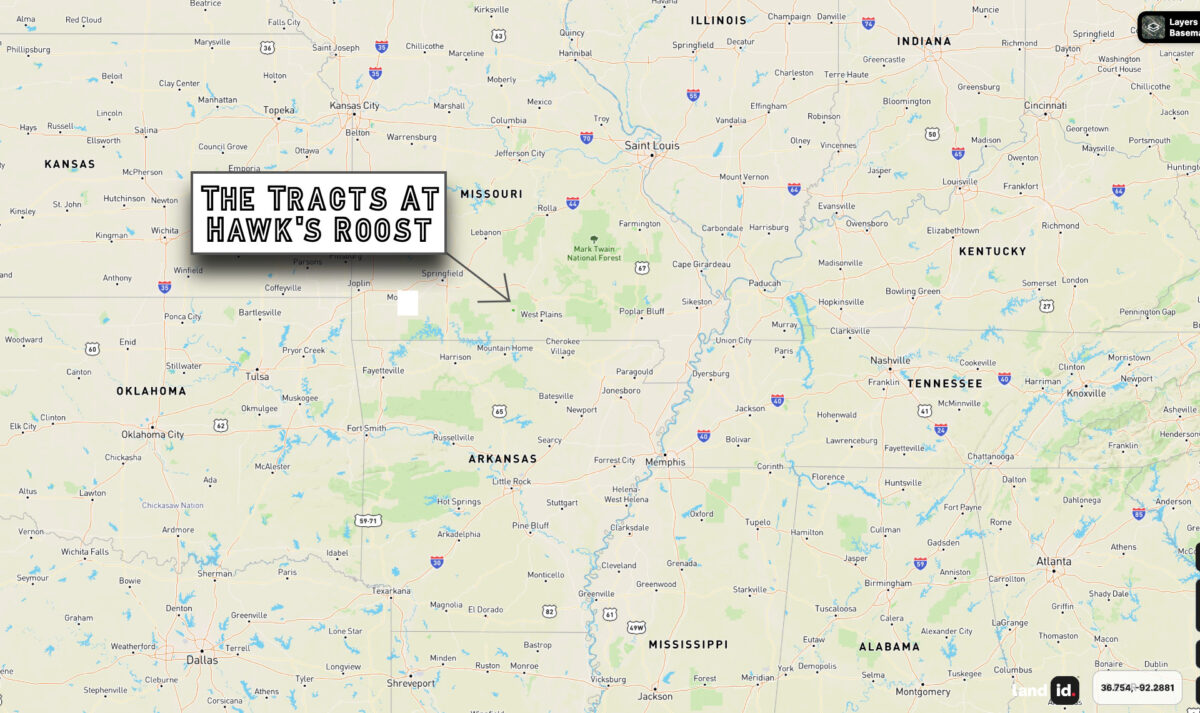
Perfect location in the Ozarks. “Hawk’s Roost” is located within about 5 miles of the gigantic Mark Twain National Forest and the very popular North Fork River.
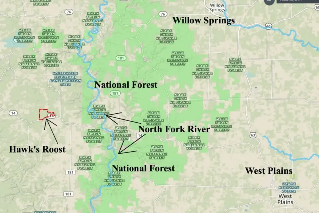
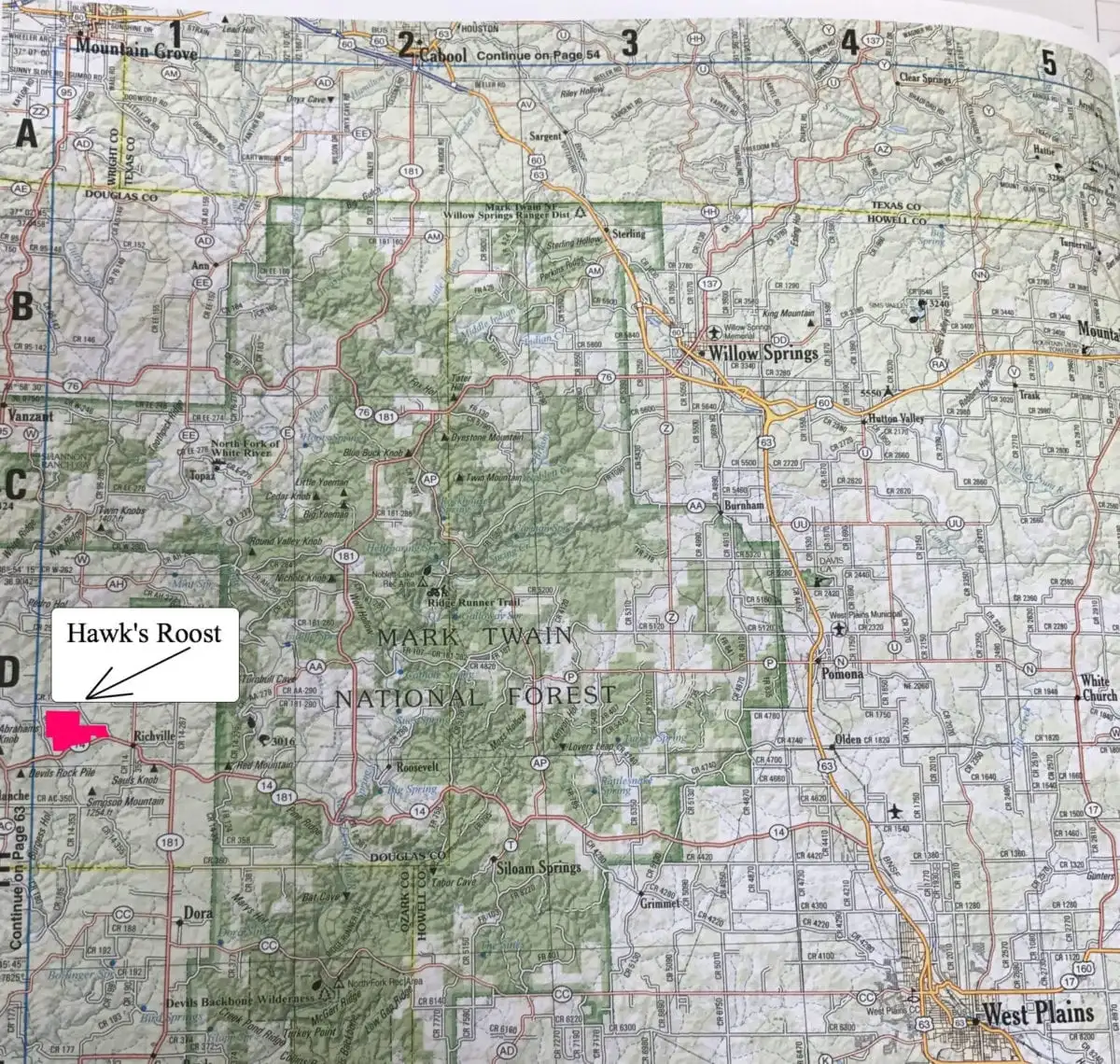
The map above shows the location of Hawk’s Roost which is in the southern Missouri Ozarks. The Mark Twain National Forest is shown in green on the map above and the National Forest can be used for additional hunting and recreation. Fishing in the North Fork River is great and there are numerous public access spots for swimming or to put in your canoe or kayak. West Plains, Missouri is a fairly good-sized regional town and is located about 25 miles to the east of Hawk’s Roost.

Screenshot
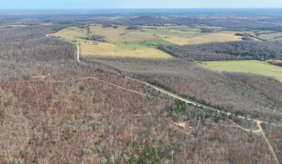
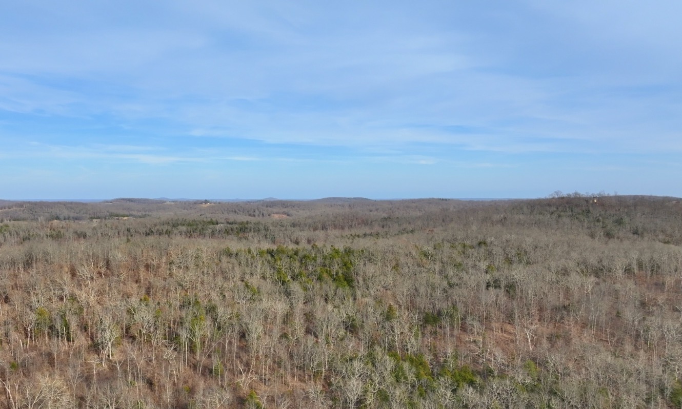
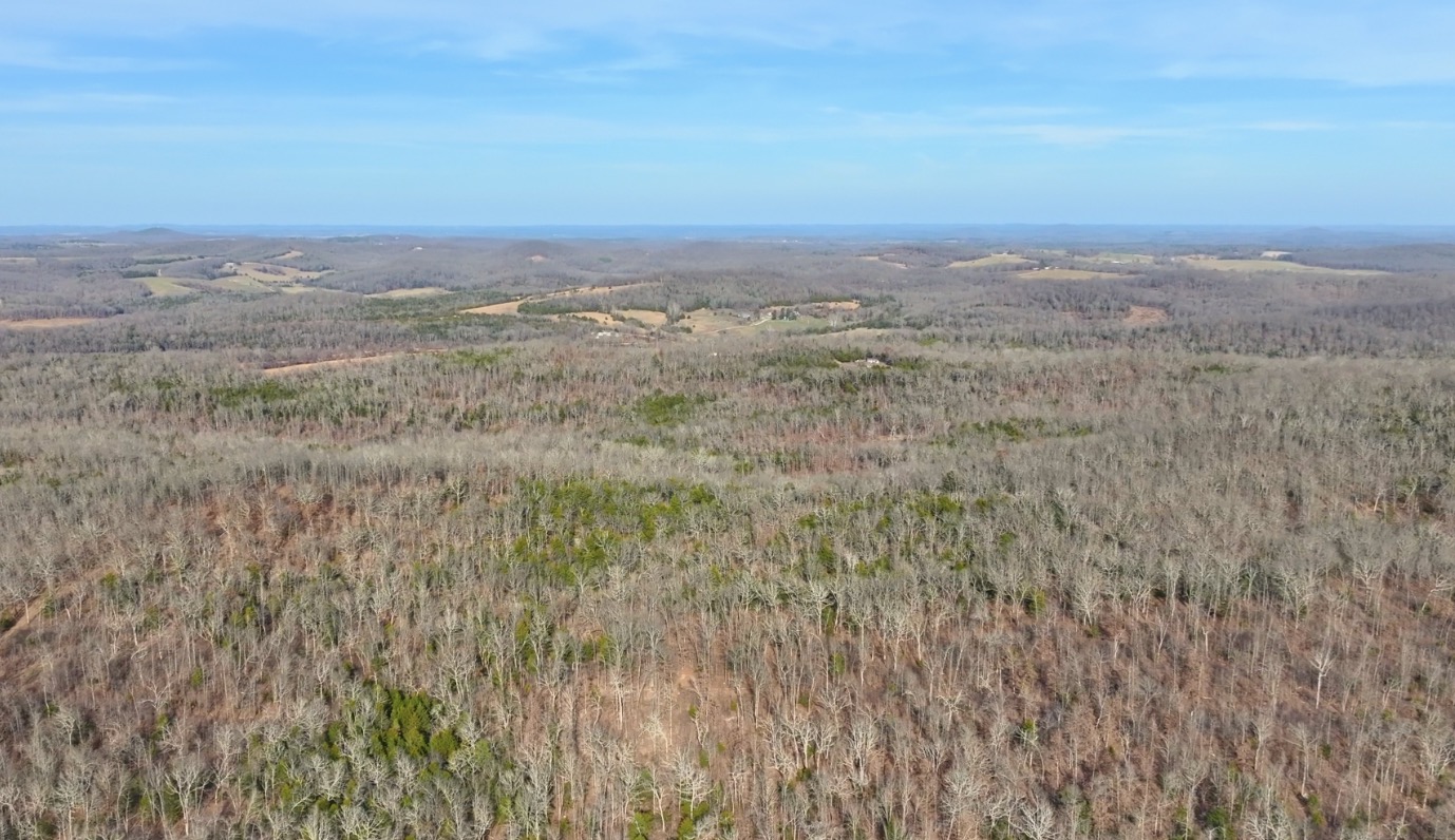
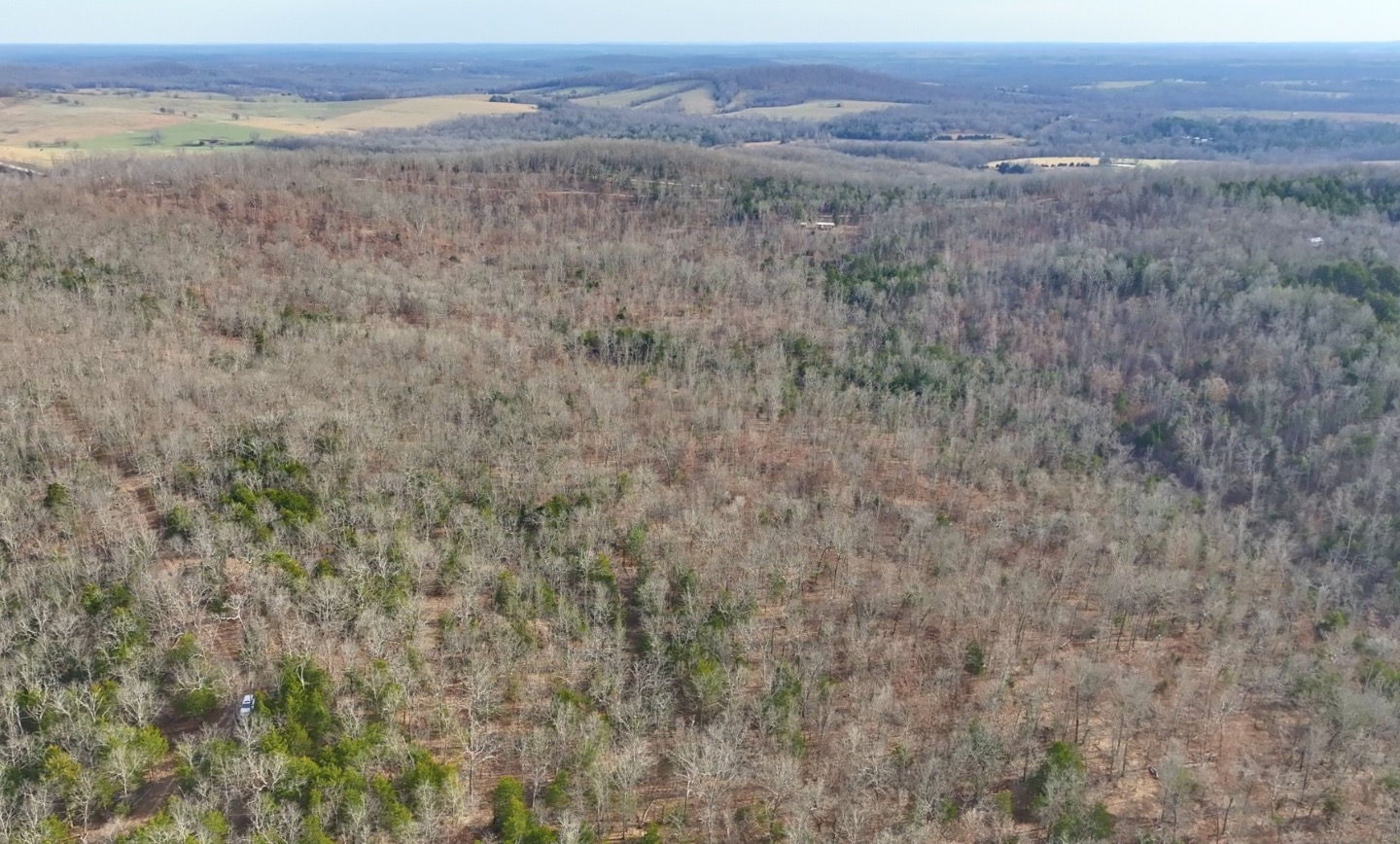
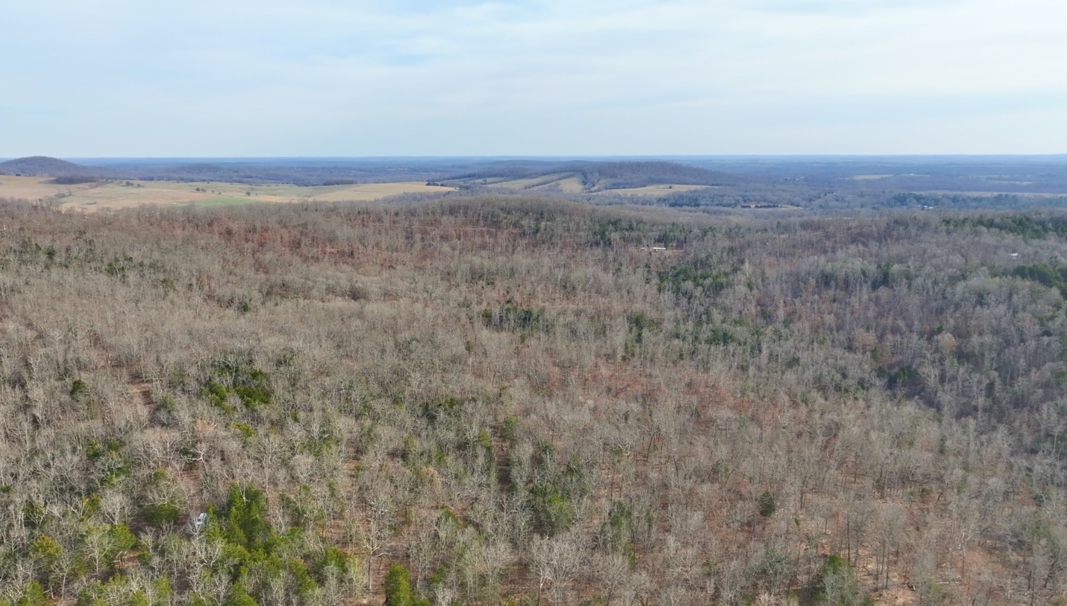
In the winter-time aerial photo above, we are looking southerly from above the easement road at the north end of the property. Since this is a winter-time photo there are no leaves on the hardwood trees, which makes it easy to spot the cedar and pine trees.
TERMS OF SALE
The full sales price for this surveyed 8.585 acre tract at Hawk’s Roost is $49,500 and we offer INSTANT owner financing with just a $1,500 down payment.
With your $1,500 Down Payment you will automatically receive our reduced annual interest rate of 7 3/4% and the payment will be $456.82 a month.
With a $2,500 down payment the annual interest rate drops to 6 3/4% and the payment drops to $420.91 a month. With a $5,000 down payment the annual interest rate drops to 5 3/4% and the payment drops to $374.54 a month. These payments are all based on about a 15 year payment schedule. Property taxes total only $60 a year and this is already included in the monthly payment amount(s) shown above. There are NO prepayment penalties and NO hidden fees or charges.
PLEASE NOTE that you have a full TWELVE MONTHS to ADD to your down payment in order to reduce your annual interest rate and payment amount! We want to give ALL of our buyers the opportunity to achieve the lowest interest rate and payment amount possible!
ALSO, if you pay off your property (your loan to us) at any time within the next 5 years you will receive a DISCOUNT in the amount of 10% of the purchase price of the property! On this property that would save you $4,950 for an early payoff!
If this is the property for you then please choose your initial down payment amount in the box below and you may pay with your debit or credit card. Also please feel free to send us an email or give us a call and we can answer any questions or complete the transaction over the phone. Our number in the office is (417) 767-2223 and you can reach us by email at [email protected].

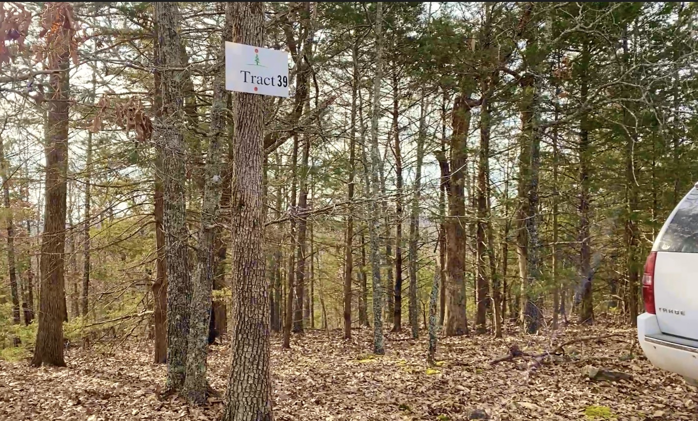
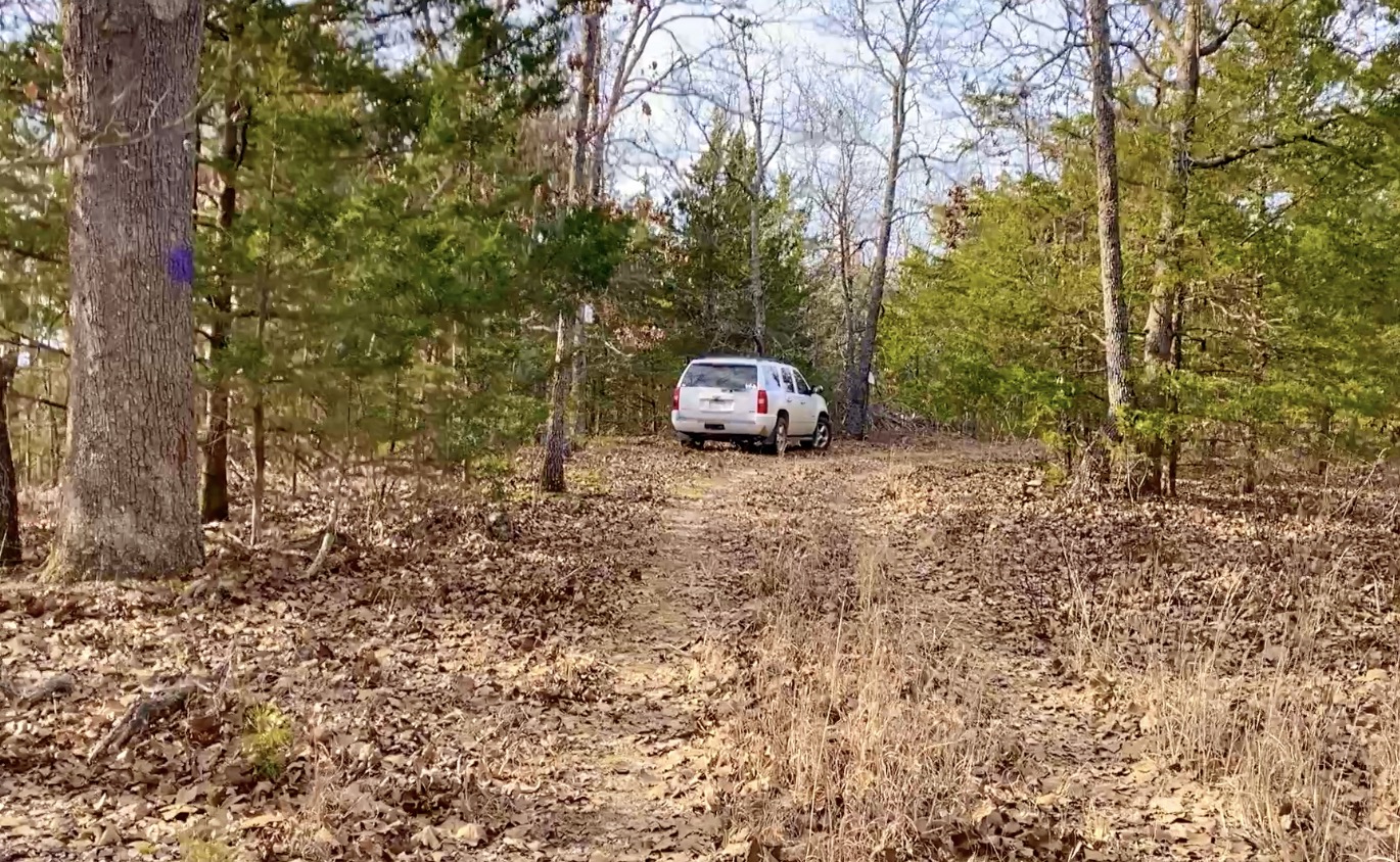
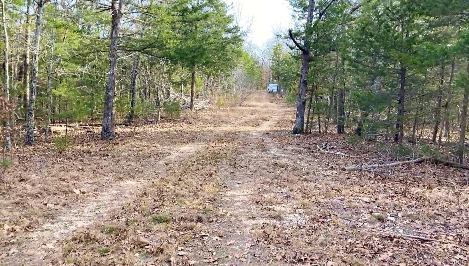
Truck on Road
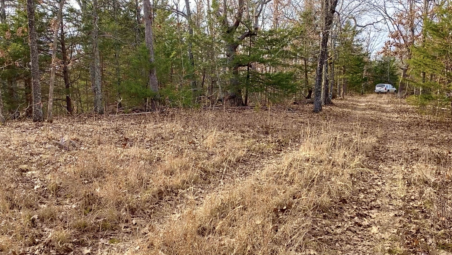
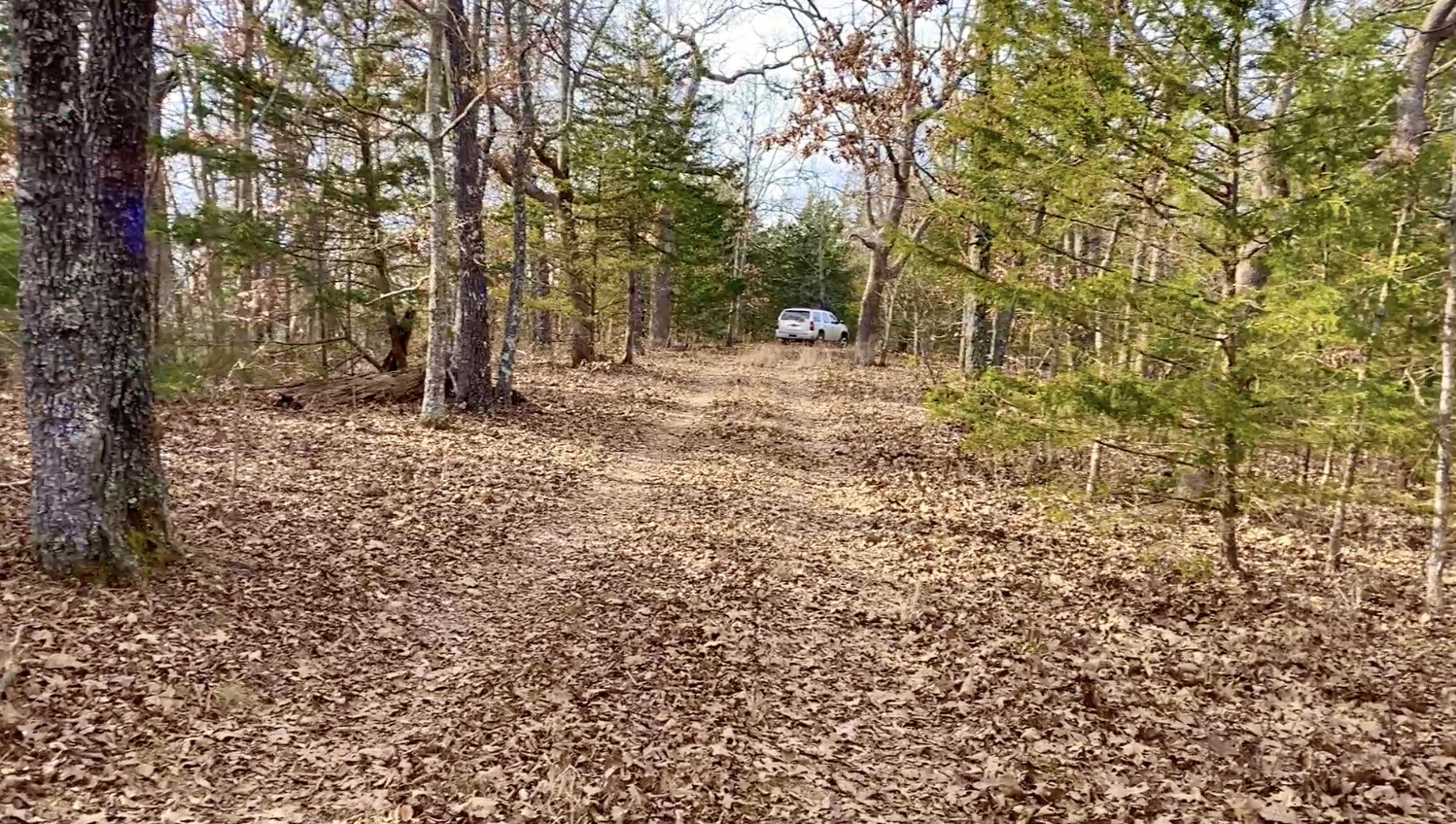
In the photo above we are parked at the north side of the property. We are facing west in the photo so the property is on the left side of the road. With no leaves on the trees you can see that this property has a large amount of timber. It is mostly covered with hardwood trees (red oak, white oak, hickory, walnut, chestnut and more) but you will also find cedar trees and even a few pine trees. In a few of the photos you may notice that there is purple paint or purple marking ribbon on some of the trees. In Missouri, the color purple is similar to a “No Trespassing” sign and the person who had been leasing the property wanted to be sure that it stayed private so they put purple markings/ribbon on some of the trees.
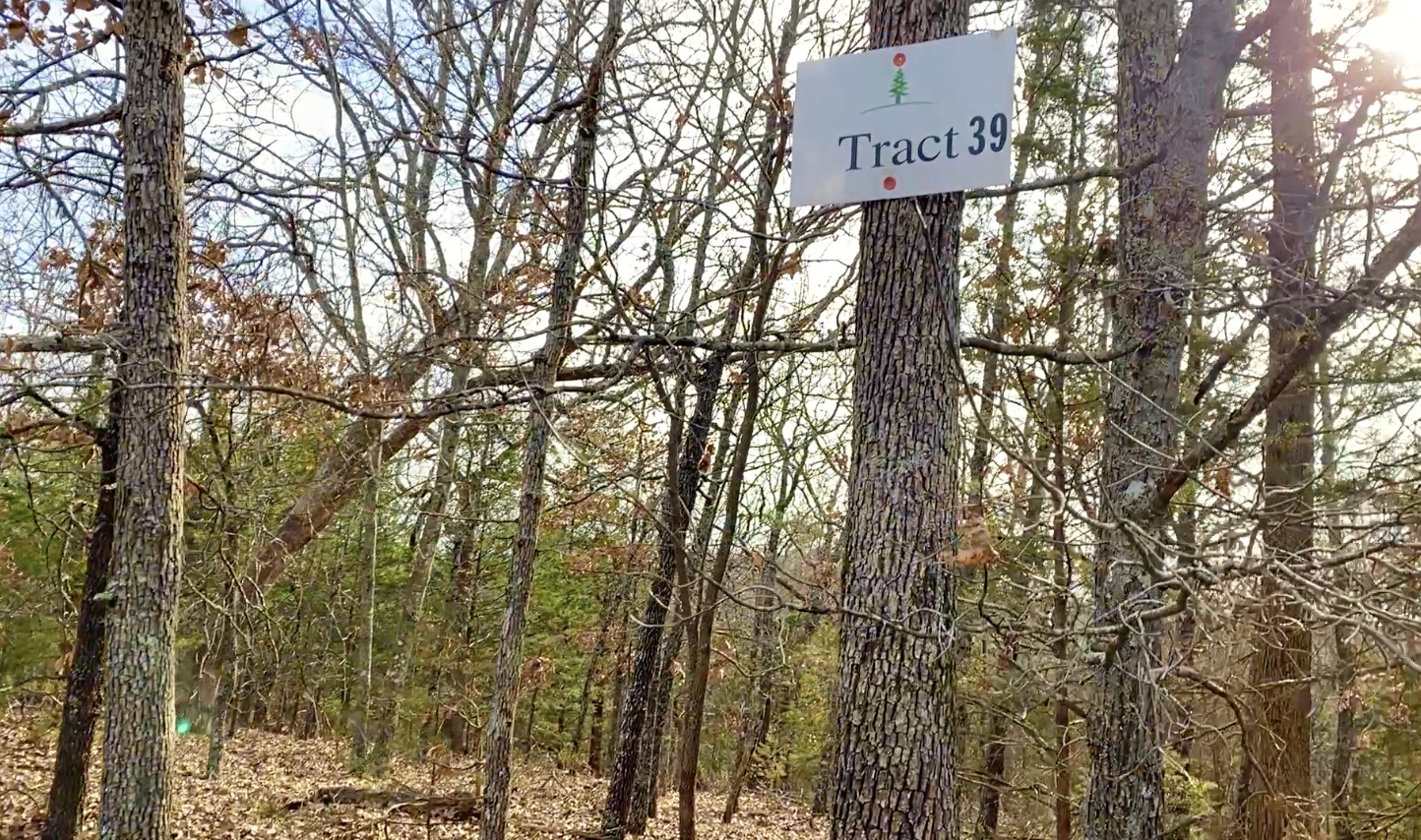
PROPERTY INFORMATION for Tract 39 at Hawk’s Roost:
Property Size: 8.585 Acres
Property Location: Douglas County, Missouri
Property Access: Permanent Deeded Access on Gravel Road. Four wheel drive recommended.
Topography: Excellent southern exposure and a mixture of gently sloping and level ground. Very usable tract with numerous areas suitable for a building site/camping site.
Electric Availability: Power is nearby, approximately 1/2 mile west of property. Many property owners in the area use solar power, even if “grid power” is available.
SPECIAL NOTE: This property has a lovely south-facing slope/exposure which is considered ideal exposure for a solar power system.
Water & Sewer: Property is outside of any city limits so it is not served by city water or sewer lines. Options for water would include drilling a well or using a cistern (for water collection and/or storage). Options for sewer would include installing a septic system but could also be as simple as an “RV style” toilet (as well as dozens of other options).
Address/G.P.S. Coordinates: General property address would be – Drury, MO 65638. — Approximate G.P.S. Coordinates (to about the center of the road frontage on the north side of the property) are 36.8453, -92.2717.
The Tracts at “Hawk’s Roost” – in Douglas County, Missouri
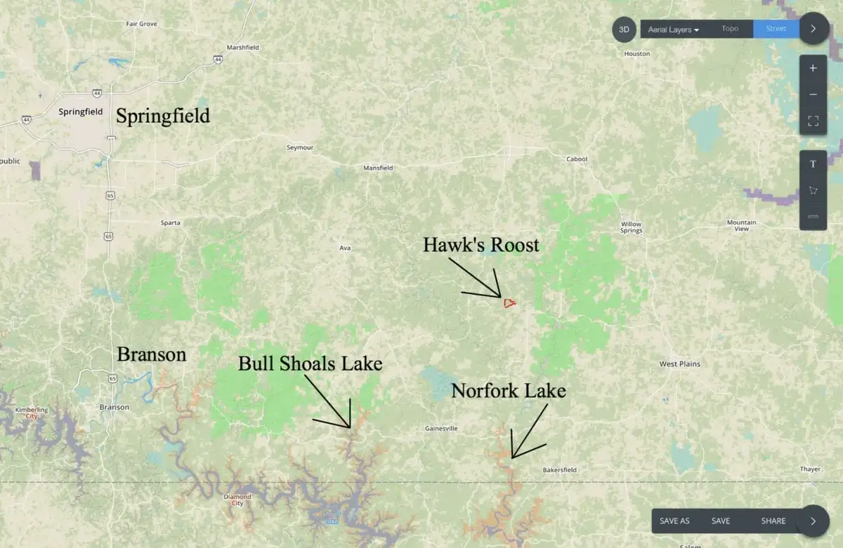
Hawk’s Roost is located in what has been called the “True Ozarks”, which is south central Missouri.Within just a few minutes of the property you will find over 50,000 acres of the Mark Twain National Forest which is Public Land that can generally be used for hunting, camping, trail riding and more. Also, within a very short drive from Hawk’s Roost you will find several popular rivers and lakes! To the east you will find the North Fork river and Bryant Creek and to the south you will find the enormous Bull Shoals Lake as well as Norfork Lake.
Springfield, Missouri is by far the largest city in southern Missouri and it can be found about 60 miles northwest of Hawk’s Roost. Branson, Missouri is about 20 miles south of Springfield which easily puts it within driving distance of Whitetail Ridge.
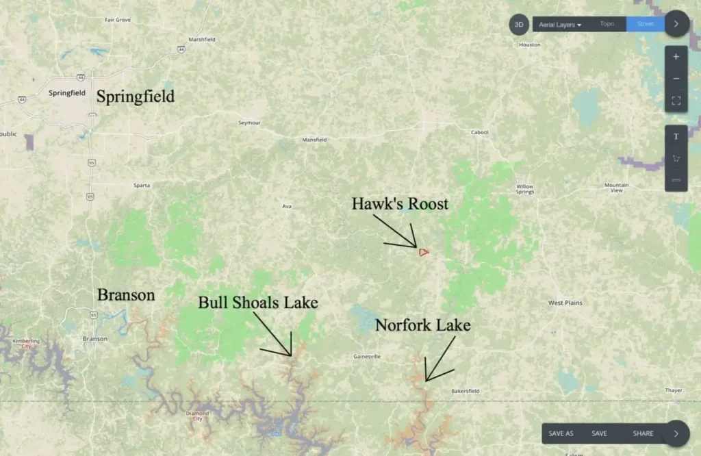
The map above shows the location of Hawk’s Roost, relative to Springfield and Branson as well as Bull Shoals Lake and Norfork Lake.
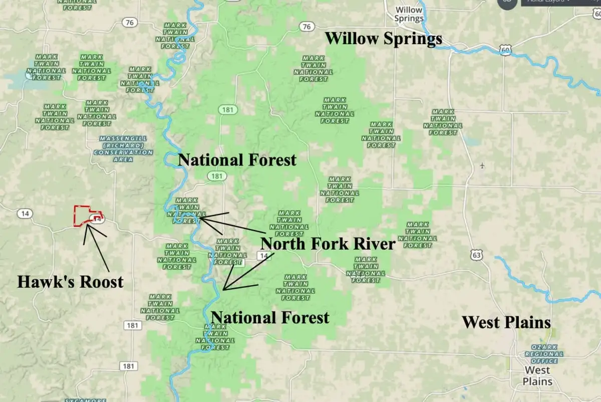
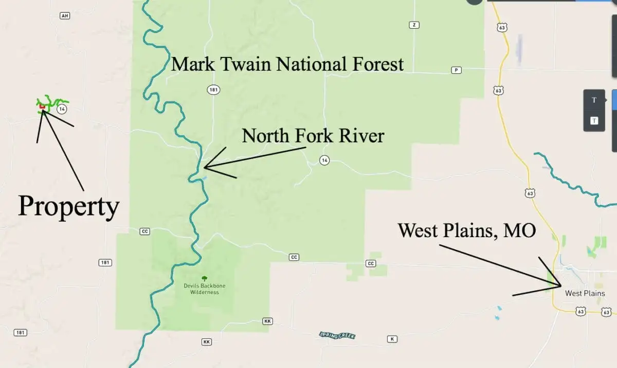
The well-known town of West Plains, Missouri is about 25 miles east of the property (as shown on the map below).
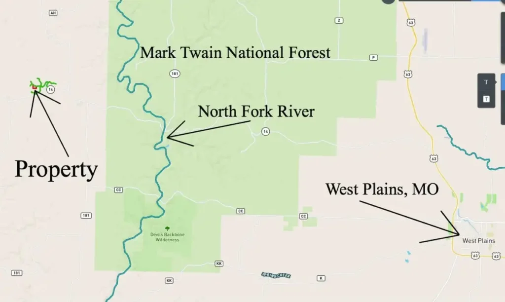
The map above shows the property relative to West Plains, Missouri. West Plains is a popular regional town which continues to grow and add stores and restaurants. Also on the map above you can see the North Fork River which is one of the most popular rivers in the Ozarks for “Float Trips”. The “green colored” area on the map above is the enormous Mark Twain National Forest which will provide you with a free lifetime supply of additional hunting and recreation land.
You can certainly hunt and camp on your private tract at Hawk’s Roost, but having the National Forest so close is almost like having a 50,000 acre “back yard” that you can use for deer and turkey hunting, fishing, hiking, trail riding and more!

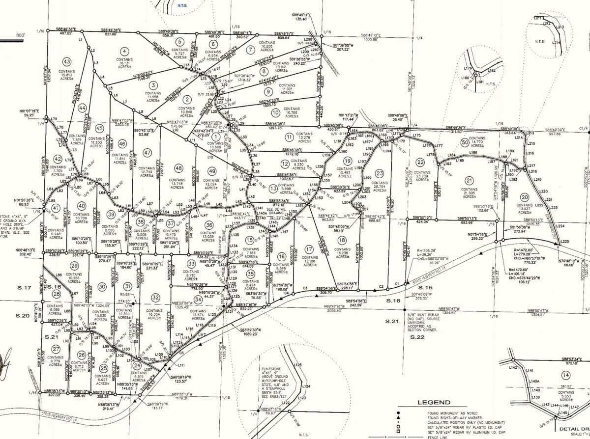
The photo above is a survey map which shows all 50 of the Tracts at Hawk’s Roost.
This listing is for Tract 39 which can be seen toward the left side of the map above. Tract 39 is 8.585 acres in size and borders the gravel easement road along its entire north side.
Below, we have several additional maps which will help to show you the “lay of the land” for this heavily wooded property.

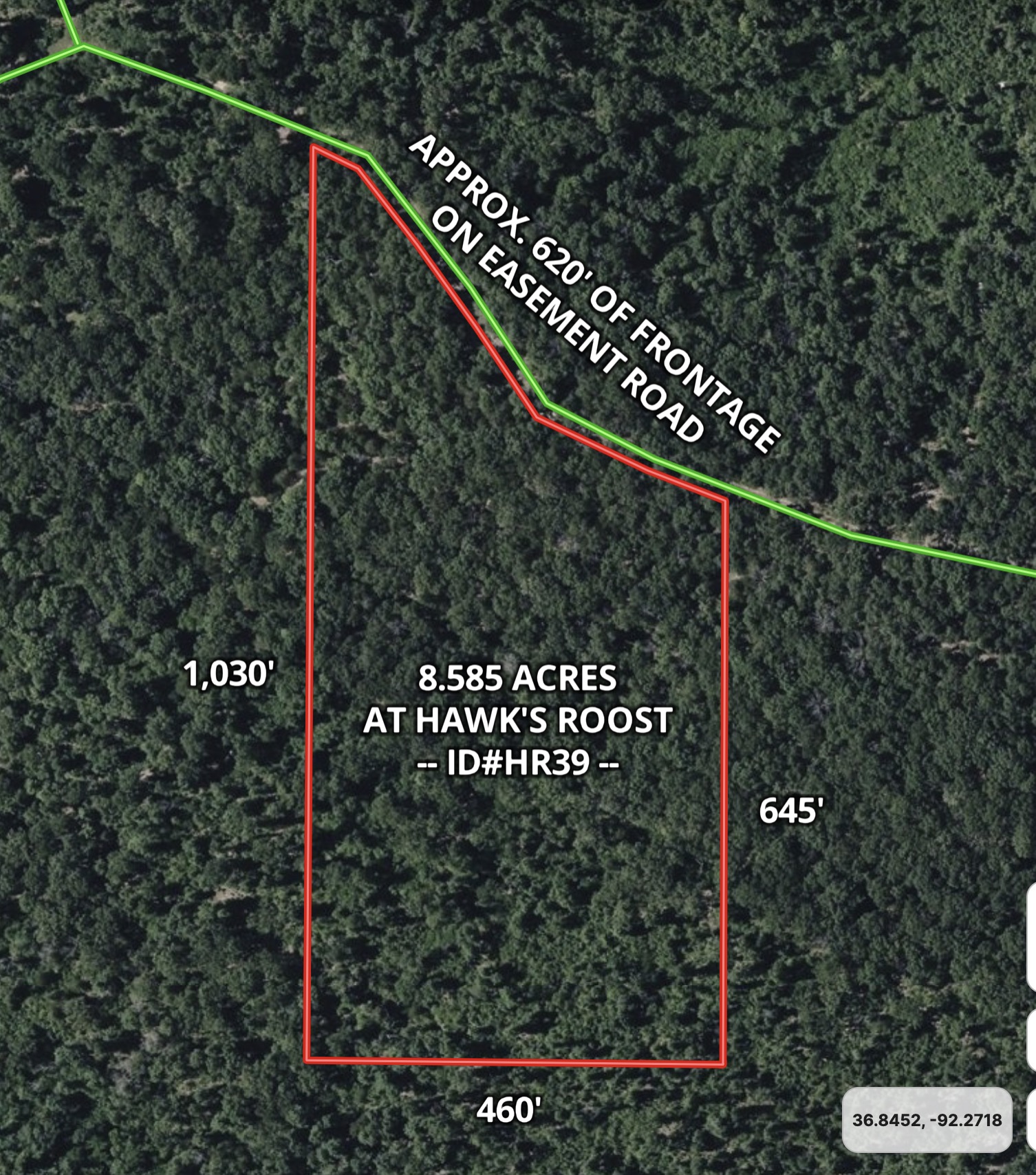
Aerial Map – ID#HR39
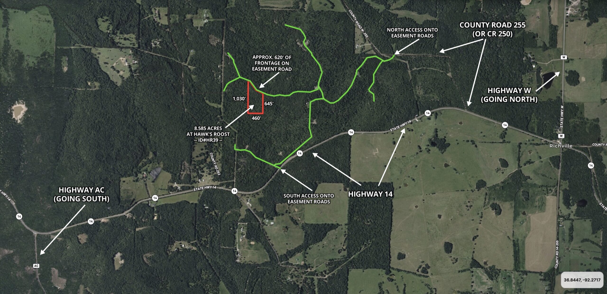
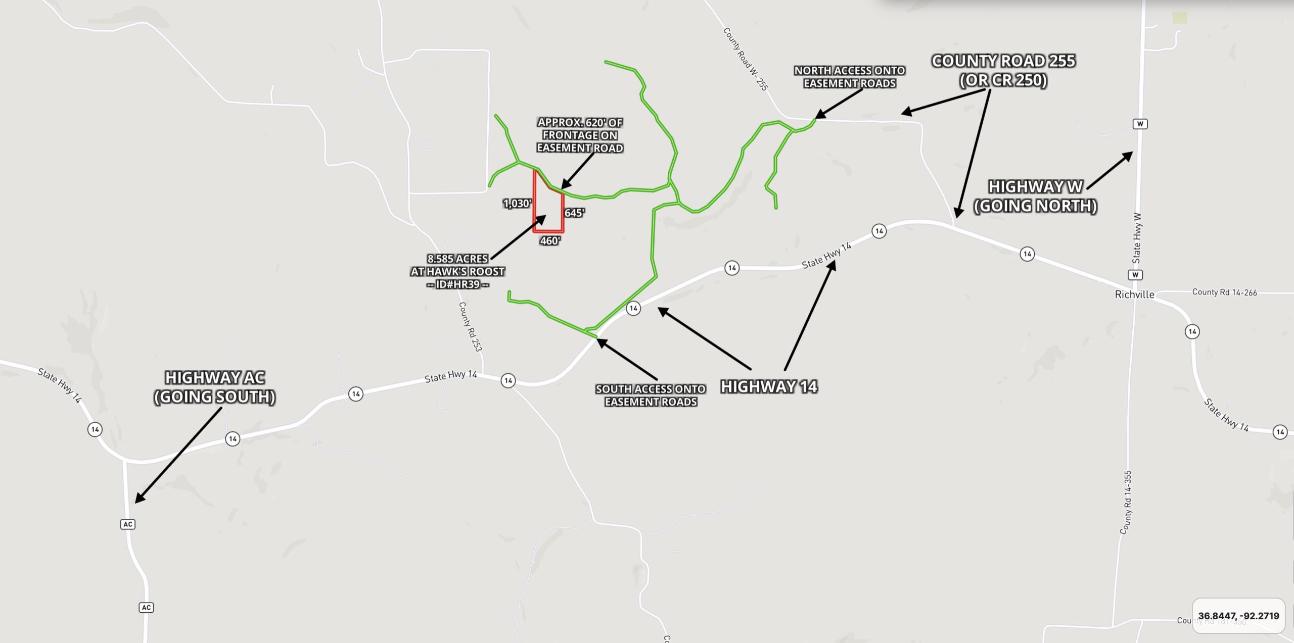
The aerial map above shows how this tract is situated. The gravel easement road runs full-length along the north end of the property for about 620 feet. This property is heavily wooded with numerous species of trees.

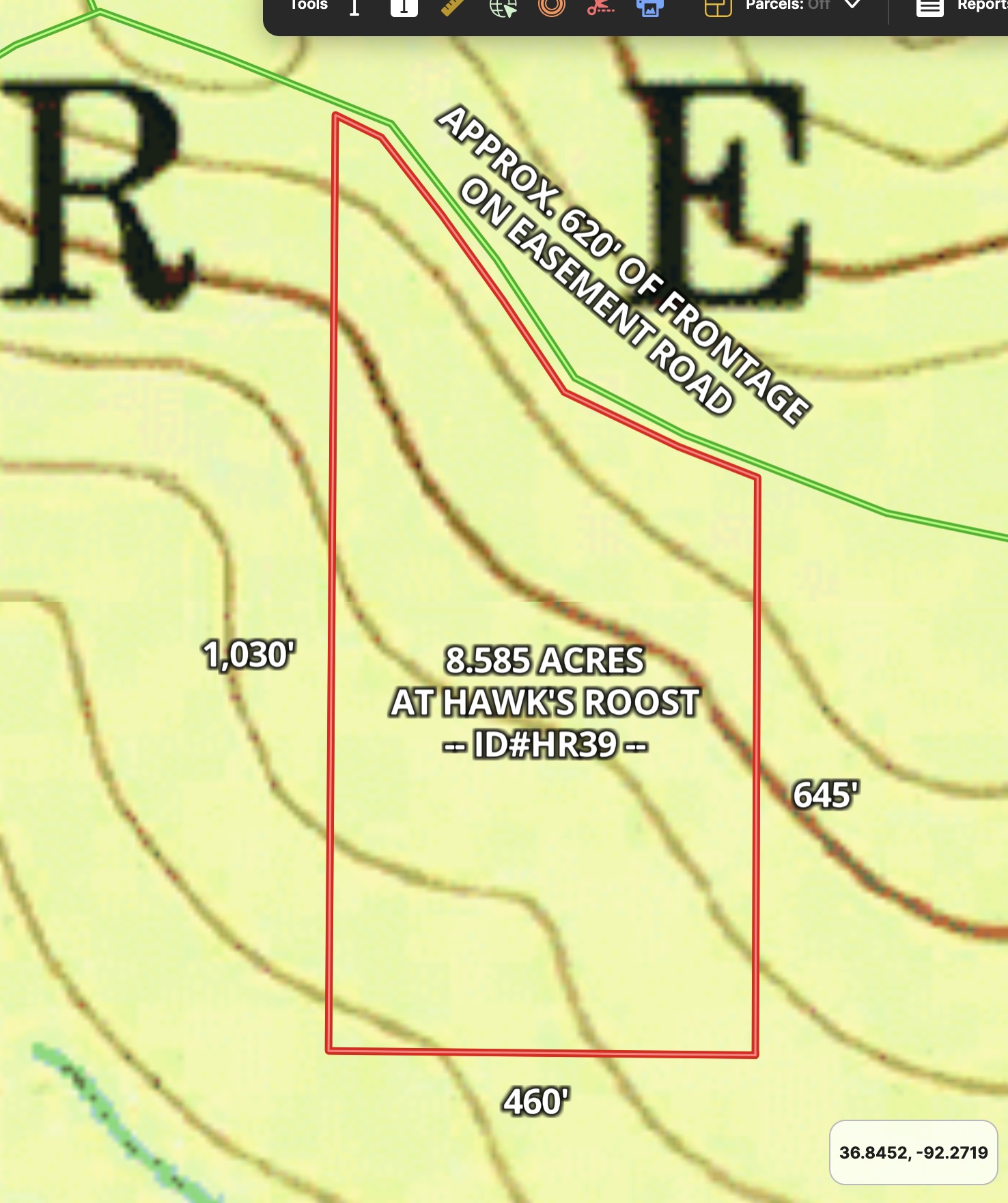
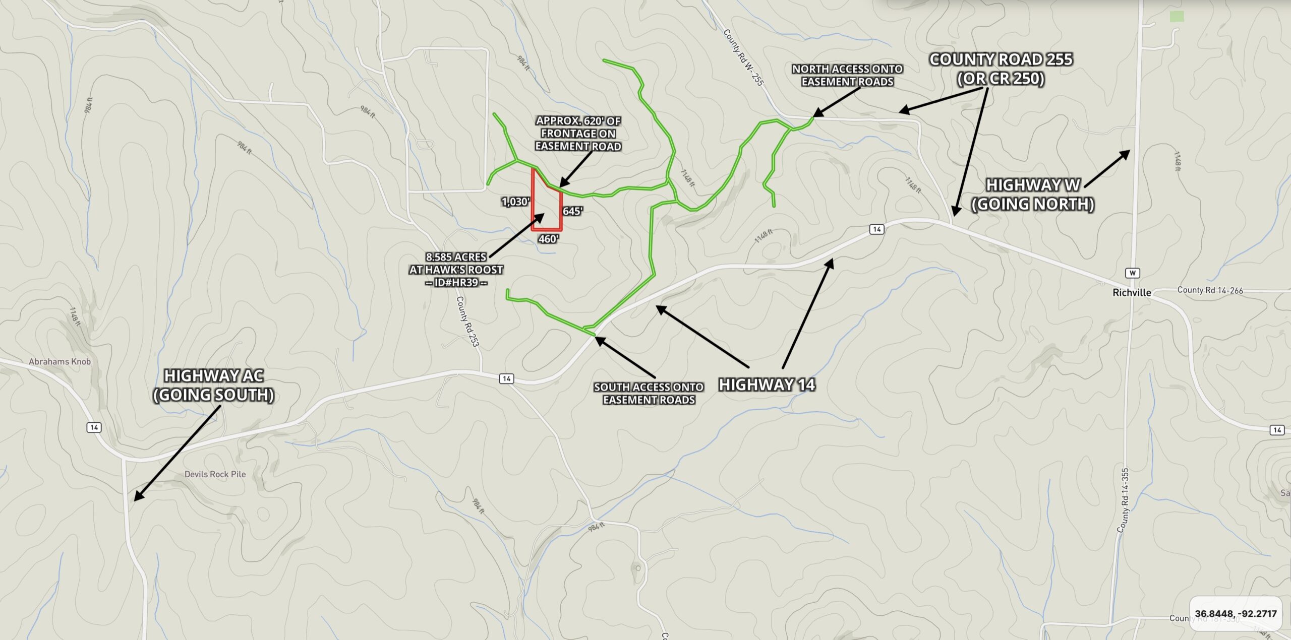
Topo Map – ID#HR39
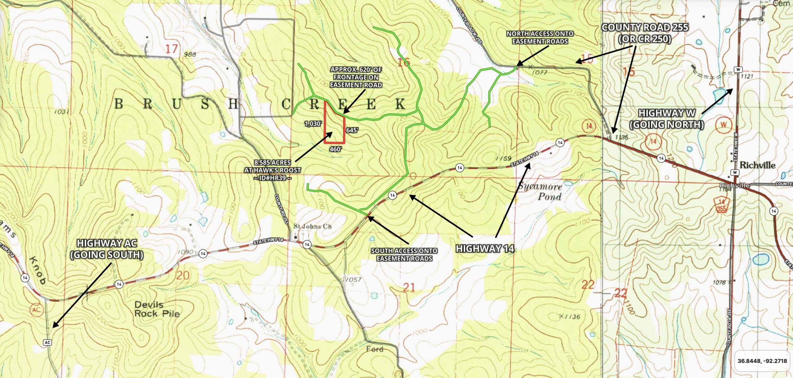
The topo map above gives you an idea of the “lay of the land”. Topo maps can be confusing if you are not used to them so be sure to also watch the drone video in this listing page to see how the land is situated. The topo map indicates that a large portion of the property is either level or only very gently sloped. This particular tract appears to have more level, usable ground than just about any other tract we have ever had in this size range.

Aerial Map of Area – ID#HR39
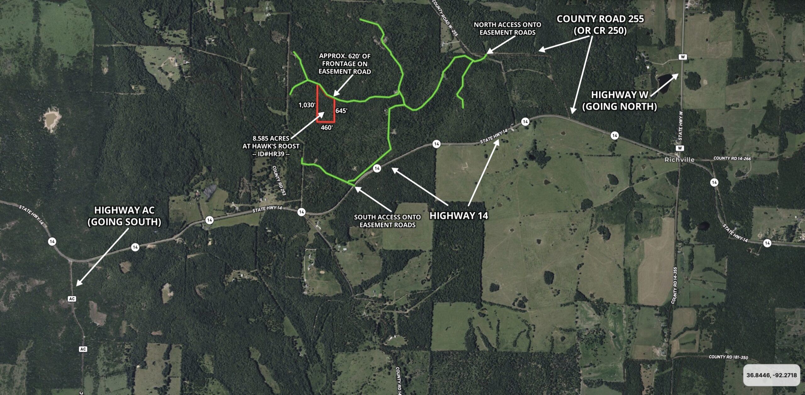
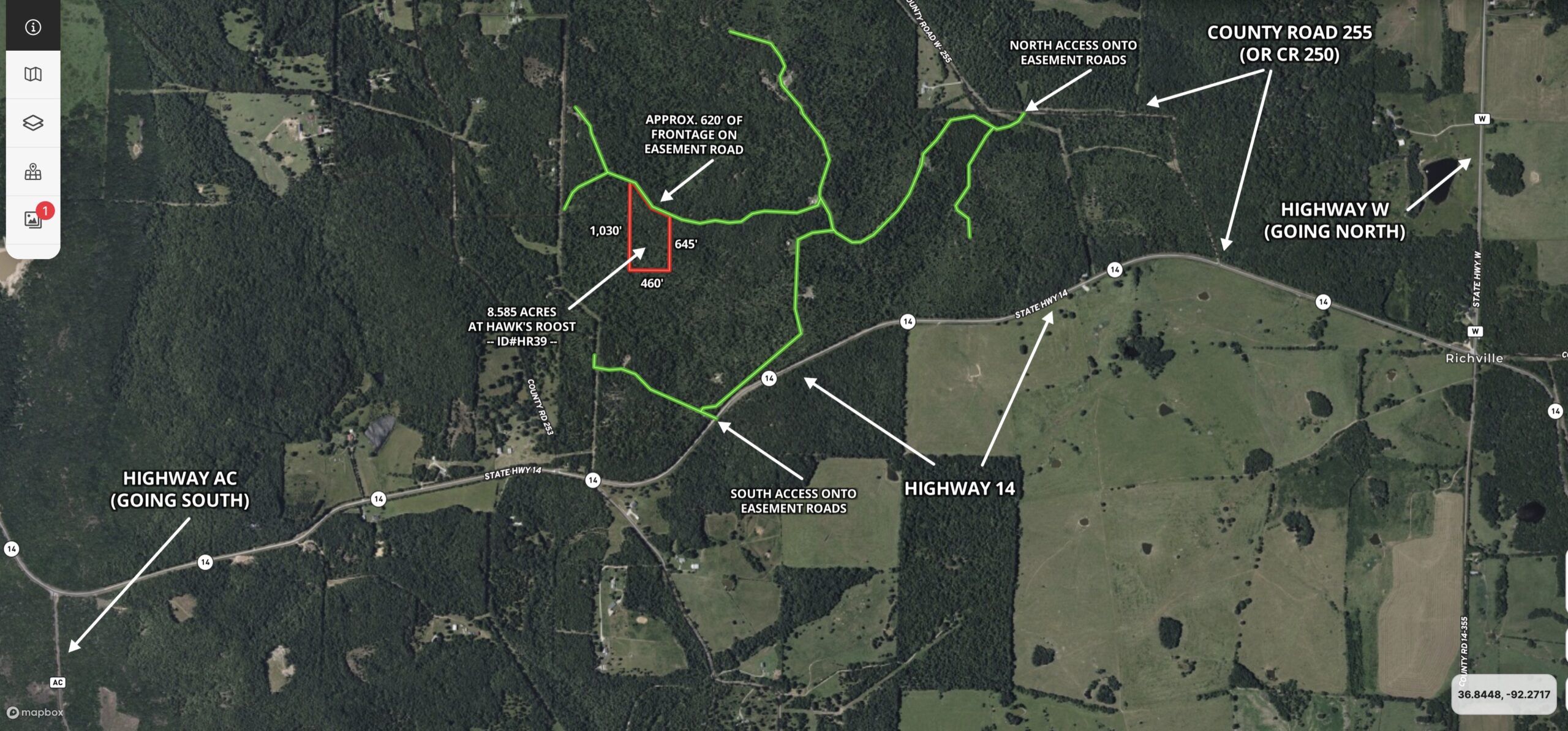
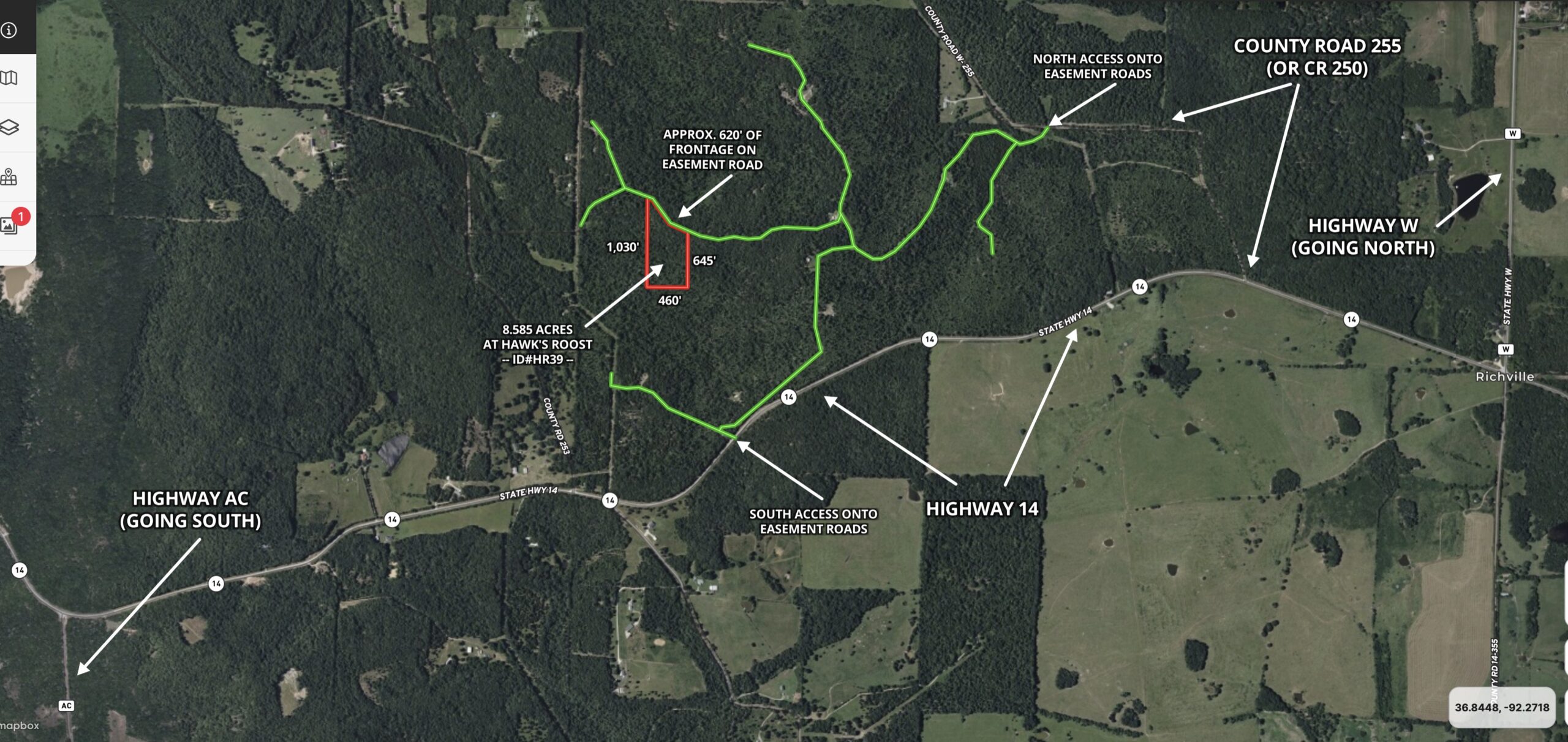
The aerial map/photo above shows the 8.585 acres and its location within Hawk’s Roost. The property is outlined in red in the photo above and the green lines are the gravel easement road system within Hawk’s Roost.

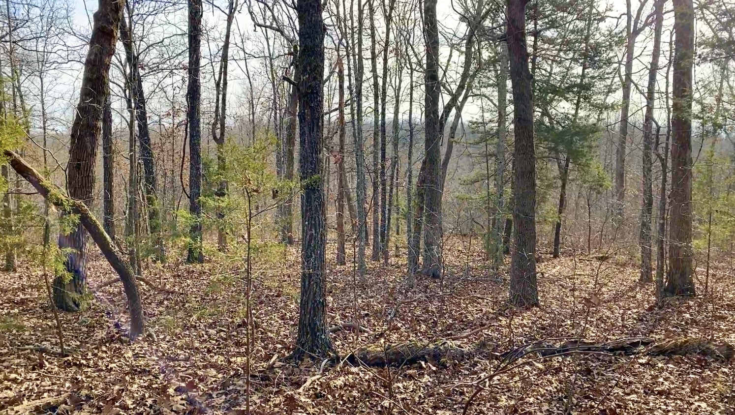
Trees on property
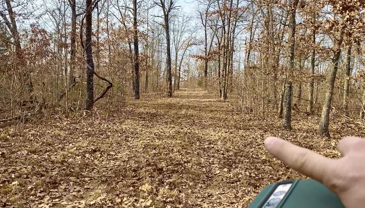
In the winter-time photo above, we are checking out some of the timber on the property.

Survey Pin
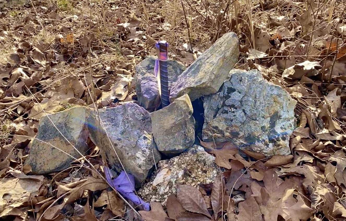
The property was surveyed a few years ago, with the corners marked. The photo above shows a survey marker at the northeast corner of the property (or likely similar to the survey marker at the northeast corner). In some of the photos in this listing (including the photo above) you may see purple paint on the trees and/or other areas. In Missouri, the color purple is used to indicate “No Trespassing”. The purple paint was added by the folks who had been leasing out the property for the last few years.

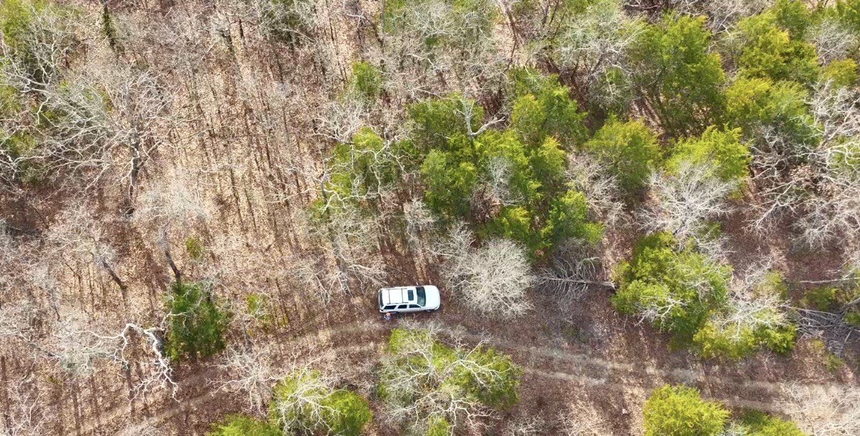
Winter-time Aerial Photo
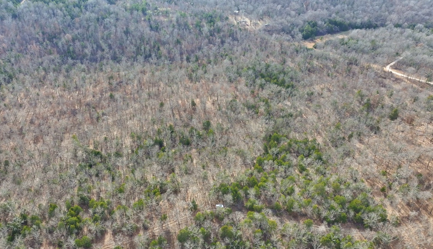
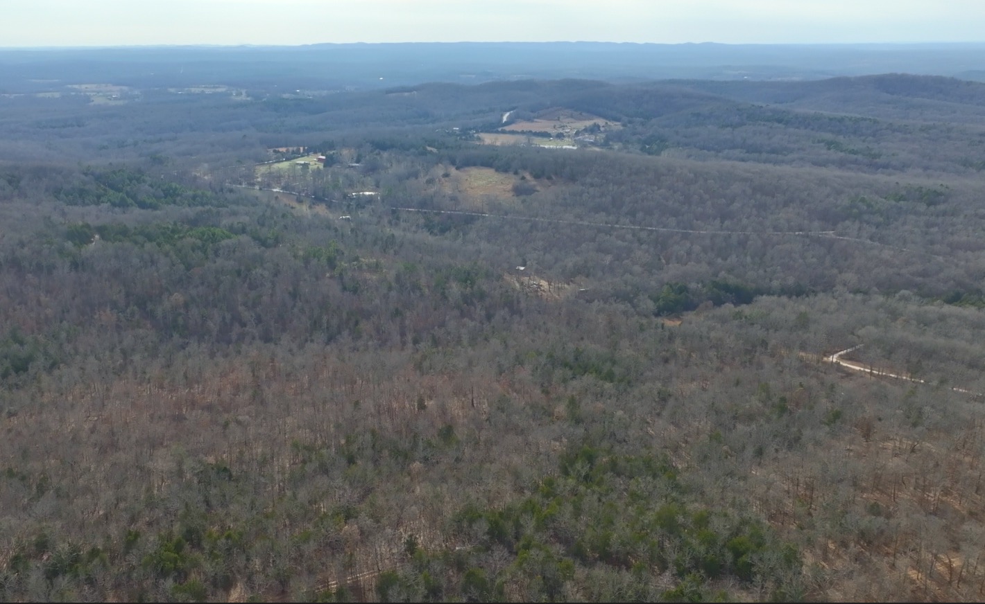
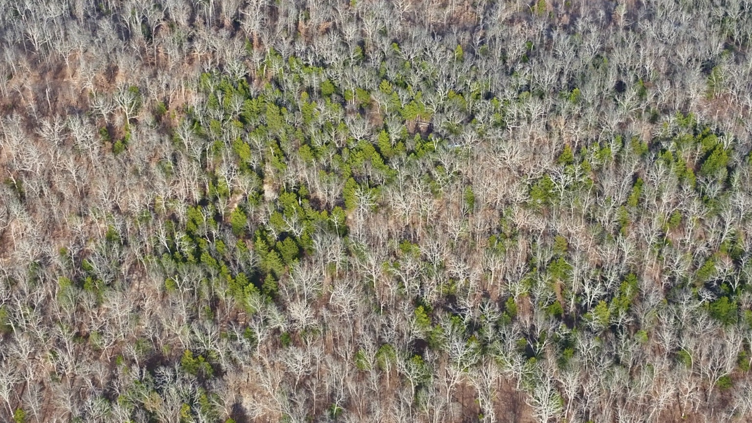
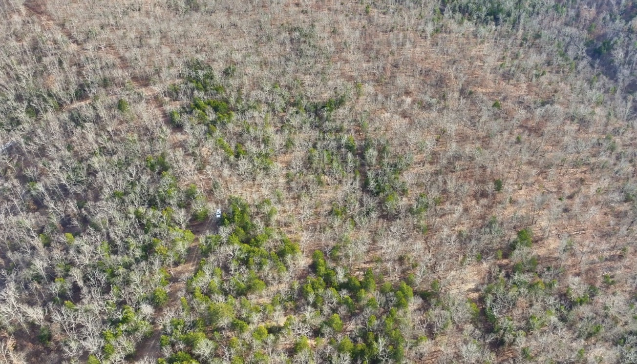
In the winter-time aerial photo above, we are facing northeast while we look over the property . If you look VERY closely you might see the white Tahoe toward the lower left portion of the photo (the Tahoe is parked near the north side of the property).
Now Some Videos of this Beautifully Wooded 8.585 Acres!
This first video is a “Drone Video” in which we check out the property and the area from the air. This is a winter-time video so the only green trees that you see will be cedars and pine trees.
Drone Video Below:
Video Drone HR39 Winter Narrated and Done
The Ground Video (below) is also a winter-time video. When the leaves are off of the trees it does make it much easier to get a good look at the property:
Video Ground HR39 Narrated
The third video (below) is an “Intro Video” in which we use the Interactive Map to take a look at the property and the surrounding area:
Video Intro HR39 Narrated and Done


The “Intro Video” (above) was taken while using the Interactive Map that we have of the property. Below, you will find the same (or a very similar) Interactive Map. It is a great tool for exploring the property and the area.
Interactive Map – “Land Id” Map – (formerly MapRight Interactive Map)
The “Land Id” interactive map below (formerly called “MapRight”) is useful for exploring the property and the area. You will have to “zoom in” in order to see this specific tract. The labels are likely to look VERY messy until you can zoom in on this specific tract.
You can move the map around and even use different “base layers” to view the property and the surrounding area:
The property boundaries are only approximate on the interactive map but they will be helpful for exploring the property and the area. This property was surveyed several years ago, with the corners marked.
About the free “Land Id” app that you can use to help check out this property:
To watch a short video that details how to use the free “Land Id” app to locate the property, as well as the property’s approximate boundaries, please click on the link below:
Click Here To See A “Land Id” (formerly “MapRight”) Tutorial
You will want to download the “Land Id” app to your phone or tablet before you visit the property, as it will make things go smoothly on your first trip (just follow the directions in the tutorial). If you have questions about Land Id please feel free to call us in the office at (417) 767-2223 and we can assist you. “Land Id” seems to be constantly updating their program so it can be a little confusing when you first get started. In fact, until recently it was called “MapRight” so it is likely you will hear us use that name within the videos in this listing page, because that is the name we have been using for years!
Directions To Hawk’s Roost:
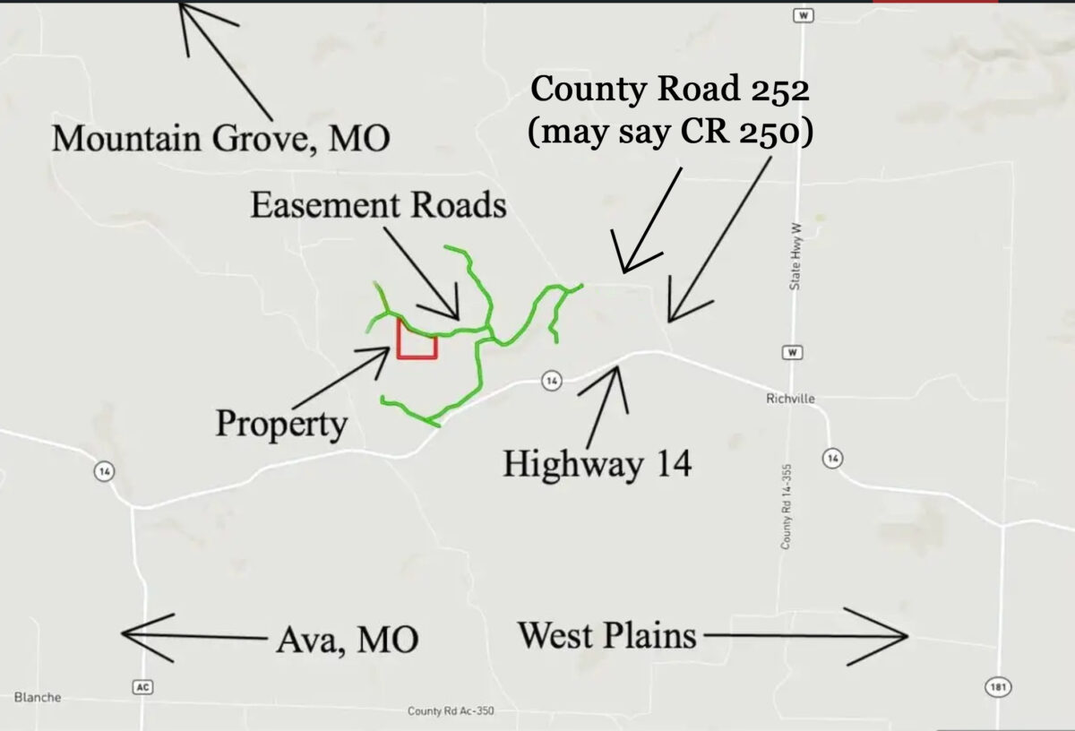
DIRECTIONS: To get to the Hawk’s Roost from Springfield, Missouri just go east on Highway 60 (for about 60 miles) to the town of Mountain Grove. From Mountain Grove, go south on Highway 95 for about 20 miles to Highway 14. Go east on Highway 14 for about 7 miles to the easement road which goes north off of Highway 14 and will take you to the property. Or, if you go past this first easement road you can go north onto County Road 255 (might be shown as CR250 or CR252 on the sign) and then proceed to the easement road system from there.
As these are gravel easement roads you will want to drive your four wheel drive truck or suv to access the property, as the extra few inches of clearance (along with the four wheel drive) could be helpful if there are rough spots in the road.
As with any available tract, please contact us before making the trip to the property as there may be a locked cable/gate toward the start of certain easement roads. If so, we will be happy to provide you with the combo for the lock when you contact us. As we mentioned earlier, the MapRight app (Land Id app) is a VERY helpful tool when you visit the property. It is great to use when driving to the property and it is even better to use when you arrive. Just get it all set up while you are in town as it can be hard to set up “on the go”.
Rural acreage has always been an excellent investment, and the last few years have made most people understand that rural property in the Ozarks is still undervalued! As this area continues to grow in popularity the demand for wooded rural acreage continues to grow at a rapid rate. Lock in your property now, while you still can!

Area Map
As shown on the map above, there are two ways into Hawk’s Roost. There is a gravel easement road which goes north off of Highway 14 and there is a separate gravel easement road which comes off of County Road 252 (which might be labeled as County Road 250 or County Road 255).
Hawk’s Roost is in an ideal location in southern Missouri. A mild climate, abundant wildlife and friendly people are just a few of the reasons that more and more people are choosing southern Missouri for their home or for a vacation/recreation property.
Also, if you look to the east and the south of Whitetail Ridge on the map above, you will notice several large green-colored areas. These are the different parts of the Mark Twain National Forest which is a HUGE National Forest that is open for public hunting, fishing, hiking, camping, trail riding and more. You can definitely hunt on your private tract at Whitetail Ridge, but if you decide to explore additional hunting land you will find that there are many THOUSANDS of acres of public land within just a few minutes of your new property!

This very well-located property is literally within half a day’s drive of NUMEROUS major cities. You can easily drive to Springfield or Branson, Missouri and be back to your property in time for lunch. But, you can also drive to Kansas City, St. Louis, Nashville, Memphis, Little Rock, Tulsa or any one of numerous other large cities and be back to your property in time for dinner (maybe a late dinner).
Property Covenants
Like all properties at Hawk’s Roost, this tract is subject to the 6 basic restrictions as shown on our website (no mobile homes, etc.). Homes or cabins built on the property must have a minimum concrete foundation size of 600 square feet (a simple 20 X 30 cabin would meet this requirement).
To see the 6 standard Deed Assurances please click here.
As with all of our properties, there is a 100 foot setback from all shared roadways (highway, county road and easement roads) for utility purposes and also as a privacy buffer. The utility easement along the sides/back of each property is 30 feet. Also please note that timber with a stump diameter larger than 8 inches (when measured at ground level) may not be cut, sold, disturbed or removed until the property has been paid for in full. We can often give written exceptions for creating building sites and driveways, contact us for details.
This tract represents an excellent opportunity for building your own off-grid home or cabin as there are no building permits required in this area! You and your friends/family can build your own cabin without permits or inspections.

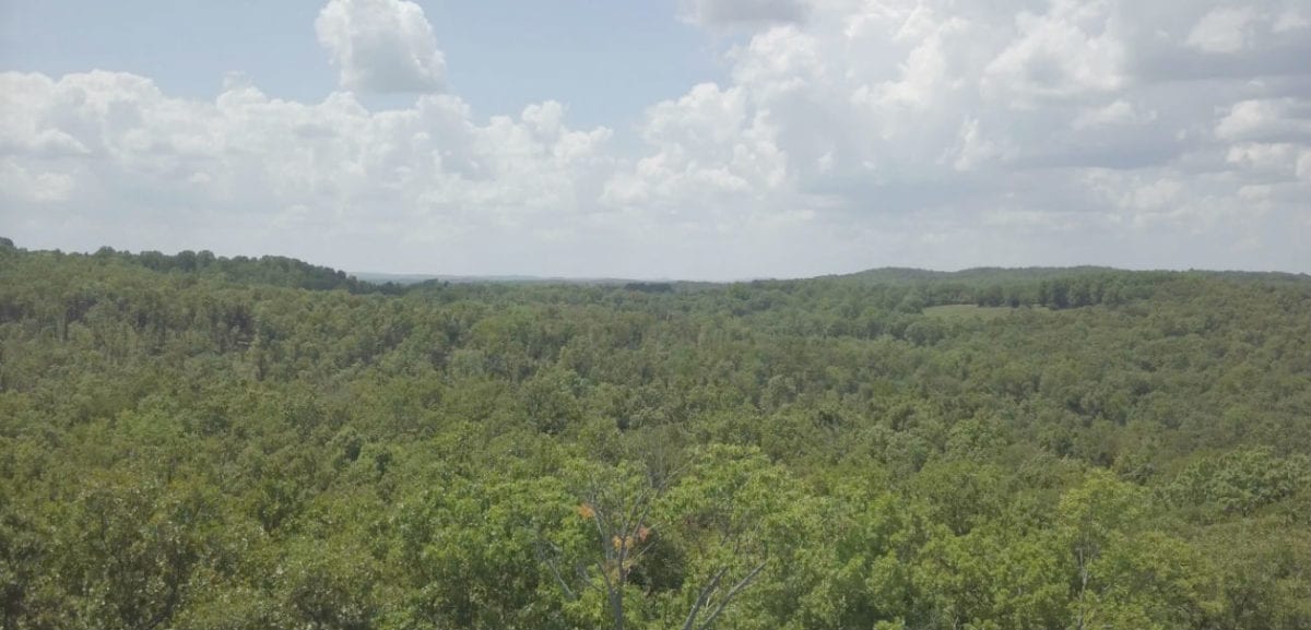
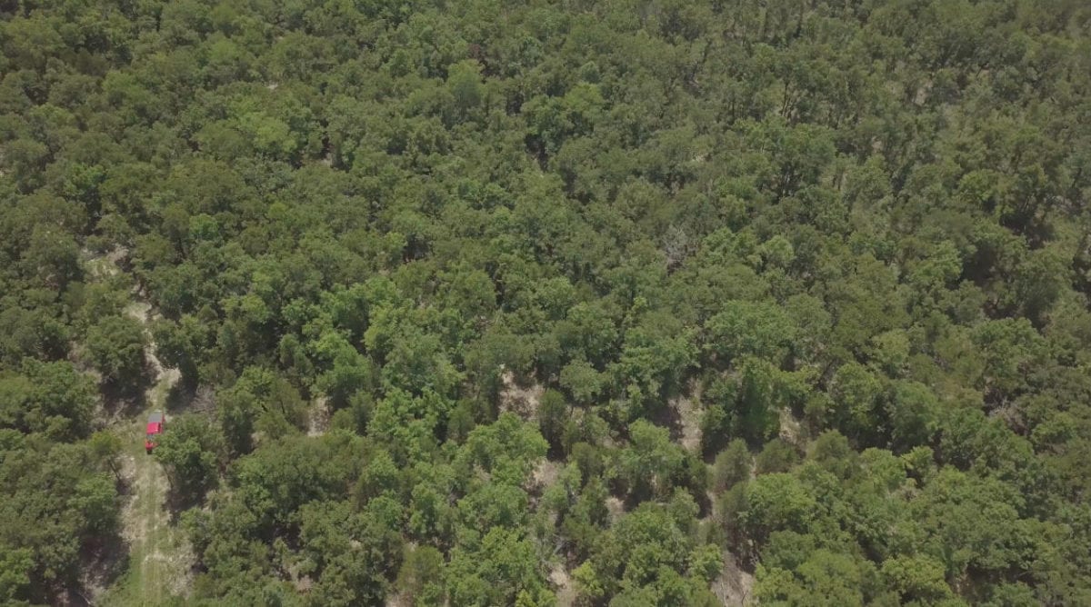
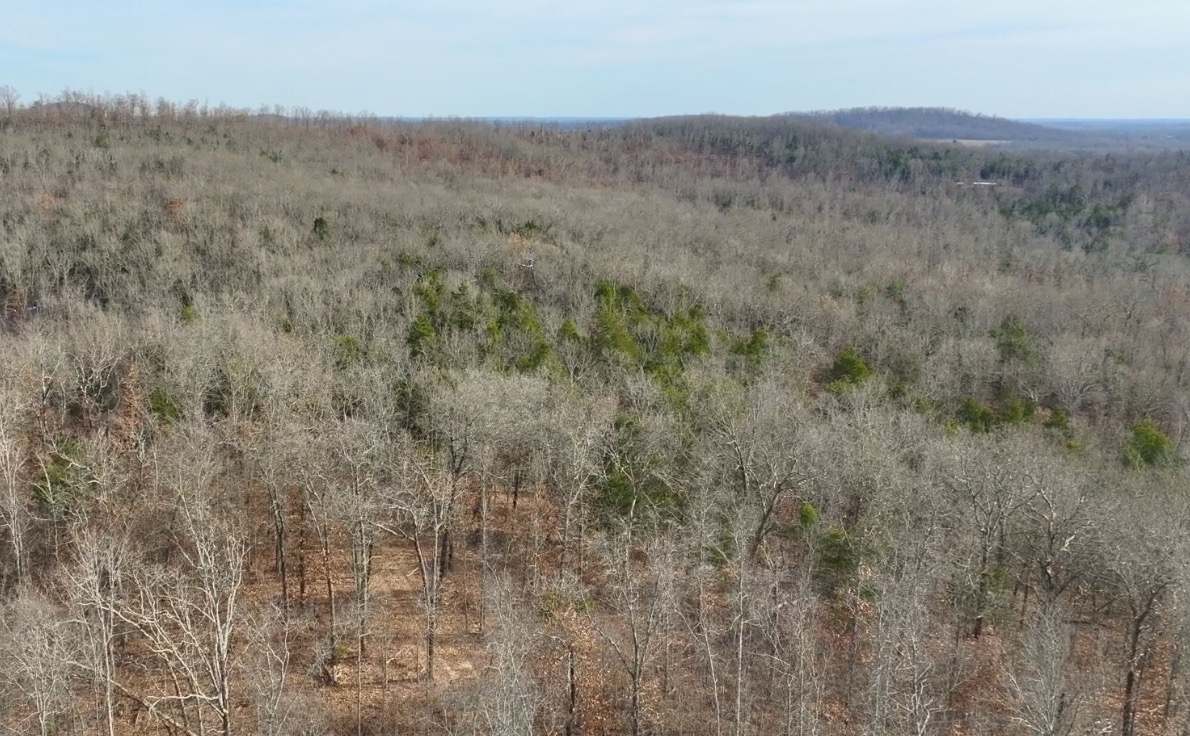
In the aerial photo above we are looking over the property. So much timber on this property!
The property is an excellent area for wildlife, including deer and turkey. Excellent privacy but still close to several towns.

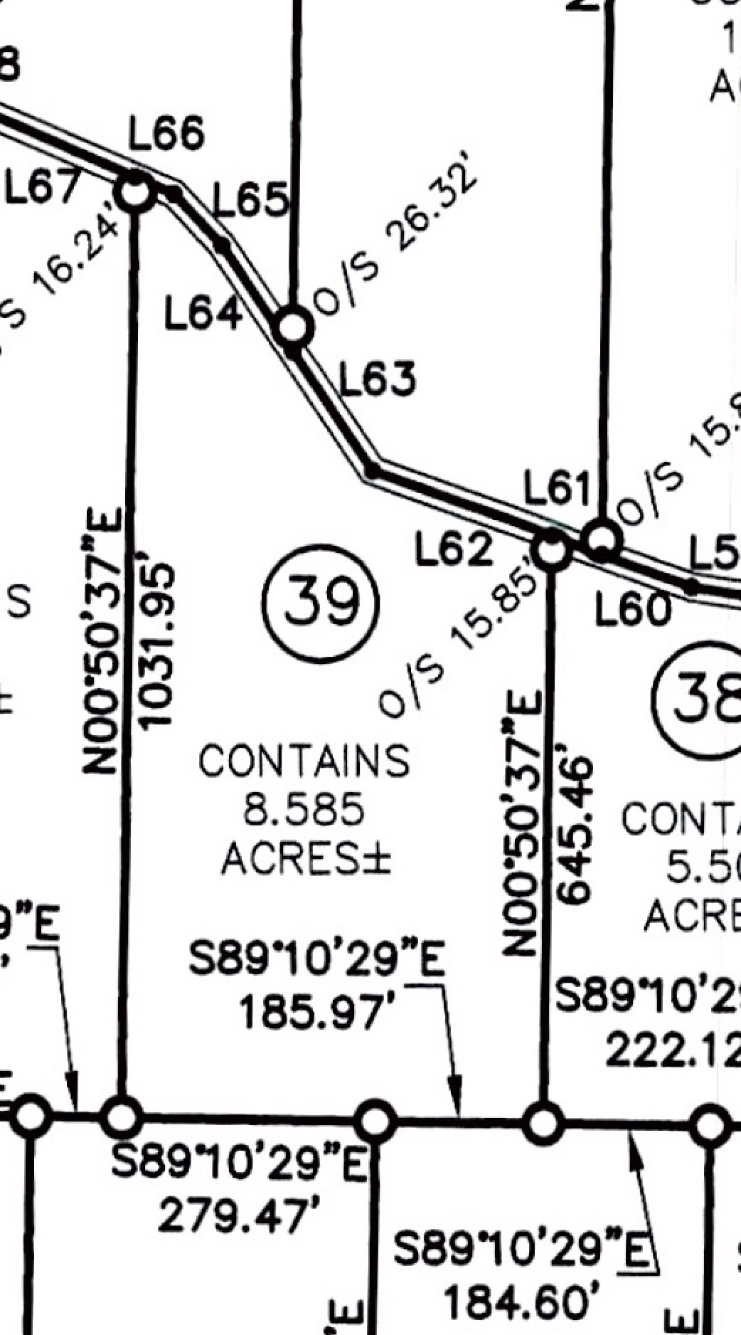
Survey Map – ID#HR39 – 8.585 Acres
Above, we have a close-up of the survey for the property. At over 8 1/2 acres in size you are likely to find numerous potential locations for camping, hunting and building.

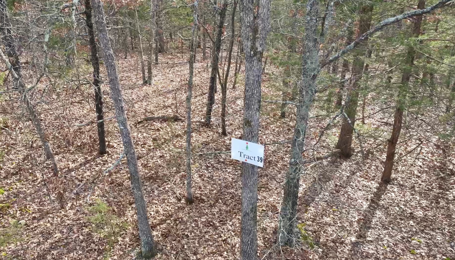
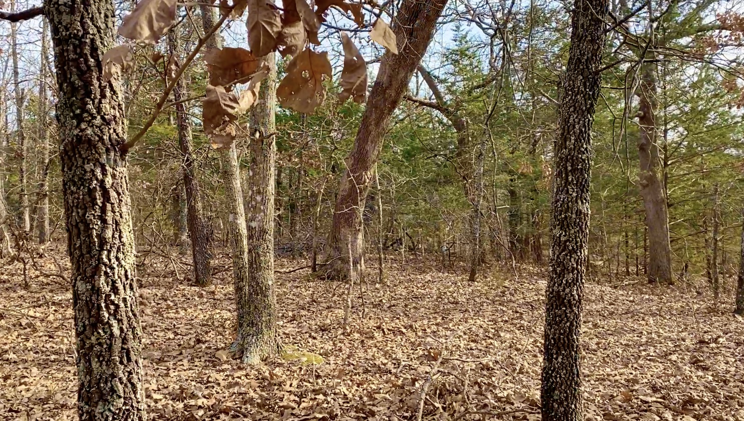
Trees on property
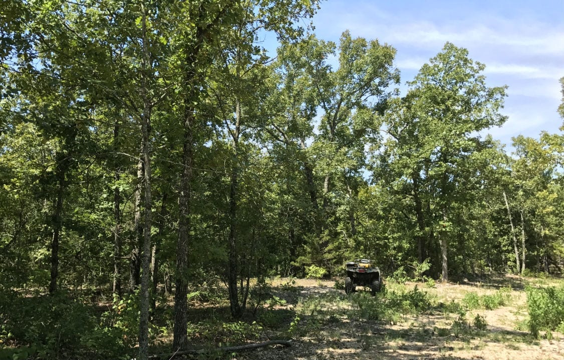
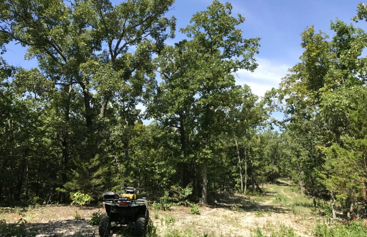
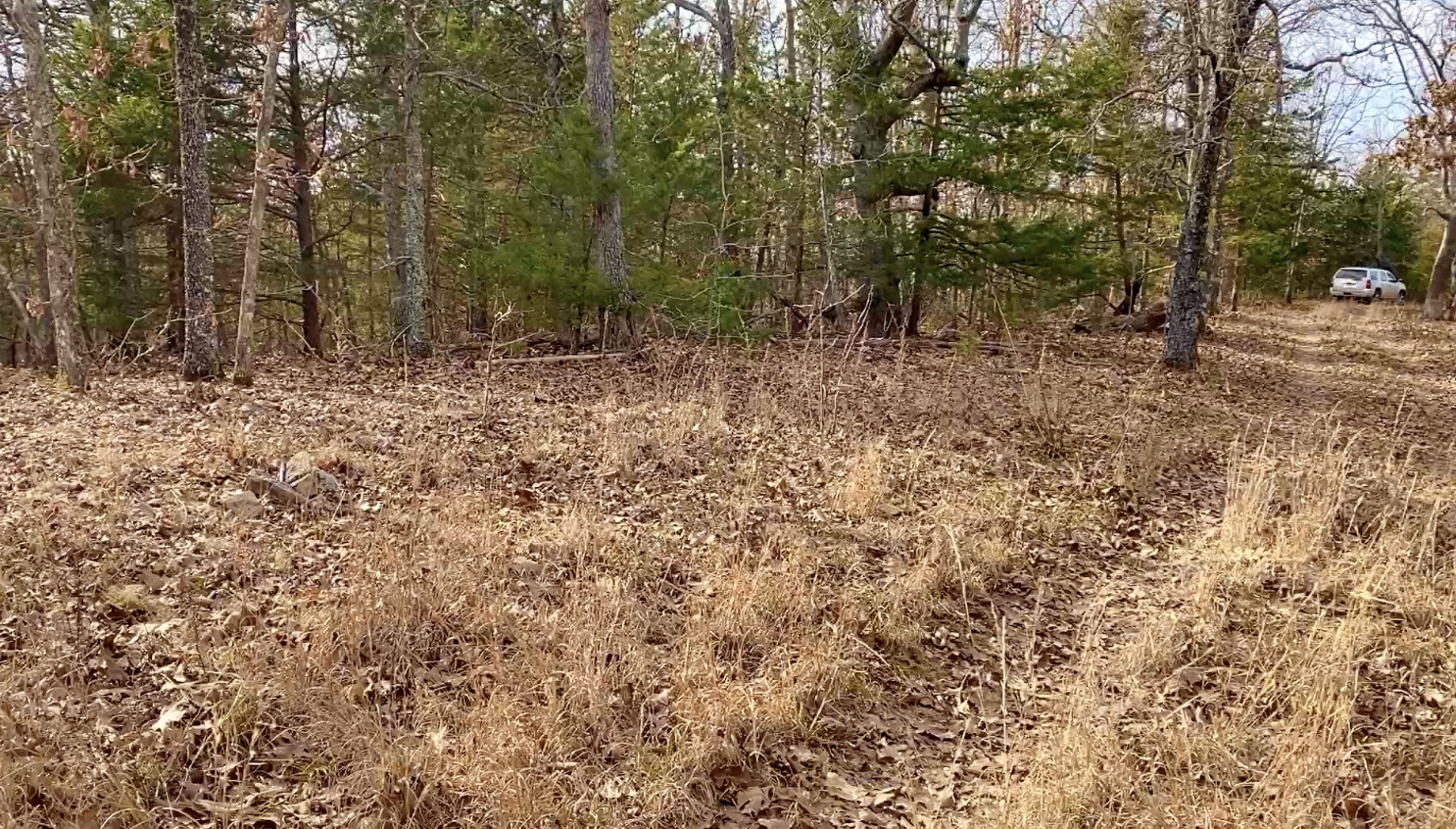
The photo above shows a few trees and a natural open area on the property.
This area is FULL of wildlife including deer and turkey. Also, within just a few miles of the property you will find thousands of acres of National Forest which can be also used for hunting and recreation. Also, within just a few miles you will find the VERY popular North Fork River and Bryant Creek. Perfect for fishing, floating, swimming canoeing and kayaking.
TERMS OF SALE
The full sales price for this surveyed 8.585 acre tract at Hawk’s Roost is $49,500 and we offer INSTANT owner financing with just a $1,500 down payment.
With your $1,500 Down Payment you will automatically receive our reduced annual interest rate of 7 3/4% and the payment will be $456.82 a month.
With a $2,500 down payment the annual interest rate drops to 6 3/4% and the payment drops to $420.91 a month. With a $5,000 down payment the annual interest rate drops to 5 3/4% and the payment drops to $374.54 a month. These payments are all based on about a 15 year payment schedule. Property taxes total only $60 a year and this is already included in the monthly payment amount(s) shown above. There are NO prepayment penalties and NO hidden fees or charges.
PLEASE NOTE that you have a full TWELVE MONTHS to ADD to your down payment in order to reduce your annual interest rate and payment amount! We want to give ALL of our buyers the opportunity to achieve the lowest interest rate and payment amount possible!
ALSO, if you pay off your property (your loan to us) at any time within the next 5 years you will receive a DISCOUNT in the amount of 10% of the purchase price of the property! On this property that would save you $4,950 for an early payoff!
If this is the property for you then please choose your initial down payment amount in the box below and you may pay with your debit or credit card. Also please feel free to send us an email or give us a call and we can answer any questions or complete the transaction over the phone. Our number in the office is (417) 767-2223 and you can reach us by email at [email protected].