SORRY, THIS PROPERTY HAS BEEN SOLD!
6.948 acre wooded tract with power onsite, road access, multiple building sites and excellent views. This 6.9 acre tract can be found in a small, private rural development which is called “Eagle Ridge” and is within a larger area called “Hawk’s Roost”.
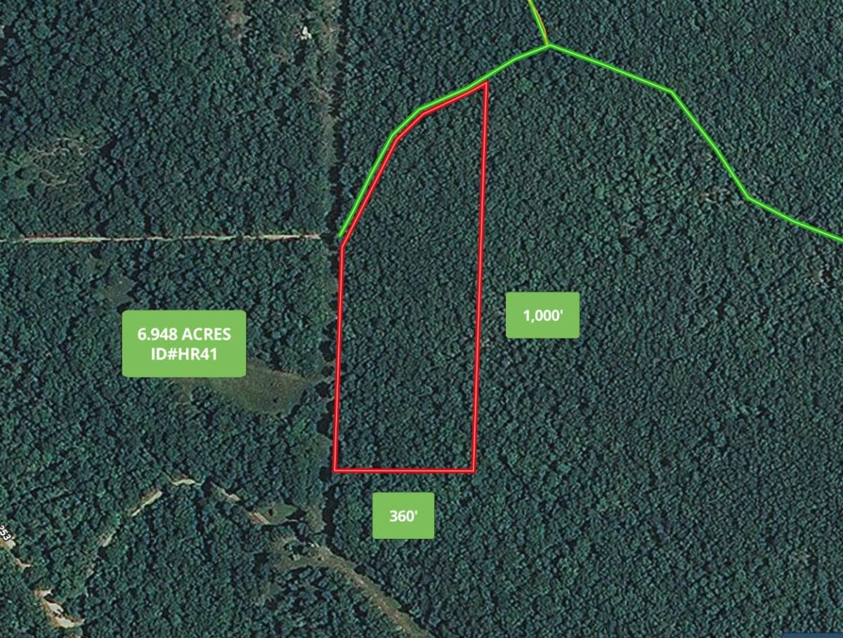
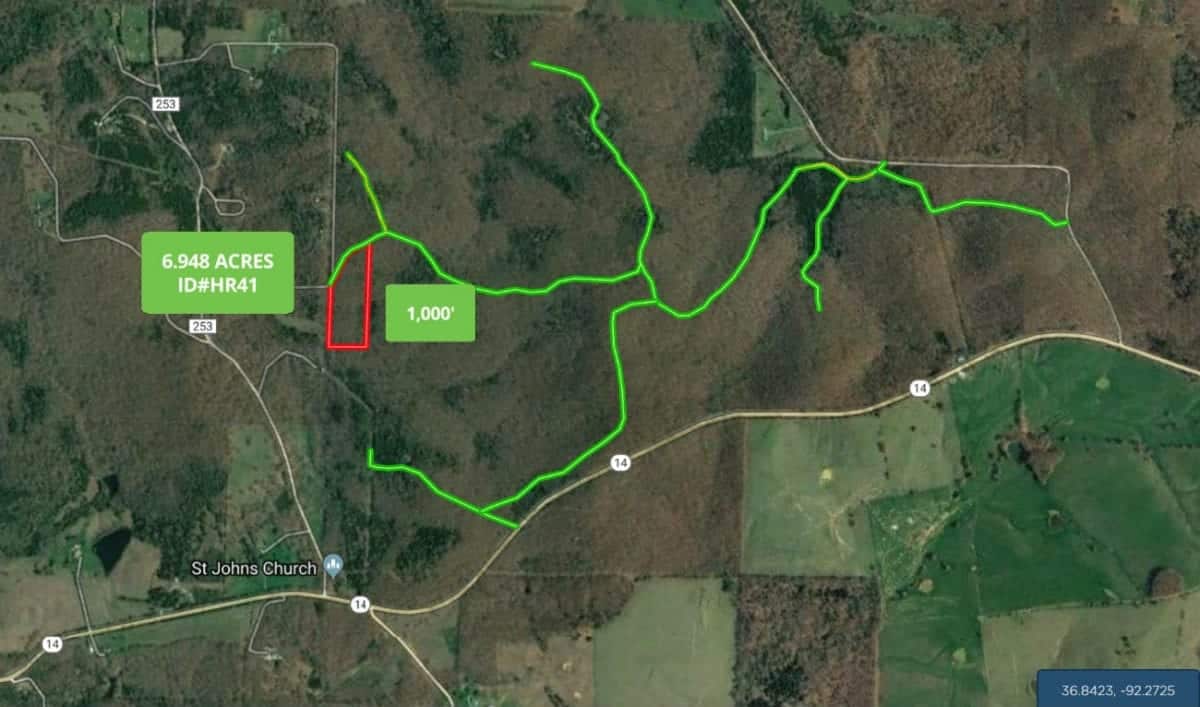
The photo above is an aerial map showing the 6.9 acres. It borders a gravel easement road along its entire north side and the power line runs adjacent to the west side.
Please click on the photos on the left side of the screen to enlarge them and to get a short description of each photo. Farther down in this listing, you will find an interactive map, as well as a couple of videos and numerous pictures and maps. All of the pictures/videos we have were taken in the middle of the winter, so you get to see the property with no leaves on the trees. In the spring/summer it will be green and beautiful! – When we get fresh and beautiful pictures this summer the price will go UP so lock in the property right now!
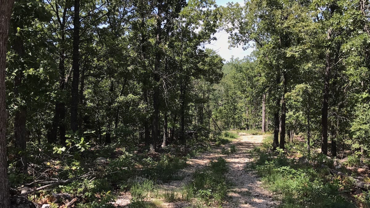
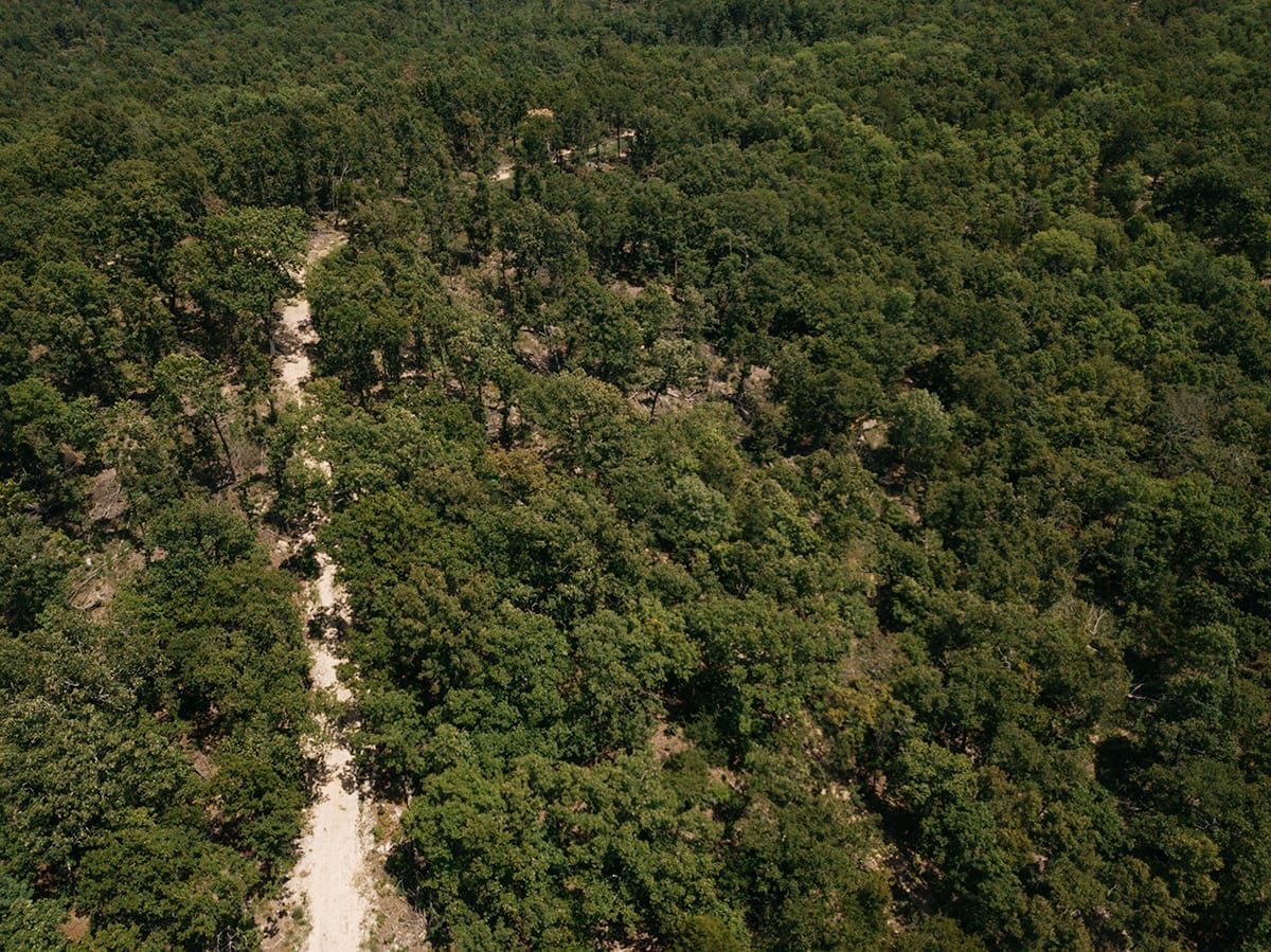
The photo above shows some of the trees on the property.
The sales price on this 6.948 acres is $24,500. With $500 down the monthly payments will be $255. This is about a 15 year payment schedule and an annual interest rate of 9 3/4%. With $1,500 down the interest rate drops to 7 3/4% and the payment drops to $220 a month. With $2,500 down the interest rate drops to 6 3/4% and the payment drops to $195 a month. With $5,000 down the interest rate drops to 5 3/4% and the payment drops to $165 a month. These payments are all based on about a 15 year payment schedule. Property taxes are only about $45 a year and are current. There are no prepayment penalties, no hidden fees and no balloon payments.
PLEASE NOTE that you have a full 12 months to ADD to your down payment in order to reduce your interest rate and payment amount!
Many of the properties at Hawk’s Roost were logged within the last couple of years but they were not clear cut so there are quite trees remaining.
Please refer to our interactive map (above) for additional property views and information. Please note that the boundary lines and measurements are approximate. This interactive map is fairly new for us and if you have a chance we would love to have your feedback on it. Is it awesome? Is it great? Is it confusing? We would like to know!
Also, please note that on the interactive map it seems to work best if you click the “View Full Screen” option. Once you are in the “Full Screen” option you can select “Topo” to see a topographic map which does a good job of showing how the property is situated. Also, we can email you the direct link for this interactive map of the 6.948 acres (which is Tract 41), so you can view it in your phone or tablet when you make the trip to the property (you will need to download the MapRight app to your phone/tablet).
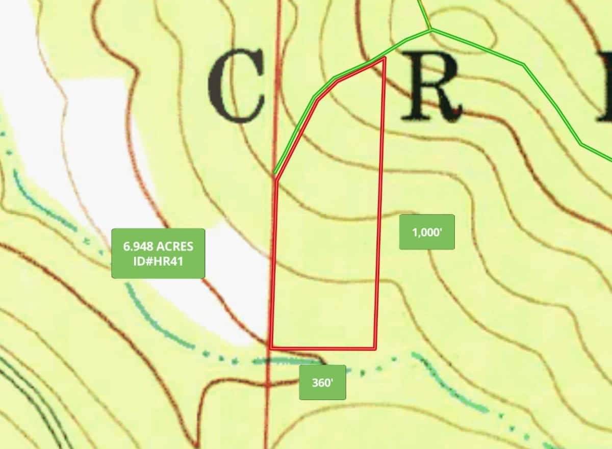
The topo map above shows how the 6.948 acres is situated. It is the highest on the north side and it slopes down gradually as you move to the south.
In the video below, we explore the property from the ground:
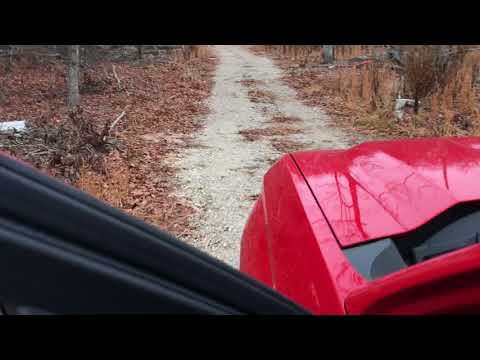
Tract 41 Ground
In the second video (below) we explore the property from the air, with our drone:

Drone Tract 41 Hawks Roost Narrated
The property is an excellent area for wildlife including white-tailed deer and turkeys. Great privacy but still close to several towns and some excellent rivers for swimming, fishing and floating.
Feel free to make the trip to check out the property. From Mountain Grove, Missouri go south on Highway 95 for about 20 miles to Highway 14. Go east on Highway 14 for about 7 miles to County Road 250 on the left (north). Take County Road 250 to the gravel easement roads (shown on the map below) to get to the property. There is also an easement road which comes directly off of Highway 14 and leads to the property (see the map below).
Please print the map above (as well as the other maps and directions) when you visit the property. We will be happy to email, text, fax or mail the maps and directions to you if you would like! The map above shows a road coming toward the property from the west but this is someone else’s private driveway and can not be used to access the property. The green roads on the maps above are the actual easement roads which you can always use to access the property.
These are gravel easement roads so you will want to use a truck or an suv to access the property as the extra few inches of clearance could be helpful if there are rough spots in the road.
As we mentioned earlier, we will be happy to email you the “MapRight” link which will be very helpful when you visit the property. If you have a smartphone you can download the MapRight app and you will be able to see exactly where you are when you view the property. This is by far the best way to view the property if you have a smartphone or tablet with cell/internet service.
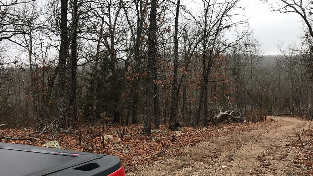
In the photo above we are parked on the private easement road and the land is on the left.
Like all of the properties that we sell, this tract is subject to the 6 basic restrictions as shown on our website (no mobile homes, etc.). Homes or cabins built on the property must have a minimum concrete foundation size of 600 square feet (a simple 20 X 30 cabin would meet this requirement).
To see the 6 standard Deed Assurances please click here.

While the area was logged a couple of years ago, this tract appears to have quite a bit of timber remaining.
As with all of our properties, there is a 100 foot setback from all shared roadways (highway, county road and easement roads) for utility purposes. This ensures that you will have access to power and phone if/when you need it. The utility easement along the sides/back of each property is 30 feet. Also please note that timber with a stump diameter larger than 8 inches may not be cut, sold or removed until the property has been paid for in full (we can give written exceptions for creating building sites and driveways).
This area is FULL of wildlife including deer and turkey. Also, within just a few miles of the property you will find thousands of acres of National Forest which can be also used for hunting and recreation. Also, within just a few miles you will find the VERY popular North Fork River and Bryant Creek. Perfect for fishing, floating, swimming canoeing and kayaking.
The sales price on this 6.948 acres is $24,500. With $500 down the monthly payments will be $255. This is about a 15 year payment schedule and an annual interest rate of 9 3/4%. With $1,500 down the interest rate drops to 7 3/4% and the payment drops to $220 a month. With $2,500 down the interest rate drops to 6 3/4% and the payment drops to $195 a month. With $5,000 down the interest rate drops to 5 3/4% and the payment drops to $165 a month. These payments are all based on about a 15 year payment schedule. Property taxes are only about $45 a year and are current. There are no prepayment penalties, no hidden fees and no balloon payments.
PLEASE NOTE that you have a full 12 months to ADD to your down payment in order to reduce your interest rate and payment amount!
If this is the property for you then please choose your initial down payment amount in the box below (if it is still available) and you can pay with any debit or credit card. Also please feel free to send us an email or give us a call and we can answer any questions or complete the transaction over the phone. Our number in the office is 417-882-3400 or you can reach us anytime by email at [email protected].


