SORRY, THIS PROPERTY HAS BEEN SOLD!
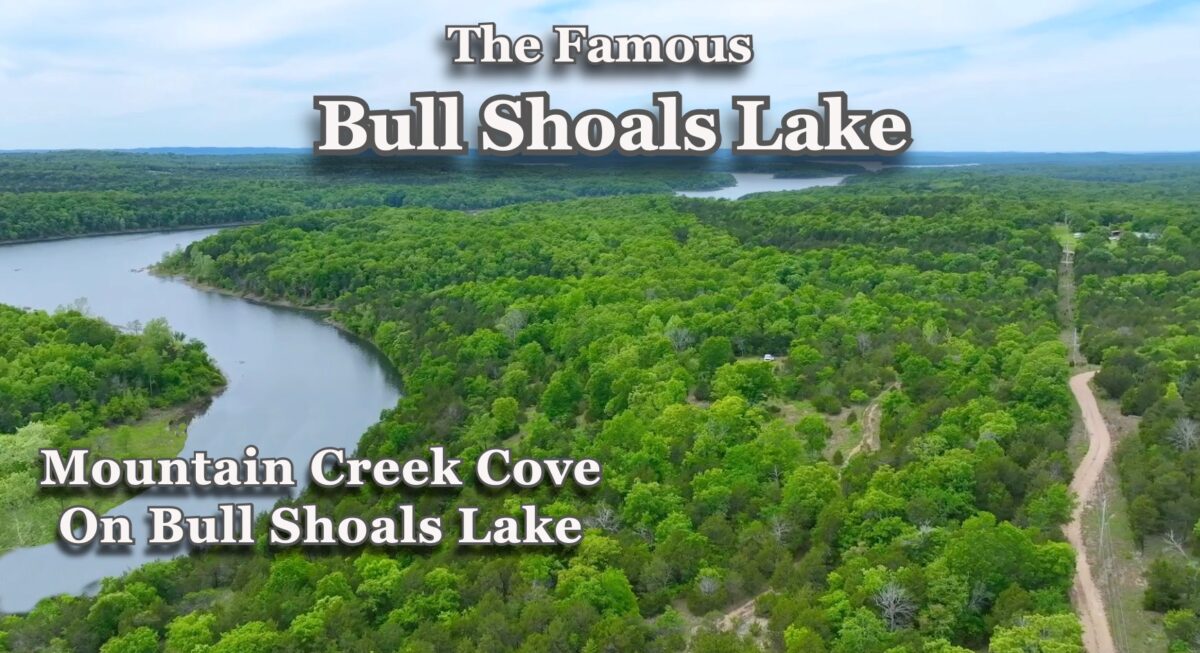
Rare, large tract of Owner Financed Land for Sale at Bull Shoals Lake in the Arkansas Ozarks! This special acreage is located within “Mountain Creek Cove on Bull Shoals Lake” which is a very private rural development (with a total of only 4 tracts) that is adjacent to the Corp of Engineers Land (the “Take Line”) on Bull Shoals Lake, giving you access to THOUSANDS of acres of Corp of Engineers Land for additional hunting and recreation, as well as access to the water and the hundreds of miles of shoreline! This special property is brought to you by our Sales Partner “Outcast Land Inc.” – Outcast Land Inc. is known for focusing on the highest quality land in the United States, with a special focus on premium hunting and recreation land (and of course, all tracts are buildable for your future home or cabin).
ALL of the tracts at Mountain Creek Cove On Bull Shoals Lake have DIRECT FRONTAGE on the “Take Line” at Bull Shoals Lake, which gives you direct access into the Corp of Engineers Land which surrounds the entire lake. This particular tract has a HUGE amount of DIRECT FRONTAGE on the “Take Line”. In fact, this private acreage has over 650 feet of direct frontage on the “Take Line”, along its entire south side! This is more Take Line frontage than we have almost ever seen on a property of this size (or any size)!

Aerial Photo Looking at the Property
The aerial photo above shows part of the property, which is Tract 4 at “Mountain Creek Cove on Bull Shoals Lake”. In the photo you can also see a very small part of Mountain Creek Cove, which is on the far east side of Bull Shoals Lake. In the photo we are facing northeast at the property, from over the south side of the lake.

Aerial photo from over property.
In the aerial photo above, we are now over about the middle the property and looking westerly toward the main channel of the lake. We are only seeing a very tiny fraction of the lake in this photo, as it has several hundred miles of shoreline and about 50,000 acres of surface water for fishing, swimming, tubing, wake boarding, jet skis and more!
This unique property has over 650 feet of direct “Take Line” frontage on the Corp of Engineers Land on the lake. Check out the maps and videos in this listing page and you will see a very special property.

Aerial Photo
The photo above was taken at about the southwest side of Tract 4. This is an interesting “transition area” where the creek/river becomes part of the lake.
With the south line of this property directly bordering the Corp of Engineers “Take Line”, it is a very short walk directly to the water/lake. At certain times of the year the Corp of Engineers will lower the water level of the lake (generally in the “off season” which would be winter months). When they lower the water level this section of the cove will be more “creek” than “lake”. When the water level is at it’s highest this section is likely to be more “lake” than “creek”.

As shown on the aerial map above, Tract 4 is 12 acres in size.

Close-Up Aerial Map
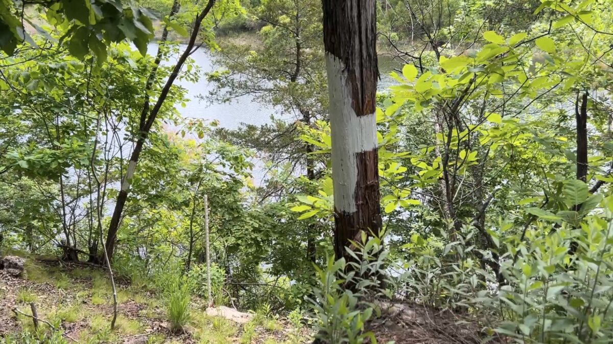
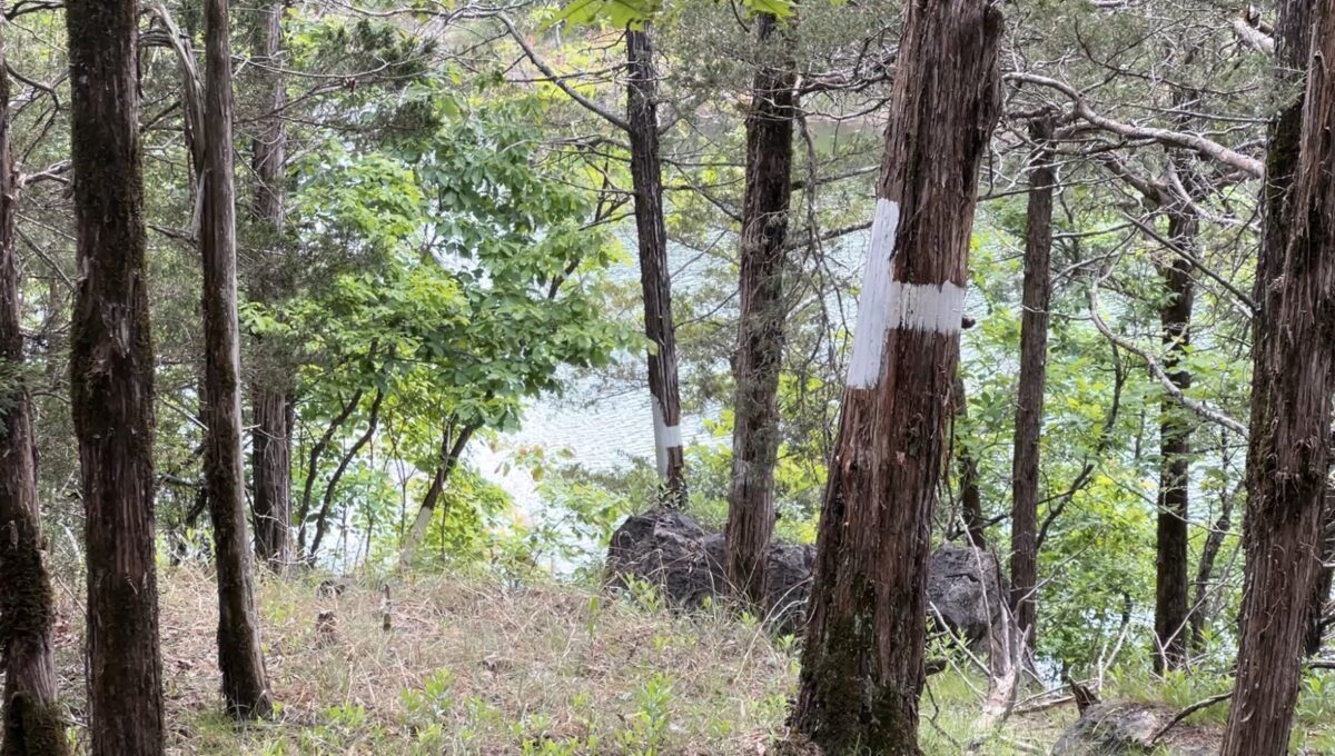
The property has over 400′ of frontage on Mountain Creek Trail on its north side. This property already has a power line on-site which runs across the north end of the property (next to the road). The white dashed line on the map above shows a possible location for a driveway and trail on the property. This is the approximate route that we walked when we visited the property. Since there did not appear to be a driveway into the property, we simply parked on the road on the north side and walked into the 12 acres. It looked to us like it would only take a few hours with a chainsaw to clear a usable driveway into the property.
TERMS OF SALE
The full sales price for this very rare and very special 12 acre property with over 650 feet of direct “Take Line” frontage at Bull Shoals Lake (Tract 4 at Mountain Creek Cove) is $129,500. With your down payment of $2,500 you will automatically receive our reduced annual interest rate of 6 3/4% and the monthly payments will be $1,133.84.
With a $5,000 down payment the annual interest rate drops to 5 3/4% (our lowest rate) and the payment drops to $1,043.87 a month. These payments are all based on about a 15 year amortization schedule. Property taxes will only be about $120 a year and this is already included in the monthly payment amount(s) shown above. There are NO prepayment penalties and NO hidden fees.
PLEASE NOTE that you have a full TWELVE MONTHS to ADD to your down payment in order to reduce your interest rate and payment amount! We want to give ALL of our buyers the opportunity to achieve the lowest interest rate and payment amount possible!
ALSO, if you pay off your property (your loan to us) at any time within the next 5 years you will get a DISCOUNT in the amount of 10% of the purchase price of the property! On this property that would save you $12,950 for an early payoff!
The tracts at Mountain Creek Cove on Bull Shoals Lake are sold through our partner company which is Outcast Land Inc. – The sales process is the same as you see on the InstantAcres website, but the paperwork will show Outcast Land Inc. as the “seller”.
If this property is still available you may purchase it instantly through the “Buy Now” link on this page or you can call us in the office at (417) 767-2223 and we can answer any questions you may have, or we can take your payment over the phone. Also, please feel free to email us at [email protected] and we can answer your questions via email.
Outcast Land is committed to bringing you the HIGHEST QUALITY recreation land in the nation. All tracts are located in areas with a PROVEN track record for deer and turkey hunting and in this case SPECTACULAR fishing and water activities including boating, swimming and even scuba diving. This “Fishing, Hunting and Recreational Development” brought to you by Outcast Land has basic Property Covenants in place to ensure that the tract you purchase can be used for fishing, hunting and recreation for generations to come. By the way, all tracts sold by Outcast Land are buildable for a cabin or home, subject to the basic property covenants (although most Outcast Land customers are more interested in deer “signs” then street signs).
Although the properties sold by Outcast Land Inc. are buildable for a home or cabin, they can not be used as a residence until after the owner financed loan has been paid in full (this is a condition of the Owner Financing on Outcast Land tracts). Although this does not affect buyers who are hunters, campers, fishermen or recreational land users, it could affect folks who are looking for a place to immediately build and live. If you are looking for a place to immediately build and live than please contact us and we can let you know what is available that might suit your needs.
This heavily wooded owner financed land at Bull Shoals Lake is possibly the perfect place for fishing, hunting, camping, recreation and for creating lifelong memories with family and friends.
Also, with convenient road access via Mountain Creek Trail and a power line already on the property, this may be the land you have been looking for that could be an ideal spot for your retirement home or your vacation cabin. The direct frontage on the “Take Line” makes this a highly desirable property as it is VERY hard to find a property with any direct “Take Line” frontage.
Mountain Creek Cove on Bull Shoals Lake
Mountain Creek Cove on Bull Shoals Lake is a very private rural development consisting of only 4 tracts. It is located toward the east side of the famous Bull Shoals Lake in the Northern Arkansas Ozarks.
All 4 tracts at Mountain Creek Cove have DIRECT FRONTAGE of the Corp of Engineers “Take Line” along their south sides. Properties with direct “Take Line” frontage are rare and they are in high demand. This is because when you own a property with “Take Line” frontage you can go directly from your private property into the Corp of Engineers land which can be used for hunting, hiking, lake access and other recreational pursuits.
All 4 tracts within Mountain Creek Cove also have a power line on-site (generally at the north end of the property, near Mountain Creek Trail). Although you may not even have a use for power right now, having it available greatly enhances the value of your property. It also ensures that if you decide that you DO need power (even years from now) that you will be able to access electricity.
The tracts at “Mountain Creek Cove on Bull Shoals Lake” are in an ideal location for privacy at the lake. They are located on a “dead-end” road with basically NO through traffic, and they are only about 10 miles from Theodosia, Missouri, which is generally considered the main town on the eastern side of Bull Shoals Lake.

The aerial drone photo above was taken while flying over Bull Shoals Lake at the town of Theodosia, Missouri. Theodosia is about 10 miles northwest of Mountain Creek Cove. In the photo we are looking south at the bridge over Bull Shoals Lake (this is Highway 160) . Theodosia has at least one large marina which may be a great place to visit and to grab lunch. It also has several restaurants, gas stations and stores.
***Tract 4 at Mountain Creek Cove on Bull Shoals Lake***
This listing is for Tract 4, which is 12 acres in size and has over 650 feet of direct “Take Line” frontage.
This tract is an excellent mixture of open areas and heavily wooded areas. The thickest timber appears to be toward the middle and south sides of the property. When we checked out the property we discovered several trails that lead you through the beautiful mature timber. There also appeared to be at least a couple of locations within the property that had been set up for deer hunting (with tons of signs that deer spent a lot of time on the property). This large tract has about 400 feet of frontage on Mountain Creek Trail along its north side. This is also where you will find the power line (very convenient location).
We have added several maps and pictures to this listing page, which will help you to get a good “feel” for the property. We have also added additional maps/pictures/info about Bull Shoals Lake and the beautiful area around the lake.

Aerial facing east
The aerial photo above was taken while looking easterly at the property, which is on the left side of the water in the photo.
Although this “Listing Page” is fairly lengthy it does contain a large amount of great information about this specific tract as well as Mountain Creek Cove, Bull Shoals Lake and the general area.
Also, if you have not already visited the main page for Mountain Creek Cove on Bull Shoals Lake, you can do so by clicking on the link below. It is likely you have just come from that page, and that you clicked on the link for this tract within the “table” of available tracts. But if not, please do check out the main page for Mountain Creek Cove on Bull Shoals Lake (by clicking the link below this paragraph) and watch the videos that we have included on that main page. Although some of the info/maps on that page are also included in this listing page, there is probably some information that you will only find on the main page for Mountain Creek Cove on Bull Shoals Lake. Below, you will find the link to the Main Page for Mountain Creek Cove on Bull Shoals Lake:
More information about Tract 4 at “Mountain Creek Cove on Bull Shoals Lake”
Tract 4 is 12 acres in size and has road frontage on Mountain Creek Trail, which ends shortly after the property (very private setting). Although most of the roads in the area appeared to be in fairly good shape when we visited the area, we did encounter a few rough spots so a four wheel drive truck or suv is recommended.
The property is the highest at its northwest side by Mountain Creek Trail. As you go southerly onto the property it appears to stay level for several hundred feet and then slopes down very gradually as you get closer to the south side. This particular property (Tract 4) has more usable area than any of the other tracts within the development, because of the very gentle topography.

Topo Map
The topo map above gives us an idea of the “lay of the land” (as described above the map). Tract 4 is outlined in red toward the right side of the map.
We have explored very little of the property but you are sure to find some gorgeous mature timber as well as some cool rock features (and maybe even a live spring). The property offers numerous potential areas for building a home or a cabin, or for creating that perfect campsite for family and friends.

Potential Live Spring on the Property
The photo above shows some running water that we discovered when we were walking around the property. It appeared to come out of the ground near a large tree, and flowed down toward the lake. We followed the flowing water for a couple hundred feet and then it went underground. Maybe it re-appeared down by the lake, but we don’t know!

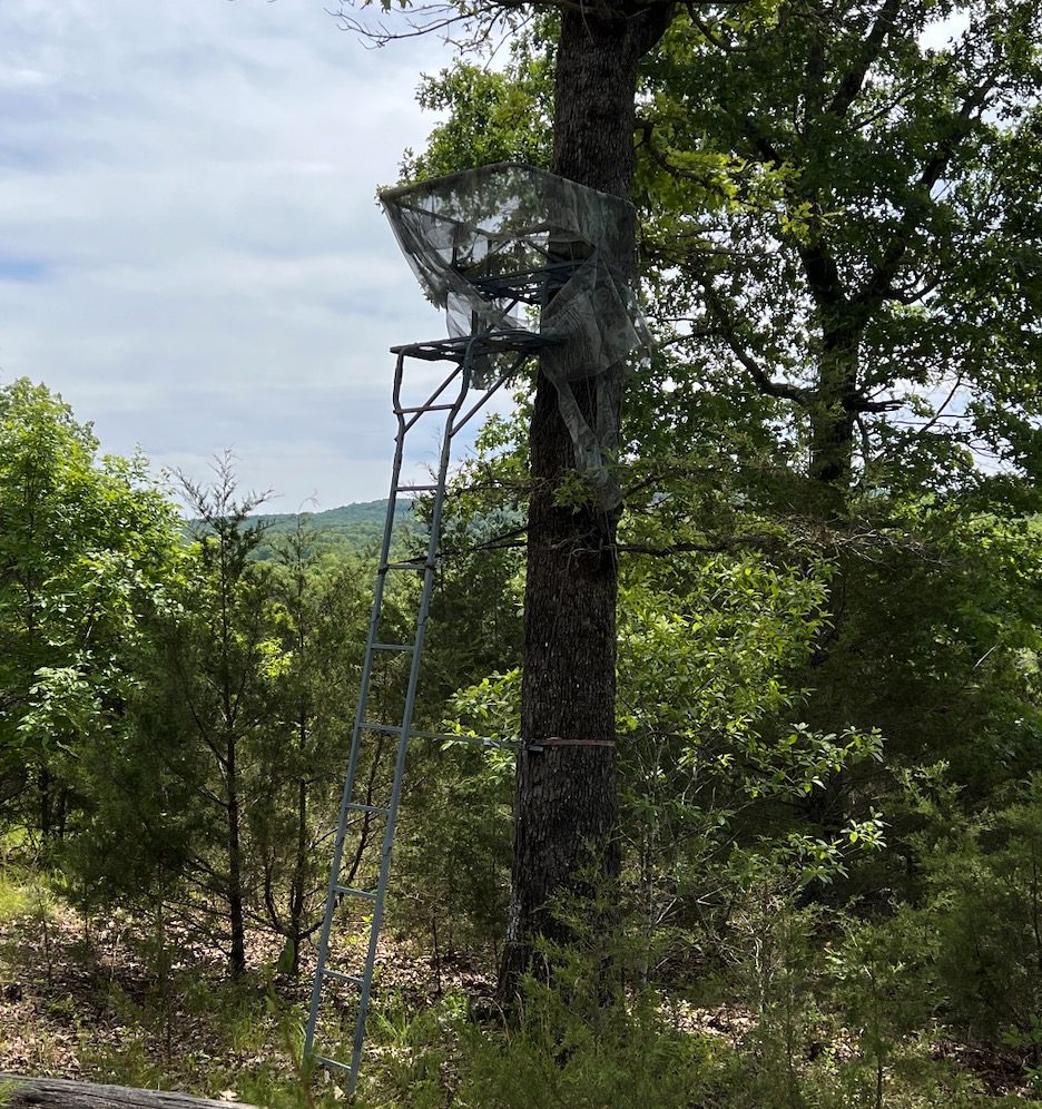
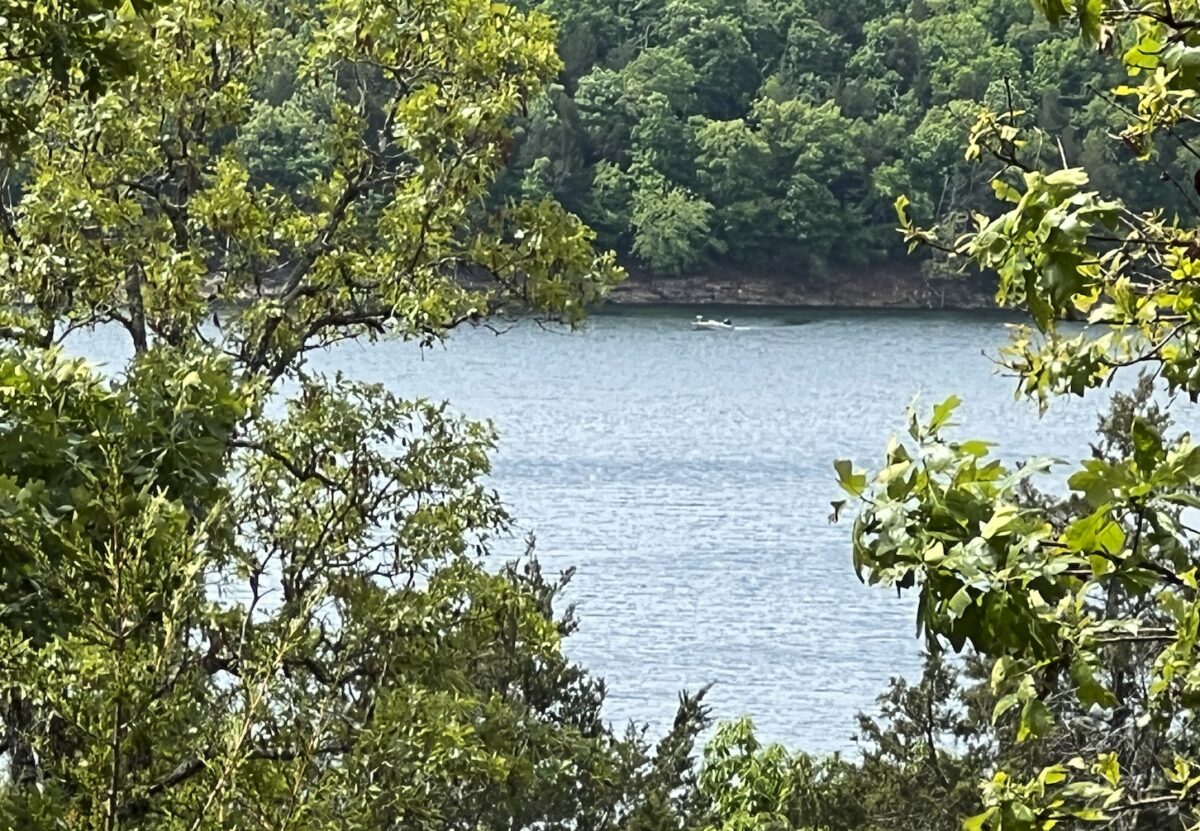
The photo above was taken from an old tree stand that we discovered on one of the tracts. When we climbed up the tree-stand we were able to see over some of the mature timber, and we had a nice view of Bull Shoals Lake. In fact, if you look at the photo above you will see that we were able to take a picture of a bass boat in the cove, while we were up in the tree-stand.
Because of the way that this special property is situated, you would be able to GREATLY improve the lake-view by selectively removing some of the timber on the property. But please remember, until the property has been paid for in full you would not be able to cut/remove any of the timber on the property (except with express written permission).

Trees on Property
This property contains a beautiful mixture of timber including hardwood trees as well as cedar trees. The photo above gives us a look at an area near the center of the property that appears to be mostly cedar trees. Although, the large amount of leaves on the ground in the photo makes it evident that there are certainly hardwood trees nearby, as well.
Now Some Videos!
This first video is a “Drone Video” in which we check out the property and the area from the air:
upload Video Drone MB04 Narrated and Done
The next video is a “Ground Video” in which we check out a small part of the property (on foot):
MB04 Video Ground MB04 Walking Around Long DONE
This next video is a “Ground Video” in which we walk around and find some cool stuff on the property:
MB04 Video Ground MB04 Finding Cool Stuff DONE
The last video is an “Intro Video” in which we use the Interactive Map to explore the property and the area. This video is longer than the others but it does contain some good information:
upload Video Intro MB04 Narrated and Done


More Information about the Property and the Area:
Having a power line already on-site is a huge bonus. Even if you never plan on needing power, having the line on-site adds a great deal to the value of your property.
Properties with access to a major lake have for years been one of the best choices for investment, as well as for enjoyment. As property prices across the nation continue to rise, history has taught us that it is the better quality land that will have the largest rise in value. Also, as more and more people discover the low priced land in the Ozarks it will continue to push our land prices up until they begin to get close to the sky-high land prices in most other parts of the Country.
Because private individuals generally cannot own the actual shoreline on Bull Shoals Lake (because it is a Corp of Engineers Lake), a property with good direct frontage on the “Take Line” is often considered a lakefront property. Excellent investment potential!
Interactive Map – “Land Id” Map – (formerly MapRight Interactive Map)
The “Land Id” interactive map below (formerly called “MapRight”) is useful for exploring the property and the area. You will have to “zoom in” in order to see this specific tract. The labels are likely to look VERY messy until you can zoom in on this specific tract (the property is Tract 1 on the Interactive Map). This is very similar to the Interactive Map that you may have seen on the main page for Mountain Creek on Bull Shoals Lake.
You can move the map around and even use different “base layers” to view the property and the surrounding area:
The property boundaries are only approximate on the interactive map but they will be helpful for exploring the property and the area.
About the free “Land Id” app that you can use to help check out this property:
To watch a short video that details how to use the free “Land Id” app to locate the property, as well as the property’s approximate boundaries, please click on the link below:
Click Here To See A “Land Id” (formerly “MapRight”) Tutorial
You will want to download the “Land Id” app to your phone or tablet before you visit the property, as it will make things go smoothly on your first trip (just follow the directions in the tutorial). If you have questions about Land Id please feel free to call us in the office at (417) 767-2223 and we can assist you. “Land Id” seems to be constantly updating their program so it can be a little confusing when you first get started. In fact, until recently it was called “MapRight” so it is likely you will hear us use that name within the videos in this listing page, because that is the name we have been using for years!
As you have already seen earlier in this listing, there is a residential power line which runs directly across the north side of this property, giving you excellent access to electric. Being outside of city limits means you will not find public water/sewer available, and it also means this tract is not subject to the strict regulations you would find within city limits. If you require a permanent water source you could drill a well, or for occasional use a cistern (water collection/storage) can be a good choice. For septic, you could install a standard septic (which can potentially be done yourself, if you desire) or possibly use an alternative style system (such as composting toilet or one of dozens of other systems that are now on the market). For occasional use, an “rv style” toilet works well (as do numerous of other options). We had cell service in the areas we checked within the development (our phones use Verizon) . The wireless internet in the work truck seemed to work just fine within the development.
HUNTERS, FISHERMEN (and FISHERWOMEN), CAMPERS AND RECREATIONAL LAND USERS have specific desires and requests when they are searching for a property. In general, these folks plan to camp and use their recreational property more often than most people. They also generally do not plan to build a home and live on the property in the near future.
With these specific needs in mind, Outcast Land is proud to bring you this “Recreational Development”. All of the tracts within this rural development are usable for fishing, hunting, camping, recreation and even building a home or cabin, but there are a couple of important distinctions that make these tracts special:
- All Outcast Land tracts are buildable but please keep in mind that they can not be used for a permanent residence until after the loan (to us) has been paid for in full. You can definitely build a cabin (or use a portable building) for camping and hunting, but in order to live on the property the loan must be paid in full and your residence must be at least 600 square feet in size and be built on a permanent continuous concrete foundation (slab, stem wall/crawl space, basement). A block foundation could be considered “continuous concrete” so long as the blocks are mortared together.
- Camping is allowed for up to 90 days a year, instead of the standard 45 days. This gives you twice as much camping/hunting time on your acreage.
- You can ALWAYS camp, for hunting purposes, during the scheduled deer hunting (rifle season) and turkey hunting seasons (even if that would put you over the 90 day period). Outcast Land does NOT wish to limit the hunting opportunities on your property.
Other property covenants (setback distances, etc) will be very similar to the standard Property Covenants that you see within the InstantAcres.com “property covenants” section. To see the Outcast Land Property Covenants for Mountain Creek Cove on Bull Shoals Lake please click on the link below:
To see the Property Covenants for Mountain Creek Cove on Bull Shoals Lake, please click here.
Hunters, Anglers and Recreational land buyers generally have no interest in living on their property in the near future (although often they do plan for a retirement home/cabin on the property). BUT, many hunters, campers and recreational land buyers do tell us that it can be a hardship to have nearby neighbors living in portable buildings, camper trailers or homemade “tiny homes” while they attempt to enjoy their acreage for hunting & recreation with their families and friends.
We love “homesteaders” (in fact, we have an entire category on our website specifically for homesteaders) and you may also love “homesteaders” but these tracts from Outcast Land are not designed for the “homesteader”. These tracts are designed for the serious angler/hunter/camper/recreational user who does not desire to be surrounded by homesteaders while hunting, camping and using their property.
Please note that timber with a stump diameter larger than 8 inches may not be cut, sold or removed until the owner financed loan on the property has been paid for in full (we can often give written exceptions for creating or expanding a building site or a driveway/trail).
Because there are a number of marinas and campgrounds around Bull Shoals Lake, it may be convenient for you to plan to rent a cabin or an RV site nearby while you clear a driveway and/or a building site on your property. Trees with a stump diameter of over 8 inches (measured at ground level) can not be cut or disturbed until the property has been paid for in full BUT we do recognize that in order to clear a driveway and a site it is almost always necessary to remove some mature timber. Because of this, we have a very simple program in place with which you can generally get written permission to remove the necessary trees (often we are able to give written permission within 1-2 days, or less). Contact us for details about obtaining permission for tree removal for your driveway and building/camping site.
Although the property is private and secluded, the town of Theodosia, as well as other towns,are within just a short drive. If you bring your boat or jet-skis (or rent a boat from a marina) then there are hundreds of places to explore and enjoy on the enormous Bull Shoals Lake.

Hey, here’s a cool map!
The map above shows Bull Shoals Lake which was created in the 1950’s when the Army Corp Of Engineers built an enormous dam in northern Arkansas in order to create Bull Shoals Lake for power generation and flood control. The south portion of the lake is located in Arkansas and the northern portion of the lake is in Missouri. The map above gives us a good overview of the entire lake, which is HUGE. The map above is also “zoomed in” on the area around Theodosia, Missouri because that is a main destination on the east side of the lake. Theodosia is only about 10 miles northwest of the property. The green shaded area on the map (adjacent to the lake) is the Corp of Engineers Land which gives you access to thousands of acres of additional land for hunting and recreation and also gives you access to the hundreds of miles of shoreline on Bull Shoals Lake for fishing, swimming, boating and exploring.
Because the Corp Of Engineers Land is also open for hunting, you actually have direct access to several thousand acres of additional hunting land in the area (similar to owning a property that borders the National Forest). Build your home or cabin on your private acreage and spend years exploring the miles of shoreline and thousands of acres of Corp of Engineers Land!
Mountain Creek Cove has a proven “track record” for numerous deer and turkey. Almost every time we visit the area we see multiple deer and often we see wild turkey as well. You can definitely hunt on your private tract at Mountain Creek Cove on Bull Shoals Lake, and because you can also hunt in the Corp of Engineers Land you actually have an enormous amount of land on which you can hunt and explore!
This is an amazing opportunity to own and use a high quality piece of real estate while watching the value rise. Build your home or cabin and go fishing for your lunch and dinner! Fishing, riding jet skis, water skiing and tubing are all excellent here. Bull Shoals Lake is a wonderful lake for boats of basically any size, from small bass boats (or even canoes) all the way up to huge yachts or sailboats.
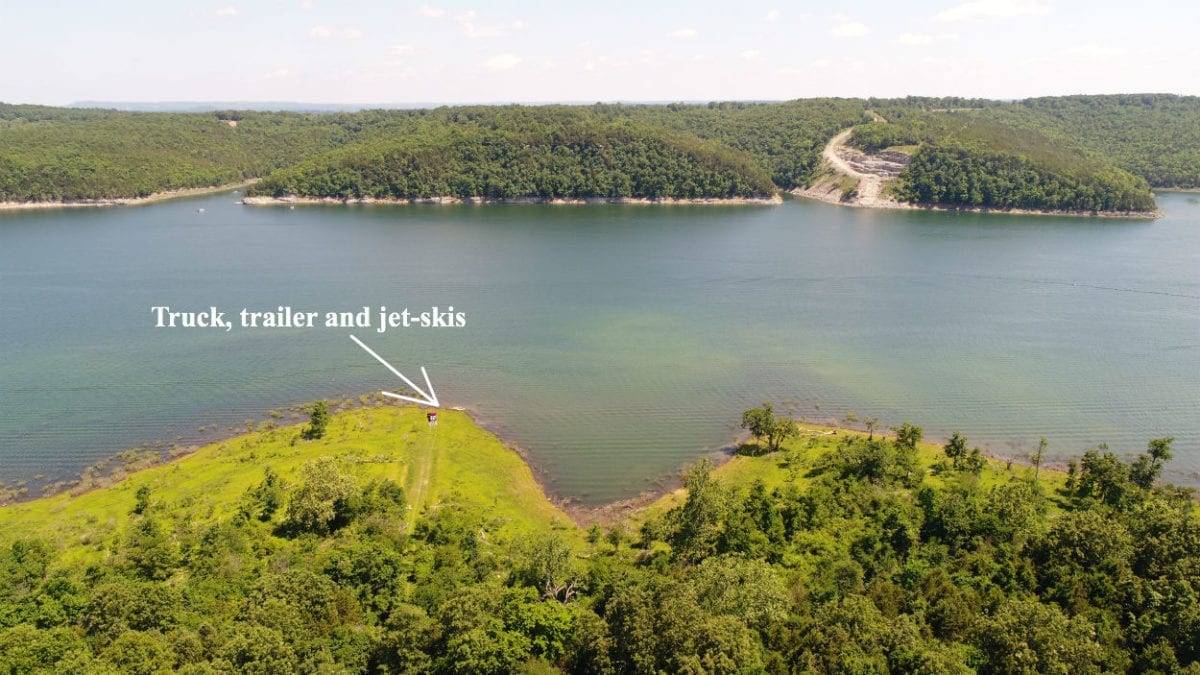
The aerial photo above was taken in an area about 10 miles west of Mountain Creek Cove (still on Bull Shoals Lake) and in the photo we have just launched a pair of jet-skis at a “primitive” boat launch on the lake. As with much of the shoreline on the lake, at certain times of the year there can be a wild grass that grows on the area between the water and the timber. Come and explore the miles of shoreline. You can fish all year around!
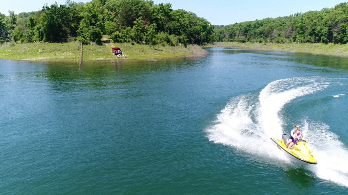
In the photo above we have just put two jet-skis into the water on another “primitive” boat launch on Bull Shoals Lake. The launch above is about 15 miles west of Mountain Creek Cove (still on Bull Shoals Lake). We were able to use a drone to grab a picture of one of the jet-skis before it zipped away to explore the shoreline on the lake.
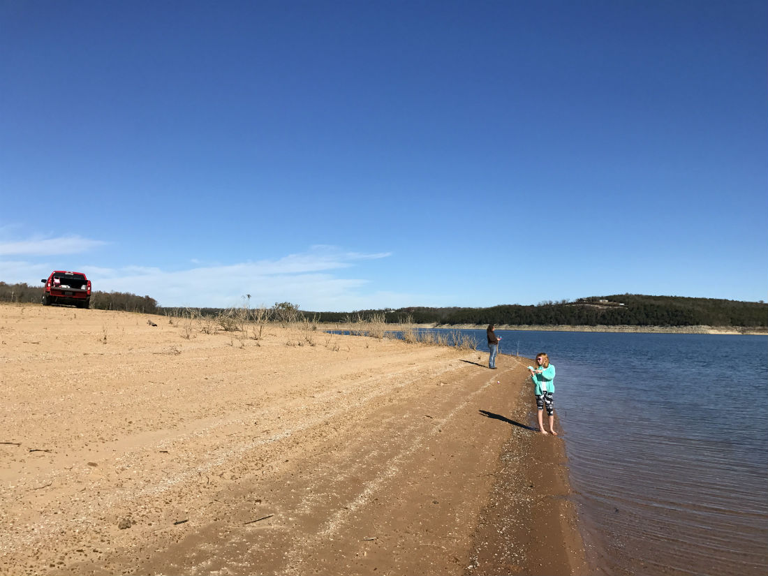
In the winter photo above, the young lady is going after some bass from the shore of Bull Shoals Lake. The Corp of Engineers often lowers the water level of the lake in the winter but that does not seem to affect the fishing and boating. What a great way to spend your vacation!
What can you do on your new property at “Mountain Creek Cove on Bull Shoals Lake”?
These tracts are NOT subject to the zoning regulations that you will find in most areas of the country! This property is within a Rural Development and does have basic property covenants BUT almost all of the Outcast Land buyers find that these covenants simply do NOT limit what they plan to do with their property. In fact, most Outcast Land buyers that we speak to would simply NOT invest in a rural property without basic covenants in place to protect their investment!
At your property within “Mountain Creek Cove on Bull Shoals Lake” you can:
- Fish from the miles of shoreline at the lake within the “Corp Land”
- Hunt on your property AND within the thousands of acres of “Corp Land”
- Camp
- Build a cabin or a home (subject to the basic property covenants)
- Have a portable building or shipping container (for camping, hunting, recreation and storage)
- Use your camper or RV for camping, hunting and recreation
On your property at “Mountain Creek Cove on Bull Shoals Lake” you can not:
- No commercial businesses
- Can not live on the property until the owner financed loan has been paid in full
- No cutting of the timber until the property has been paid for in full (we can often make written exceptions for clearing a building site or driveway, contact us for details)
- No junkyards of any kind
All of the tracts at Mountain Creek Cove on Bull Shoals Lake have setback distances from Mountain Creek Trail for privacy and to maintain the natural “feel” of the area. These setback areas are also designated as potential future utility easements and as privacy buffers. All buildings, homesites, parking areas, storage areas, etc. must be at least 100 feet from the centerline of Mountain Creek Trail (this area acts as a privacy setback as well as a future utility easement).
Fences/gates may not be placed within 50 feet of the centerline of Mountain Creek Trail, as this area is a designated road easement area.
These tracts represent an excellent opportunity for building your own hunting cabin, as we have been told that there are no building permits required in this area! You and your friends/family can build your own cabin without permits or inspections.
When you do build a residence on your property it must be at least 600 square feet in size and have a concrete foundation (slab, stem wall, basement). As mentioned earlier in this listing, in order to live on the property the Owner Financed loan would need to be paid in full. Many times, buyers use our Owner Financing to purchase the property and then after a year or two they get a loan through a local bank (or a national bank) and pay off the owner financed loan. It’s a great way to immediately get the property that you want and it gives you maximum flexibility as you can choose to later obtain a loan through a bank (paying off the owner financed loan) or to simply continue to use the convenient owner financing until the property has been paid for in full.
DIRECTIONS to “Mountain Creek Cove on Bull Shoals Lake”:
Coming from the North or West:
To get to “Mountain Creek Cove on Bull Shoals Lake” from the North or West (coming from the direction of Springfield, Missouri) just go south Highway 65 out of Springfield for a little over 25 miles and then go east on Highway 160 (toward Forsyth). Head east on Highway 160 for about 40 miles and you will come to Theodosia, Missouri (you are getting closer!). After you cross the bridge over Bull Shoals Lake in Theodosia you will continue east on Highway 160 for a little over 10 more miles and then go right (south) onto Highway 5. Go about 4 miles on Highway 5 and then go west (right) onto Highway W. Go about 2 1/2 miles on Highway W and then turn south (left) onto County Road 619. This is a gravel road and the street sign may actually say County Road 622. Head southerly on this gravel road for about 3 1/2 miles and you will come to a “T” in the road. Go right at the “T” and go about another 1 1/2 miles and you should see the start of Mountain Creek Trail on the left side (east side) of the road.
Now head east on Mountain Creek Trail for a little less than 1/4 of a mile and you will see Tract 1 on the right side (south side) of the road. Continue heading east along Mountain Creek Trail if you are viewing Tracts 2, 3 or 4.
Coming from the East:
To get to “Mountain Creek Cove on Bull Shoals Lake” from the East (coming from the West Plains, MO area) just go west on Highway 160 out of West Plains for about 35 miles to the town of Gainesville, Missouri. From Gainesville, continue to proceed west on Highway 160 for about 2 miles and then go south onto Highway 5. Once you are on Highway 5, proceed the same as the directions above.
Coming from the South:
To get to “Mountain Creek Cove on Bull Shoals Lake” from the South (coming from the Mountain Home, Arkansas area) just go north out of Mountain Home on Highway 5 and proceed for a little less than 20 miles then head west onto Highway W. Now proceed the same as the first set of directions.
If you are coming in from the south the map shows that there are probably quicker ways to get to the property, but we didn’t want to send you on a route that we had not personally experienced.
If you would prefer to use a “street address” that you can input into Google Maps or Apple Maps you can use the address below (this should take you fairly close to the start of Mountain Creek Trail, which you would then take to the property):
000 Mountain Creek Trail
Oakland, AR 72661
Also, here are the GPS Coordinates at about the start of Mountain Creek Trail:
36.4836, -92.5768
This tract offers maximum privacy as it is located on a dead end road with no “through traffic”. Because this tract extends back from the County Road for several hundred feet you could potentially have your building and/or camping site tucked away so that it was completely private.
It has always been difficult to find any available quality land near Bull Shoals Lake and it has always been almost impossible for us to find land with direct frontage on the “Take Line” at the lake. When you add to that the fact that this tract is heavily wooded, has County Road access AND has an electric line on-site you have a property with amazing investment potential that you can also use to create lifelong memories with family and friends.
It is continually getting harder and harder to find good-quality acreage for fishing, hunting and recreation (and building a home or cabin). With its privacy and excellent location, this tract represents what we feel is one of the best investment opportunities that we have ever had. Fish, camp, hunt and enjoy your property right away – and watch as the land values in this area continue to climb as more and more people discover Bull Shoals Lake and the beautiful Ozarks.
The fishing, camping, hunting and recreational opportunities in this area are awesome. This tract could be suitable for hunting, camping, building and recreation, and Bull Shoals Lake is well-known as one of the best fishing lakes in the United States.

State Map
The map above shows the location of Mountain Creek Cove, relative to Springfield, Missouri as well as Theodosia, Missouri, Gainesville, Missouri and Mountain Home, Arkansas. You can fly into Springfield and be on your private paradise at the lake within a couple of hours. Branson also has an airport which is small but is continually adding flights.
This is investment-quality acreage in a fantastic location. These heavily wooded tracts at Mountain Creek Cove are some of the ONLY properties we have ever found at Bull Shoals Lake that have direct “Take Line” frontage AND have a power line already on-site. It’s rare to find a property with so much investment potential that you can actually use and enjoy!
TERMS OF SALE
The full sales price for this very rare and very special 12 acre property with over 650 feet of direct “Take Line” frontage at Bull Shoals Lake (Tract 4 at Mountain Creek Cove) is $129,500. With your down payment of $2,500 you will automatically receive our reduced annual interest rate of 6 3/4% and the monthly payments will be $1,133.84.
With a $5,000 down payment the annual interest rate drops to 5 3/4% (our lowest rate) and the payment drops to $1,043.87 a month. These payments are all based on about a 15 year amortization schedule. Property taxes will only be about $120 a year and this is already included in the monthly payment amount(s) shown above. There are NO prepayment penalties and NO hidden fees.
PLEASE NOTE that you have a full TWELVE MONTHS to ADD to your down payment in order to reduce your interest rate and payment amount! We want to give ALL of our buyers the opportunity to achieve the lowest interest rate and payment amount possible!
ALSO, if you pay off your property (your loan to us) at any time within the next 5 years you will get a DISCOUNT in the amount of 10% of the purchase price of the property! On this property that would save you $12,950 for an early payoff!
The tracts at Mountain Creek Cove on Bull Shoals Lake are sold through our partner company which is Outcast Land Inc. – The sales process is the same as you see on the InstantAcres website, but the paperwork will show Outcast Land Inc. as the “seller”.
If this property is still available you may purchase it instantly through the “Buy Now” link on this page or you can call us in the office at (417) 767-2223 and we can answer any questions you may have, or we can take your payment over the phone. Also, please feel free to email us at [email protected] and we can answer your questions via email.
As soon as your down payment has been received we will send out your paperwork (via email with Docusign) and you are welcome to use and enjoy your new property immediately. If this is the property for you then please choose your initial down payment amount in the box below and you can pay with a debit or credit card. Also please feel free to send us an email or give us a call and we can answer any questions or complete the transaction over the phone. Our number in the office is (417) 767-2223 and you can email us at [email protected] with any questions or just to chat about the property!