SORRY, THIS PROPERTY HAS JUST BEEN SOLD!
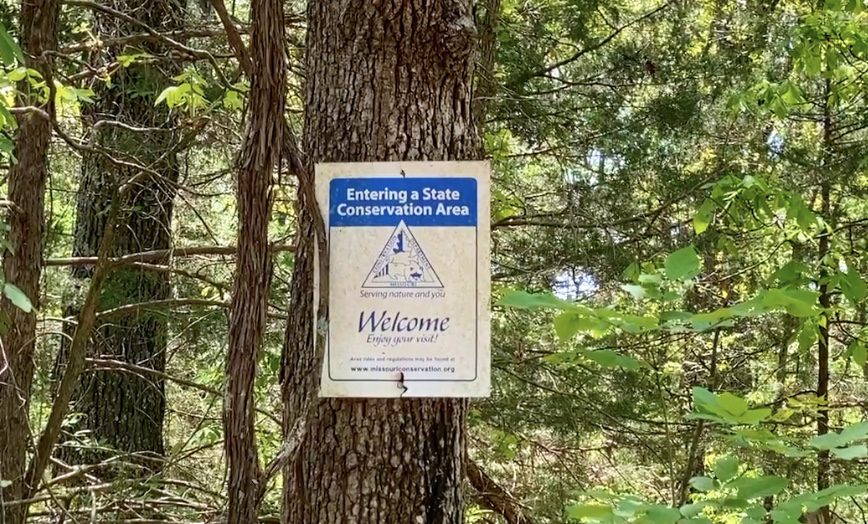
This heavily wooded 10 acre tract at “The Mule Shoe Project” offers County Road frontage for easy access, an electric line on-site AND is less than a mile from the enormous Mule Shoe Conservation Area. The Conservation Area includes access to over 2,000 acres of ADDITIONAL land for hunting, camping and recreation AND access to over a mile of river frontage on the beautiful Little Niangua River for swimming, fishing and canoeing.
This means you can enjoy your private acreage and still take advantage of the THOUSANDS of acres of additional land for hunting, camping, fishing, swimming and recreation. The hunting in the area is excellent as this part of the Ozarks is well known for white-tailed deer and wild turkey (you can also “hunt” for arrowheads on the gravel bars within the Little Niangua River).
Please check out all of the pictures and videos in this listing to get a good look at this special property and at the beautiful Mule Shoe Conservation Area!
This property is accessed by a well-maintained, gravel county road (Hickory County Road 66) along its entire north side, giving you good road access throughout the entire year. The property appears to be basically all wooded (except for possibly some small natural clearings and trails). There is no “driveway” into this property so you would need to have one created/cleared in order to pull your truck or SUV onto the property. This gives you the opportunity to choose your driveway location and to add additional value to your acreage.
It is VERY rarely that we are able to offer a property with a power line on-site AND with direct County Road frontage. When you add to that the fact that this tract is heavily wooded, has a small creek bed AND is less than a mile from the Mule Shoe Conservation Area and the Little Niangua River, you end up with a very special property!
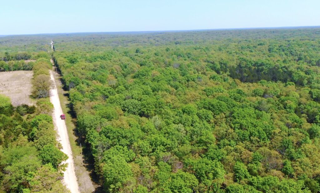
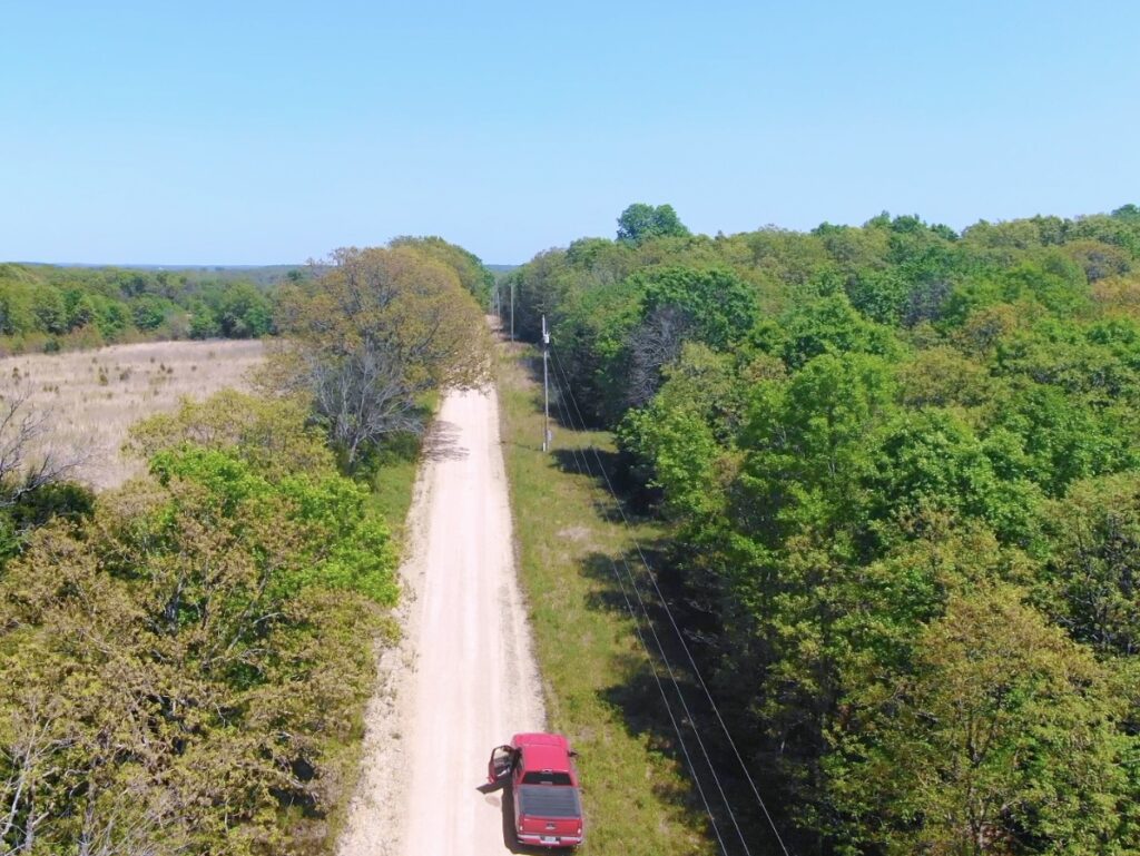
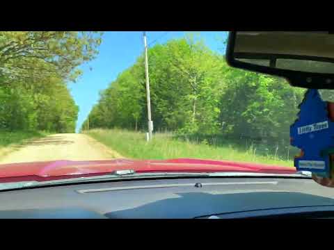
In the photo above we are facing east on County Road 66, which borders the entire north side of the property (drone photo taken above the County Road). The property is on the right side of the road in this photo. As you can see in the photo, there is a power line DIRECTLY on the north side of this property. Although you may not need the power in the near future, it is VERY convenient to have the power line on the property – it will add value to your property AND make your life much easier if you decide to build a home or a cabin that requires electricity. You can certainly go “off-grid” with your campsite, hunting cabin (or home) but even the most “Hardcore Off-Grid Folks” seem to appreciate having a power line readily available. – If you look back to the right side of the photo above, you can see the cedar grove (and natural glade area) that is on the property.
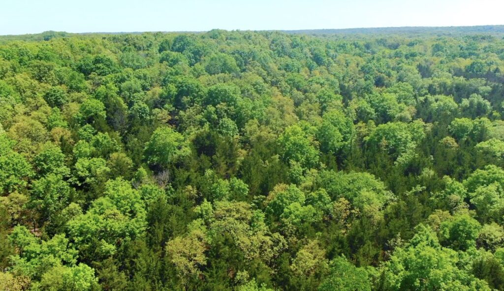
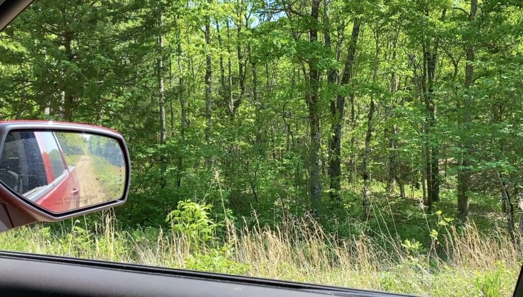
In the photo above you can see a few of the thousands of beautiful trees on this heavily wooded property. We saw no signs of recent logging on this private tract and it appears to be an excellent mixture of timber including red oak ,white oak, cedar, hickory, sycamore and much more.
This top quality acreage is brought to you by our Sales Partner “Outcast Land Inc”. Outcast Land is known for focusing on the highest quality hunting and recreation land in the United States. Every tract sold by Outcast Land is hand-picked for its hunting, recreation and investment appeal. All Outcast Land tracts are buildable but they can not be used as a residence until after the owner financed loan has been paid in full (please see the “Homesteader Friendly” category if you are looking for a place on which to live in the near future). Because this tract is offered to you through our website at www.InstantAcres.com, the sales process is identical to the other tracts that we sell ($1,500-$5,000 Down Payment, Owner Financing, etc.). This tract can be purchased from this listing page if it is still available.
We have a very limited number of these tracts at “The Mule Shoe Project”, which are some of the HIGHEST QUALITY hunting and recreation tracts in the nation. This area is consistently ranked as one of the top hunting areas in Missouri (and in the nation). The Conservation Area gives you over 2,000 acres of ADDITIONAL acreage for hunting, camping, fishing, canoeing and recreation.
There are a very limited number of tracts at “The Mule Shoe Project” and ONLY the tracts on the north side have a power line on-site.
The Mule Show Conservation Area offers multiple camping areas (free use) which may be a convenient place to camp for a few days while you explore the options on your new property. We have been told that you can camp in the Conservation Area for up to 14 days in a 30 day period, for no charge (you will want to verify this before making plans to camp in the Conservation Area).
If you have not already seen the full “Information Page” for The Mule Shoe Project (which includes a ton of information and videos), please feel free to click on the link below. It is the page that has the “Tract Map” with the availability of the various tracts, so it is likely you have already visited that page in order to get the the page that you are currently on.
Click Here For The Main Page Of “The Mule Shoe Project” (if you have not already seen it)
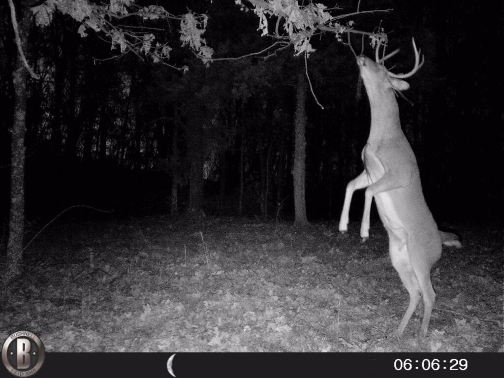
This area has a PROVEN track record for huge white-tail deer and enormous wild turkeys. In addition to being able to hunt and camp on your private acreage, you can also venture into the enormous Mule Shoe Conservation Area for additional hunting, fishing, camping and recreation.
The information (below) is the specific information about this tract, which is Tract 13 at The Mule Shoe Project. It is 10 acres in size.
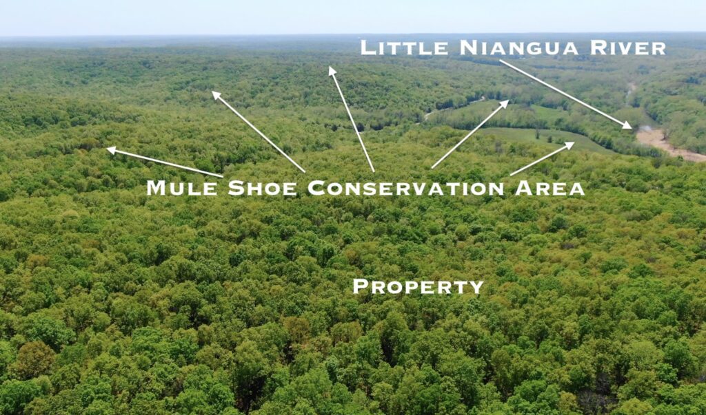
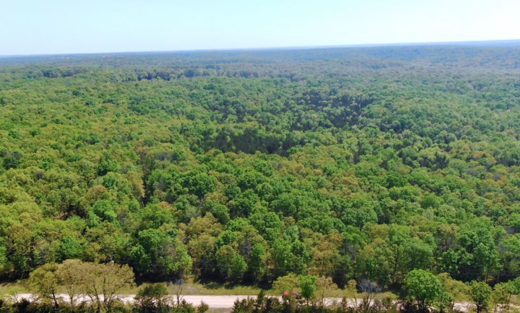
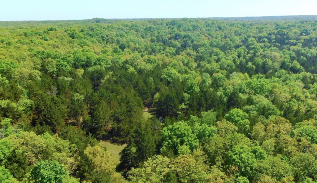
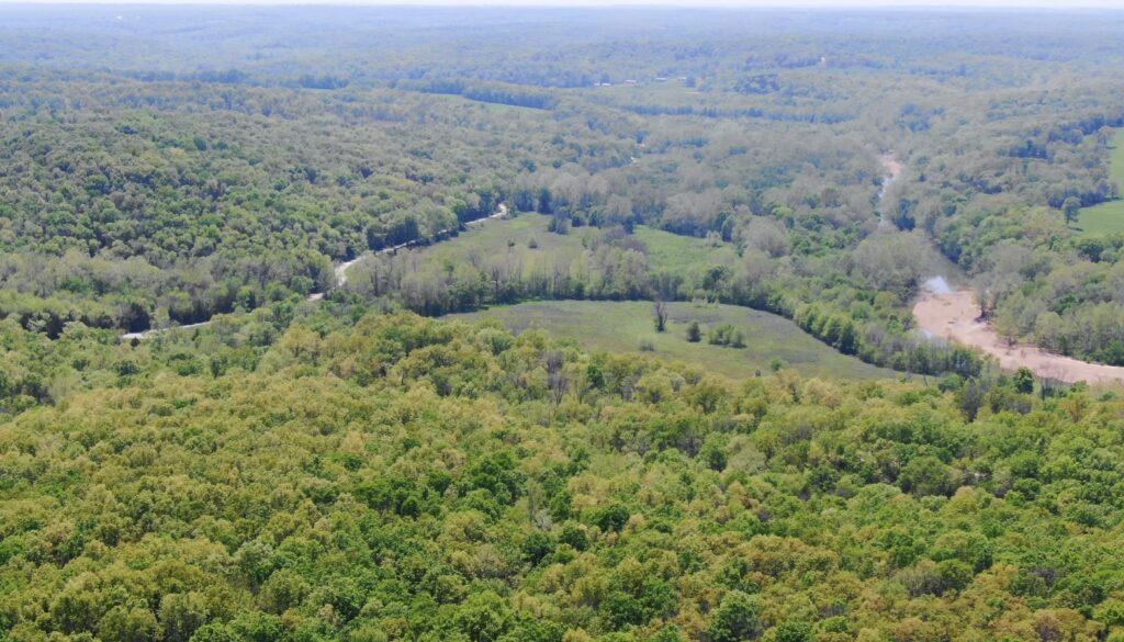
The aerial photo above gives you a “bird’s eye view” from the area. In this aerial photo, the drone is over one of the “north” tracts at “The Mule Shoe Project” and we are looking to the southwest. You can see a part of the Mule Shoe Conservation Area as well as a small section of the Little Niangua River which flows directly through the Conservation Area. In this photo we are only seeing a small part of the Conservation Area (which totals about 2,800 acres in size) and a small section of the Little Niangua River, which flows through the Conservation Area for over a mile.
In the aerial photo above, we are checking out some of the timber on the property. In this spring-time photo you can see that this property has a beautiful mixture of timber. In the aerial photo above we are looking easterly from over the north side of the property (which is on the right side of the County Road).
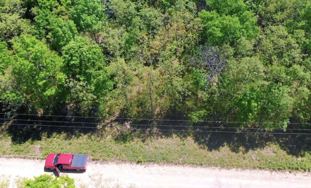
In the aerial photo above we are now facing south, and we are across the County Road from the north side of the property. You can see the power line and you can see County Road 66 (kind of). If you look very closely you may be able to see the red truck which is parked on the County Road at the north side of the property. As we look southerly in this spring-time photo it is easy to tell the cedar trees (drak green) from the hardwood trees (lighter shades of green).
In the photo below we are checking out some of the beautiful timber on this property (from the County Road).
For a limited time, this property is available with just a $500 down payment! It’s a great opportunity to save some cash while grabbing an excellent property!
The full sales price for this rare acreage at “The Mule Shoe Project” with direct County Road frontage and a power line ON site is $69,500 and we are currently offering INSTANT owner financing with just $500 down.
With your $500 down payment you will get our annual interest rate of 9 3/4% and your monthly payment will be $730.37.
PLEASE NOTE that you have a TWELVE MONTHS to ADD to your down payment in order to reduce your interest rate and payment amount! We want to give ALL of our buyers the opportunity to achieve the lowest interest rate and payment amount possible!
With a $1,500 down payment the annual interest rate drops to 7 3/4% and the monthly payments will drop to $655.07. With a $2,500 down payment the annual interest rate drops to 6 3/4% and the payment drops to $607.89 a month. With a $5,000 down payment the annual interest rate drops to 5 3/4% and the payment drops to $550.62 a month. These payments are all based on about a 15 year amortization schedule. Property taxes will be about $120 a year and this is already included in the monthly payment amount. There are NO prepayment penalties and NO hidden fees.
ALSO, if you pay off your property (your loan to us) at any time within the next 5 years you will get a 10% DISCOUNT off of the purchase price of the property! On this property that would save you $6,950 for an early payoff!
The tracts at The Mule Shoe Project are sold through our partner company which is Outcast Land Inc. – The sales process is the same as you see on the InstantAcres website, but the paperwork will show Outcast Land Inc. as the “seller”.
If this property is still available you may purchase it instantly through the “Buy Now” link on this page or you can call us in the office at (417) 767-2223 and we can answer any questions you may have or we can take your payment over the phone. Also, please feel free to email us at [email protected] and we can answer your questions via email.
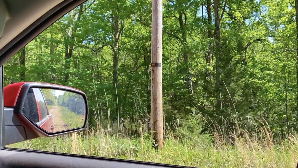
In the photo above we are looking at a power pole near the north side of the property. Not only does this property have power on-site as well as County Road frontage and mature timber, but the topo map indicates that this special tract has more “level” area than most other tracts within “The Mule Shoe Project”. Also, don’t forget about the very cool natural “glade area” which is tucked deep into the property!
This particular tract has direct frontage on the County Road along its entire north side. It appears that Hickory County does a nice job maintaining their roads but this is still a gravel road and a four wheel drive is always recommended. In the photo below we are parked on the County Road at the north side of the property.
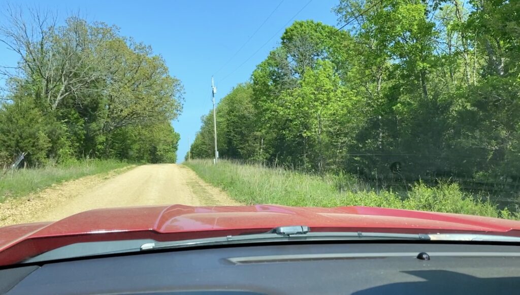
Although it is likely that you could drive to the property in just about any vehicle, in order to drive onto the property you would need to create/clear some type of driveway. This is something that many folks can do themselves but you may want to view the property before deciding what type of driveway you wish to clear. The most simple “driveway” may consist of just clearing out some of the smaller trees and using your four wheel drive to pull into the property. A more “complex” driveway may involve moving some dirt and hauling in some gravel so that you can pull onto your property with a car.
Everyone has a different idea about what type of driveway they require (if any) and we will leave that up to you! Because this property is not too far from several major cities (Camdenton, Springfield and others) there are generally people or companies who would be able to do a driveway, site and almost anything else you desire.
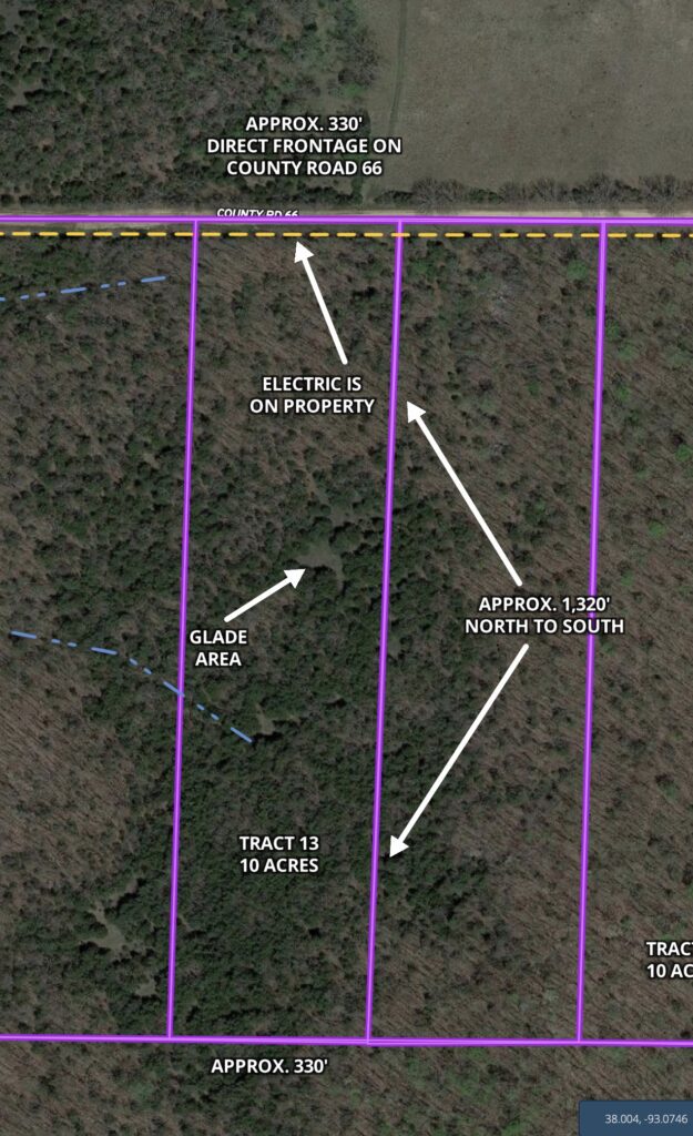
The winter-time aerial photo above shows how this private acreage is situated. This special tract directly borders the County Road along its entire north side for about 330 feet. From the County Road, the property goes back to the south for about 1,320 feet. The power line runs across the north end of the property and is shown by the yellow “dashed” line on the map. The blue “dashed” line indicates the approximate location of the little creek bed that we discovered when we visited the property. On the map above you can see the large “glade area” near the center of the property, but there also appears to be a smaller glade a few hundred feet south of the main glade.
These tracts have not been surveyed so the dimensions and sizes are approximate. Although a survey is not required, if you decide to survey your property we will give you our recommendation for a surveyor in the area.
Because the map above is a winter-time aerial photo, you can see approximately what part of the property has hardwood trees and what part has cedar trees. In the photo, the hardwood trees do not have leaves so they are basically not visible BUT the cedar trees show as the darker green spots. This tract appears to be a nice mixture of hardwoods and cedar trees, with the majority of the property having cedar trees.
Please see the interactive map (farther down on this listing page) to explore the property as well as the Conservation Area and the surrounding area. On all tracts there is a setback distance from the County Road as a privacy buffer and as a utility easement area. All buildings, parking, structures, camping, storage, etc. must be at least 100 feet back from the center-line of the County Road.
The topographic map below shows the “lay of the land”. This property is Tract 13 and is about 10 acres in size.
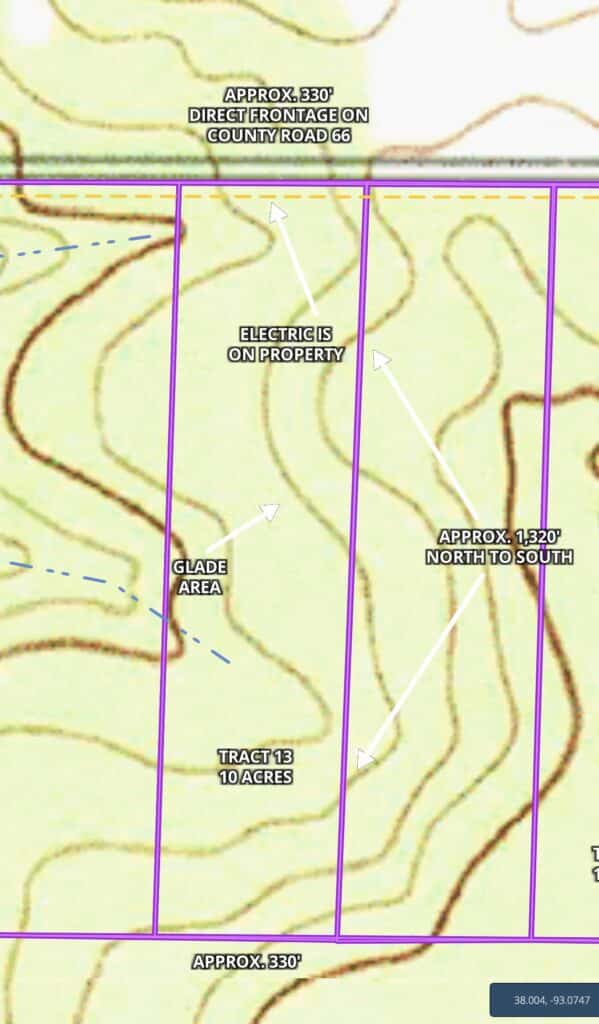
The topo map above shows that the property (Tract 13) appears to slope down gently as you go southerly from the County Road, and then begins to slope back up after a couple of hundred feet. The map indicates that the property then stays fairly level for several hundred feet until it finally begins to slope down into the valley area (where we found the tiny creek bed). Moving south from the valley area, the property begins to slope back up with the “highest” part being about the southeast corner of the property.
On the topo map above, the “contour lines” each indicate an elevation change of about 10 feet. In general, when the contour lines on a topo map are close they indicate steepness and when the lines are spaced far apart they indicate flatness. On the map above, the majority of the property appears to be fairly level with just a gentle rise and fall (other than the south end).
The topo map indicates that the highest area on this tract would be at about the southeast side of the property, with an elevation of about 940 feet above sea level (nice and high, in case weather patterns drastically change in the future). The “lowest” area on the property appears to be on the west side of the valley in about the middle of the property, with this area being about 900 feet above sea level.
Please keep in mind that we did not see any type of driveway into this property, so if you wanted to pull your truck or suv into the property you would need to clear/create some type of driveway. Based on the small bit of exploring that we did on the property, if we were to create a driveway we would likely start at about the center of the road frontage and we would angle the driveway somewhat and go to the “level area” that the topo map shows as being about 300 feet into the property. The map seems to indicate that this is a rahter large level area so it may make a nice (and private) site for camping or building. This is simply our opinion, and as we mentioned earlier it seems like everyone has a different idea about what makes an acceptable driveway and/or site. For a more private site you could venture even further into the property. You are certainly not required to clear any type of driveway/site on your property, but it would be convenient if you wish to pull onto your property to camp, explore, etc.
As with any tract of land which has a loan on it, you are not able to cut/remove the timber until the property has been paid in full EXCEPT that we do often make written exceptions if you need to remove some timber to create a driveway and/or a small site for camping/building. Contact us for details on how you can obtain written permission to remove timber on the property in order to create your driveway/site (we have a VERY easy process in place). After the property has been paid for in full you can do as you please with all of the timber on this heavily wooded tract.
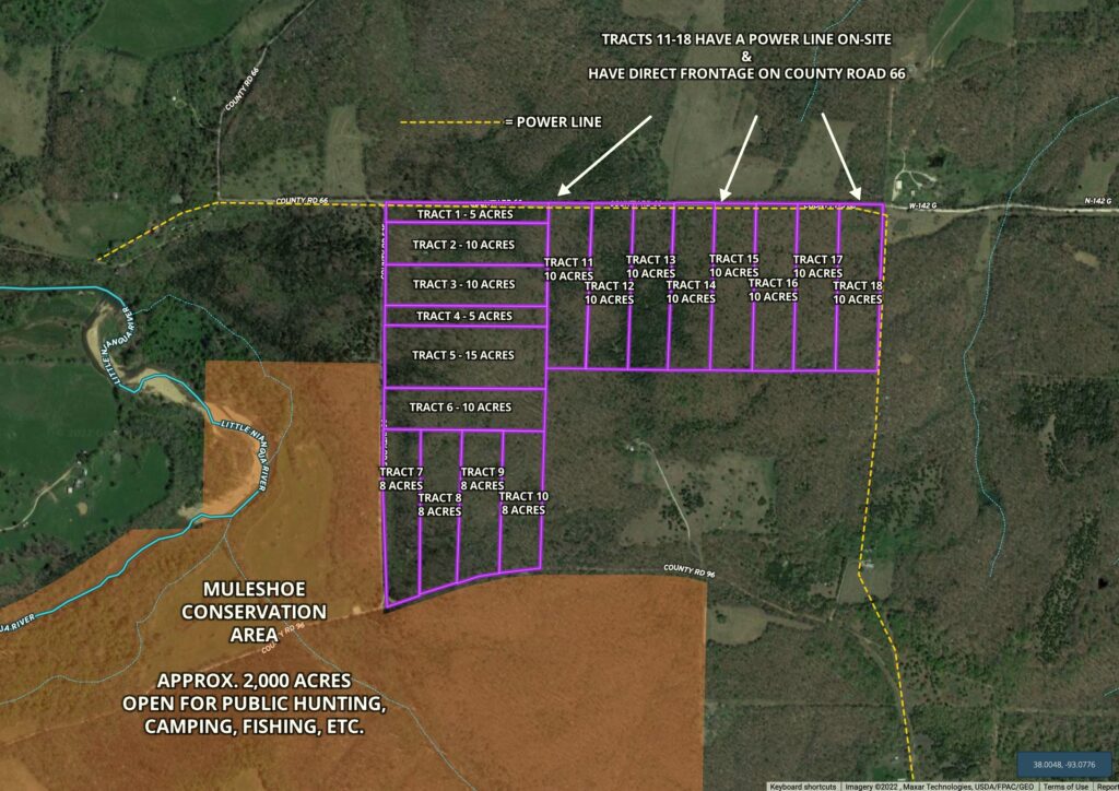
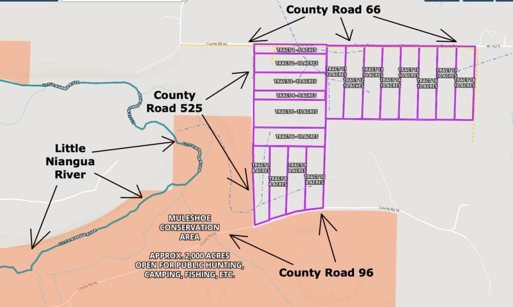
The map below shows these private tracts at “The Mule Shoe Project”. As you can see on the map below, the power line runs directly across the tracts on the north side of “The Mule Shoe Project” (shown as the yellow “dashed line” on the map below). If you require a property that has power directly on-site then one of the tracts on the north side may be a good choice. This particular tract is one of those “north tracts” so it DOES have the power line directly on-site.
Next, let’s check out some videos of this well-located acreage.
VIDEOS!
Below, you will see a few videos which will help you to “explore” the property. First, we have a drone video showing the property from the air:

Owner Financed Land with power & natural glade – 10 acres next to public land and river! ID#MC13
The next video is a “ground video” where we check out a small part of the north side of the property (from County Road 66).
Video Ground MC13 Done
In the next video (below) we use the “MapRight” interactive mapping program to explore the property and the area. It is not as exciting as a drone video but it does have a ton of good information:

Video Intro MC13
As you may already know, the deer hunting in this area is some of best in the nation. Turkey hunting is excellent as well. On this tract you can hunt, camp, ride your four wheeler, shoot your gun(s) and generally just relax and enjoy life. This tract is definitely buildable, subject to the basic property covenants which are the same for all Outcast Land tracts. If you wish to use this property as a residence, your home/cabin must be at least 600 square feet on a concrete foundation and the owner-financed loan must be paid off. The land does not have to be “free and clear” in order to live on the property but the owner-financed loan to Outcast Land Inc. must be paid off (so if you “refinance” through your bank or another lending institution then the “owner financed” loan would be paid off).
You can build a hunting cabin right away, if you choose to do so. A hunting cabin would not have to be on a concrete foundation or be 600 square feet in size (those are requirements for a residence, not a hunting/vacation cabin).
The rest of the Property Covenants are very similar to the standard covenants that you may be familiar with on many of the InstantAcres.com tracts EXCEPT that on the Outcast Land tracts (including this tract) you have a full 90 days for camping in a 12 month period, which is twice as long as the standard 45 days a year. Also, your camping (for hunting purposes) is never limited during deer season (rifle season) or spring and fall turkey season. Outcast Land never wants to limit your hunting opportunities!
If you have already seen the information page for The Mule Shoe Project than you have probably already seen the Property Covenants which do apply to all tracts at The Mule Shoe Project. For your convenience, we have also added a link to the Property Covenants below:
To see the Outcast Land Property Covenants please click here.
If you are looking for a property for “Homesteading” or living in a tiny home/shipping container/portable building then we can help you (but not with this tract or any tract within The Mule Shoe Project) – simply go back to the InstantAcres.com home page and click on the category for “Homesteader Friendly Tracts”. But, if you are a serious hunter or recreational user (who may want to live on the property some day) then you are already looking at the correct listing! You can definitely have a portable building or a camper/RV on this property for camping and hunting (just not as a residence). In fact, we know many people who have built a small hunting cabin in a weekend, with materials that fit in the back of a suburban or a pickup truck. Remember, you can definitely build a home/cabin on this tract at any time, it just can not be used as a residence until after the Owner Financed loan has been paid in full.
As we mentioned earlier, please note that timber with a stump diameter larger than 8 inches may not be cut, sold, disturbed or removed until the property has been paid for in full (we can often give written exceptions for creating a building site or a driveway/trail, contact us for details on this).
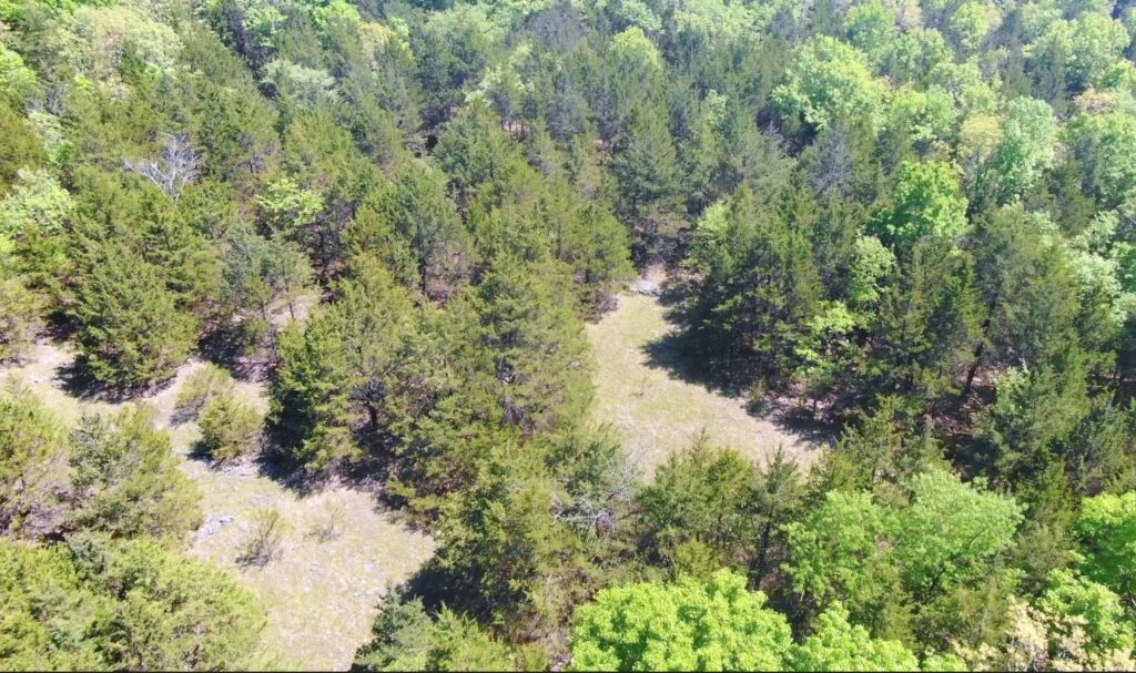
In the aerial photo above, we are looking down at the natural “glade” area which is several hundred feet into the property.
We took the photo above less than a mile from the property. Having the Conservation Area so close to your private acreage is like having a 2,000 acre backyard that you can use for additional hunting, camping and recreation (including swimming and fishing).
This property has a gorgeous mixture of timber. It appears to be a mixture of cedar trees and hardwood trees which could include: red oak, white oak, hickory, black walnut, pecan, sycamore and more.
In the aerial photo above we are looking southwesterly from fairly near the south side of the property. The Little Niangua River is a great place to spend the afternoon swimming and fishing (and hunting for arrowheads).
In the aerial photo above we are looking down toward the County Road and facing southerly.
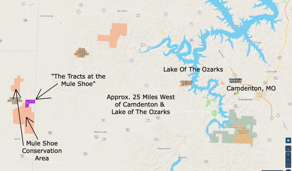
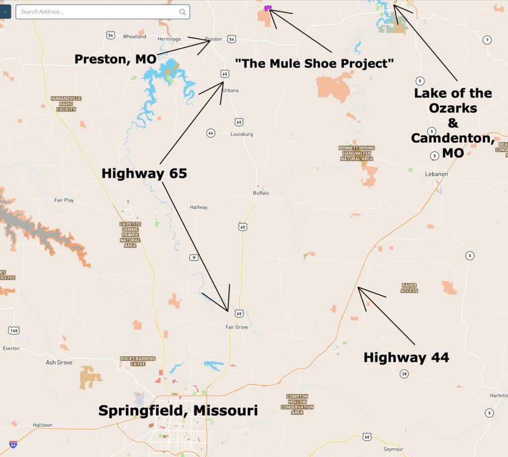
This property is located in an excellent location within the Ozarks. These private tracts are located about 25 miles west of Camdenton and the wildly popular Lake Of The Ozarks. The tracts are only about 1 1/2 hours north of Springfield, Missouri (which is the largest city in southern Missouri). The Mule Shoe Conservation Area (which directly borders several of the tracts) offers THOUSANDS of acres of additional land for hunting, camping, fishing, swimming and recreation.
The “MapRight” interactive map (below) is useful for exploring the property and the area. You may have to “zoom in” in order to see this specific tract. You can also move the map around and even use different “base layers” to view the property (the property is Tract 13 on the Interactive Map):
Please refer to our interactive map above (MapRight Map) for additional property views and information. The MapRight boundaries are approximate but they will be helpful for exploring your property and the area.
About the free “MapRight” app that you can use to help check out this property:
To watch a short video that details how to use the free “MapRight” app to locate the property, as well as the property’s approximate boundaries, please click on the link below:
Click Here To See A “MapRight” Tutorial
You will want to download the “MapRight” app to your phone or tablet before you visit the property, as it will make things go smoothly on your first trip (just follow the directions in the tutorial). If you have questions about MapRight please feel free to call us in the office at (417) 767-2223 and we can assist you. MapRight seems to be constantly updating their program so it can be a little confusing when you first get started.
What can you do on your new property at “The Mule Shoe Project”?
These tracts are NOT subject to the zoning regulations that you will find in most areas of the country! This property is within a Rural Development and does have basic property covenants BUT almost all of the Outcast Land buyers find that these covenants simply do NOT limit what they plan to do with their property. In fact, most Outcast Land buyers that we speak to would simply NOT buy a property without basic covenants in place to protect their investment!
On your property at The Mule Shoe Project you can:
- Hunt (most buyers will buy a tract with deer and turkey hunting in mind)
- Camp
- Build a cabin or a home (subject to property covenants)
- Have a portable building or shipping container (for camping, hunting, recreation and storage)
- Use your camper or RV for camping, hunting and recreation
On your property at The Mule Shoe Project you can not:
- No commercial businesses
- Can not live on the property until the owner financed loan has been paid in full
- No cutting of the timber until the property has been paid for in full (we can often make written exceptions for clearing a building site or driveway/trail)
- No junkyards of any kind
All of the tracts at The Mule Shoe Project have setback distances from the County Road for privacy and to maintain the natural “feel” of the area. These setback areas are also designated as potential utility easements. Power is already directly on several of the tracts within this development, and having the easements in place makes it a possibility for all tracts to have access to power (obtaining and extending power would be at buyers’ expense). All buildings, homesites, parking areas, storage areas, camping, etc. must be at least 100 feet from the centerline of the County Road (this area acts as a privacy setback as well as a utility easement). A few of the tracts may already have a private driveway and a clearing in place and the clearing would generally be beyond the setback distance, so that it can be used for camping, parking, building, etc. (measure it if you are unsure).
Fences/gates may not be placed within 50 feet of the centerline of the County Road, as this area is a designated road easement area and privacy buffer.
These tracts represent an excellent potential opportunity for building your own home or hunting cabin, as there are no building permits required in this area! You and your friends/family can build your own cabin without permits or inspections.
DIRECTIONS from Springfield, MO: To get to “The Mule Shoe Project” from Springfield, just go north on Highway 65 for about 50 miles to the tiny town of Preston and then go east onto Highway 54. Head east on Highway 54 for a little over two miles and then go north onto Highway F. Now go northerly on Highway F for about four miles and then turn right (go east) onto County Road 96, which is a gravel road. Head east on County Road 96 for a little over three miles and you will be at the south side of “The Mule Shoe Project”. If you come in on County Road 96 then the last mile or so of your trip will take you right past the Little Niangua River and through the Conservation Area.
You can also come in from the north by staying on Highway F until it intersects with Highway P. Then go right (east) onto Highway P and continue heading east until it turns into County Road 66 (gravel road). This County Road will take you to the north side of “The Mule Shoe Project”.
Please be sure to print out the maps/directions from this listing page when you visit the property. Additionally, if you watch the video on our “F.A.Q.” page it will explain how you can download the free “MapRight” app which can be very useful for getting to the tracts, as well as exploring the tracts and the area.
The map below shows The Mule Shoe Project relative to Springfield, MO and Camdenton, MO:
The next map gives you a closer look at the last couple of miles of the drive to the property:
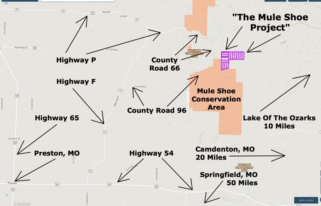
The map below is similar to the one above, except that it shows a closer view of the area and roads:
These tracts do not have a specific “street address” (because there has not been a residence on them) – but if you would like an approximate address to put into your G.P.S you can use:
14023 County Road 525
Cross Timbers, MO 65634
The address above should take you to about the northwest corner of these tracts, at the intersection of County Road 525 and County Road 66. From this location, you can use the maps within this listing page to locate your specific tract.
After your property has been paid for in full (or you have paid off the owner financed loan) then you would be able to contact the local post office to apply for a street address for your property.
As land prices continue to rise, many smart folks are realizing that by owing a property near Public Land (the Mule Shoe Conservation Area) they are able to use thousands of acres of land for hunting and recreation without having to purchase an enormous property. Many of the hunters that we speak to tell us that they are looking for at least a few hundred acres of land OR for a smaller tract that is close to Public Land. By having a 5-10 acre tract close to the Conservation Area, they are able to focus their resources on their own private acreage while still having excellent access into thousands of acres of additional land for hunting, fishing and recreation!
Properties in the Ozarks have been in demand for decades and that demand has been growing over the last several years. Traditionally, wooded acreage with County Road frontage and electric has been one of the most desirable investments (especially for smart folks who want to be able to use and enjoy their investments, rather than just look at the stocks in their portfolio).
Good quality hunting and recreation land in the Ozarks has been a proven investment for many years and demand for property near Public Land and a named river is growing by the day! As the demand for the top quality tracts continues to grow, the values will tend to continue to rise. This tract may represent an excellent opportunity for hunting, camping, building, recreation and investment. If you live or work in the Ozarks then you already know that our land values have been steadily climbing for years. Lock in your property now, before our land prices catch up with the rest of the nation!
For a limited time, this property is available with just a $500 down payment! It’s a great opportunity to save some cash while grabbing an excellent property!
The full sales price for this rare acreage at “The Mule Shoe Project” with direct County Road frontage and a power line ON site is $69,500 and we are currently offering INSTANT owner financing with just $500 down.
With your $500 down payment you will get our annual interest rate of 9 3/4% and your monthly payment will be $730.37.
PLEASE NOTE that you have a TWELVE MONTHS to ADD to your down payment in order to reduce your interest rate and payment amount! We want to give ALL of our buyers the opportunity to achieve the lowest interest rate and payment amount possible!
With a $1,500 down payment the annual interest rate drops to 7 3/4% and the monthly payments will drop to $655.07. With a $2,500 down payment the annual interest rate drops to 6 3/4% and the payment drops to $607.89 a month. With a $5,000 down payment the annual interest rate drops to 5 3/4% and the payment drops to $550.62 a month. These payments are all based on about a 15 year amortization schedule. Property taxes will be about $120 a year and this is already included in the monthly payment amount. There are NO prepayment penalties and NO hidden fees.
ALSO, if you pay off your property (your loan to us) at any time within the next 5 years you will get a 10% DISCOUNT off of the purchase price of the property! On this property that would save you $6,950 for an early payoff!
If this property is still available you may purchase it instantly through the “Buy Now” link on this page or you can call us in the office at (417) 767-2223 and we can answer any questions you may have or we can take your payment over the phone. Please feel free to contact us by email at [email protected] as well.


