Excellent new private tracts VERY close to the Niangua River, Bennett Springs State Park and also about 10,000 acres of public land for extra hunting, fishing, swimming, canoeing, camping and MORE!
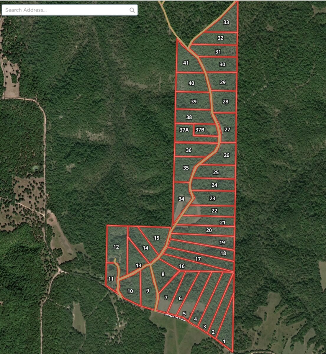
The map below shows the tracts at Whitetail Ridge South. Directly below the map you will see a list showing the available tracts along with their prices. Click on the tract number (in the list) of any available tract to see full information page for that tract.
- Tracts 1-11 are “Premium Location Tracts”. Because of their visibility from the County Road, these tracts can be used as a residence only after you have built at least a 600 square foot home on a concrete foundation. They can definitely be used for hunting and camping, even if you decide never to build a home or cabin.
- Tracts 12-41 are what we refer to as “Homesteader Friendly Tracts”. They do not require a concrete foundation and they do not have a minimum square footage in order to be used as a residence.
All of the tracts have the expanded 90 day camping time (double the normal 45 days camping period).
There will be more tracts coming available at Whitetail Ridge after the easement road has been completed (which will depend upon the weather but will likely be several weeks). The upcoming tracts will be to the north of these current tracts. There will be a total of about 65 tracts at Whitetail Ridge.

Please see the pictures, maps and videos below to learn about these beautiful wooded tracts at Whitetail Ridge!

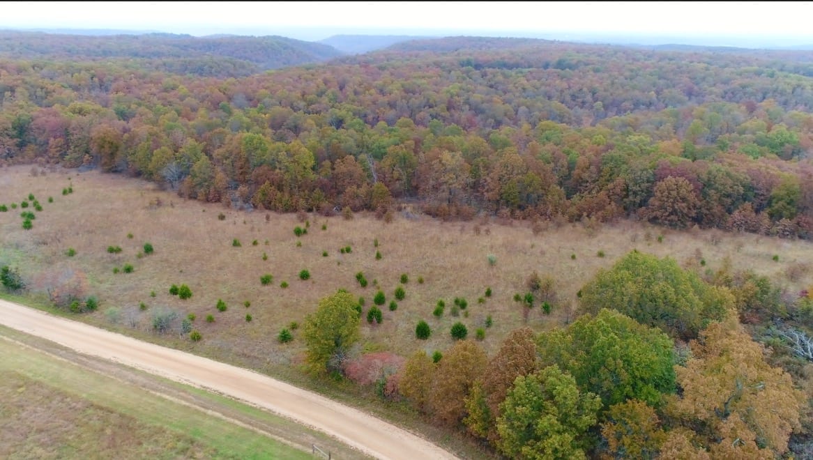
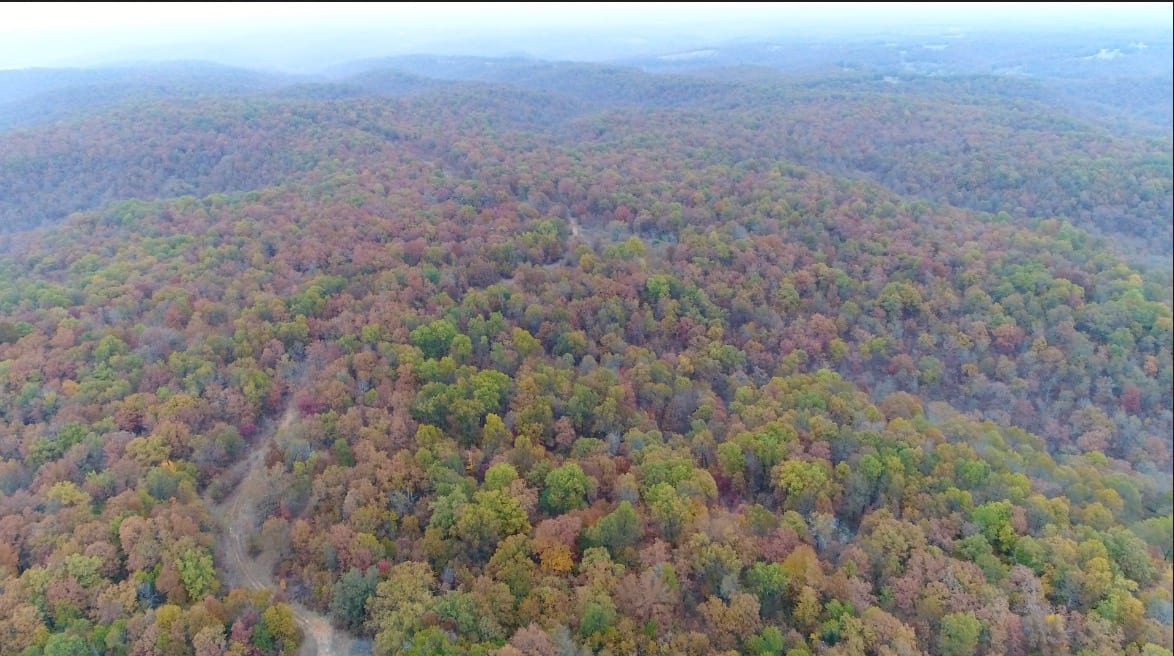
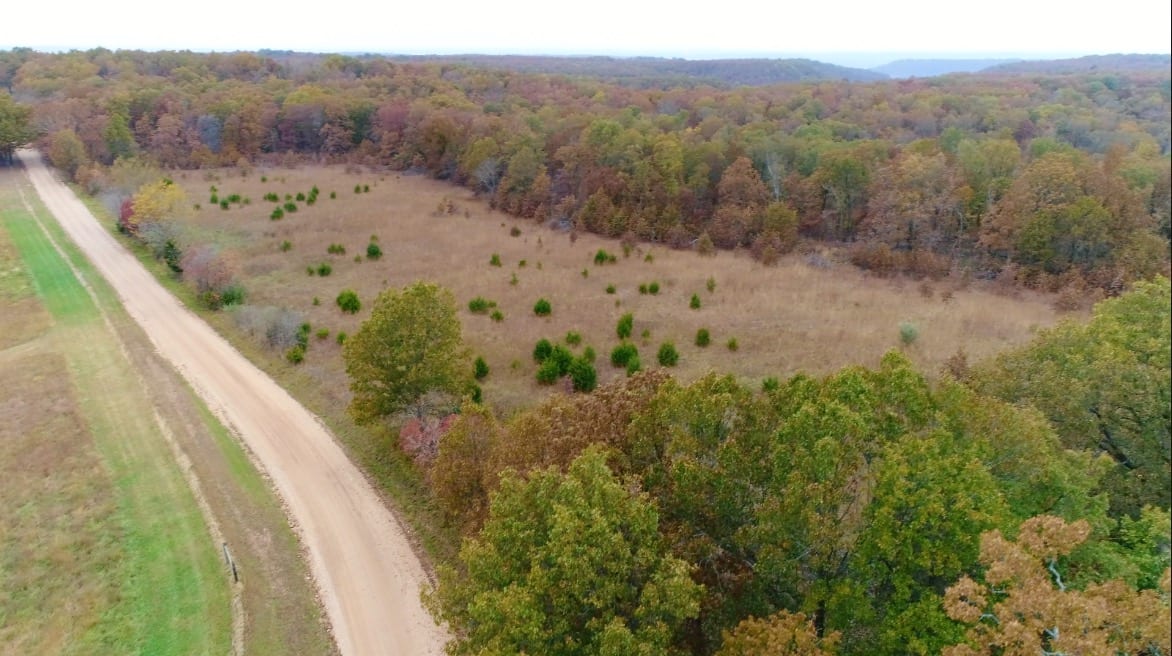
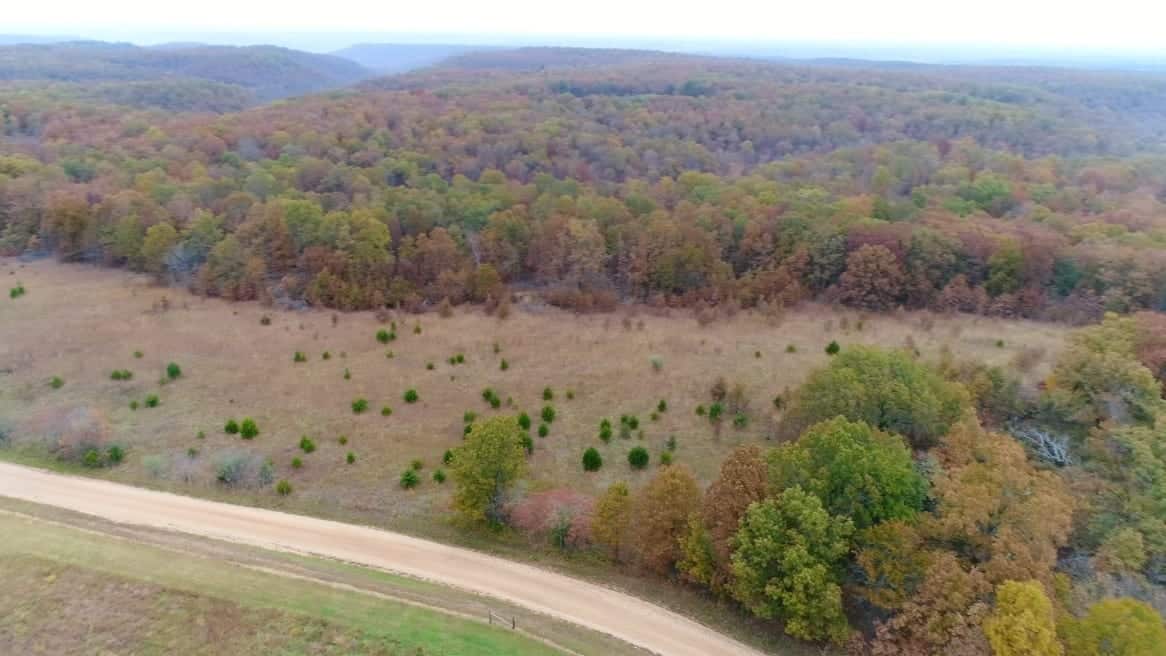
In the aerial photo above we are looking northerly at a few of the tracts within Whitetail Ridge South. All of the tracts are wooded and some tracts also have an open meadow.
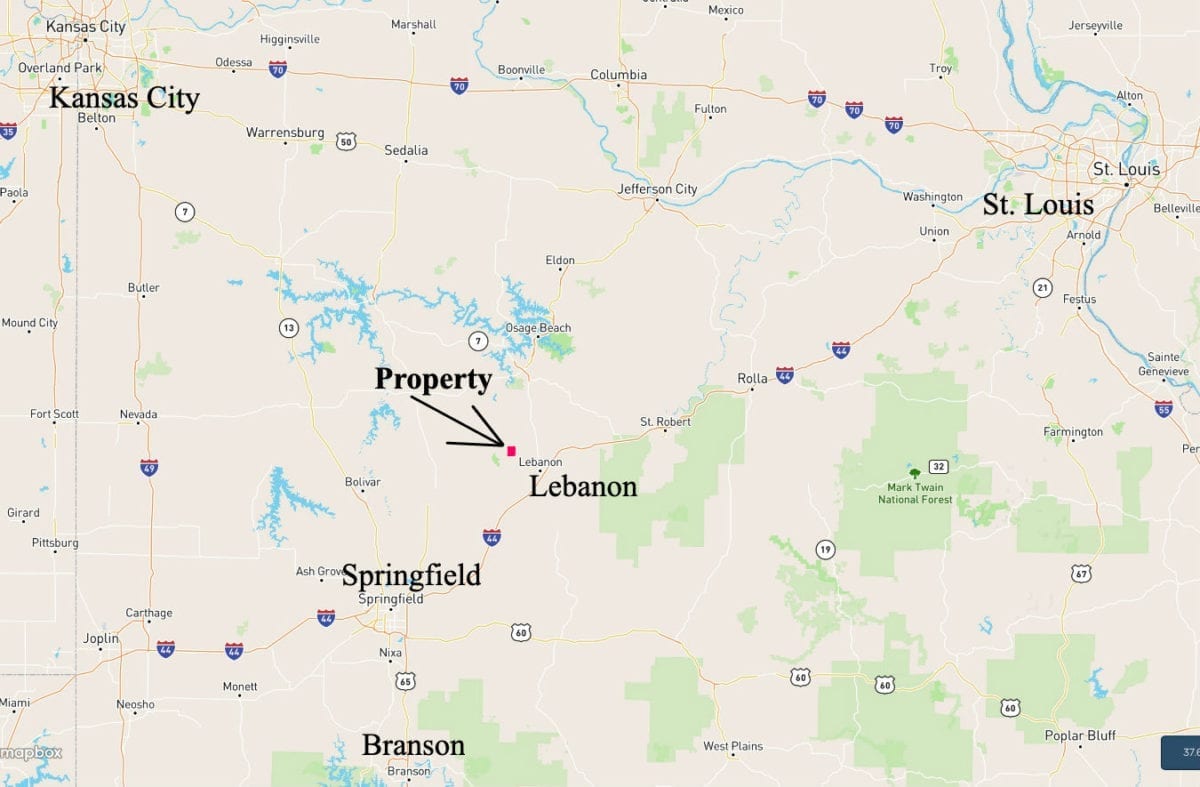
Springfield, Missouri is the largest city in southern Missouri and it is less than an hour to the south. The Springfield Airport offers numerous direct flights across the country and because it is a small airport you can be boarding your plane within about 20-30 minutes of parking your car (very cool).
Lebanon, Missouri is about 10 miles east of the property and is a nice sized city with just about everything you may need. It offers hundreds of restaurants and stores and numerous employment options.
“Whitetail Ridge” is a “Homesteader Friendly Rural Development”. This simply means that the standard Property Covenant requiring a minimum 600 square foot concrete foundation for a residence does NOT apply to many of the tracts at “Whitetail Ridge”. If you have been waiting for a property for your “tiny home” or for your “shipping container home” then you may have finally found what you are looking for! On most tracts you can even use an RV or a camper as a residence (as long as it is no more than 15 years old when moved onto the property).
As mentioned previously, Tracts 1-11 at Whitetail Ridge are “Premium Location Tracts” and because of their visibility from the County Road they do require at least a 600 square foot structure on a concrete foundation if you are using the property as a residence. Tracts 12-41 do not have this requirement.
When you visit Whitetail Ridge please use caution and bring your four wheel drive. As with any properties on a gravel easement road, a four wheel drive is always the best way to access your private acreage.
Feel free to use the Interactive Map below to check out Whitetail Ridge as well as the general area. You can zoom in and out and also move the map around and even use different “base layers” to view the tracts:
About the free “MapRight” app that you can use to help check out this property:
If you download the free “MapRight” app to your phone or tablet then it is very easy to use it to locate your property. After you have the app on your phone/tablet simply go to the listing page for your property (on whatever device you have downloaded the app to) and locate the actual interactive map on the listing page for the specific property. Toward the top left corner of the Interactive Map you will see a link that says “View Full Screen”. Click on this link and the webpage will ask you if you want to open the Interactive Map within the app (which must already be on your phone/tablet). After you say “Yes” to this it will ask permission to access your GPS (this is necessary and your GPS must also be on). After that, the interactive map should open up within the “MapRight” app on your screen AND there should be a colored dot on the map to indicate approximately where you are. It is BY FAR the best way to drive to the property and to explore the approximate boundaries. Give us a call or send us an email if you have questions about this. Our office is about 15 minutes east of Springfield, Missouri, and if you stop by we will be happy to help you get it all set up on your phone or tablet.
You do NOT need any type of subscription to “MapRight” in order to use the app. In fact, many people tell us it works better if you do NOT get a subscription or any for any type of membership. Just download the app and then follow the instructions above. And remember, we are her to help if you have trouble getting it to work!
If you would like to watch a video explaining how to download and use the free “MapRight” app, please visit the “Frequently Asked Questions” tab from the Home Page of our website.
These tracts are loaded with large whitetail deer and a huge amount wild turkeys. Our guys got hundreds of photos of deer and turkey after only having the game cams out for a couple of days.


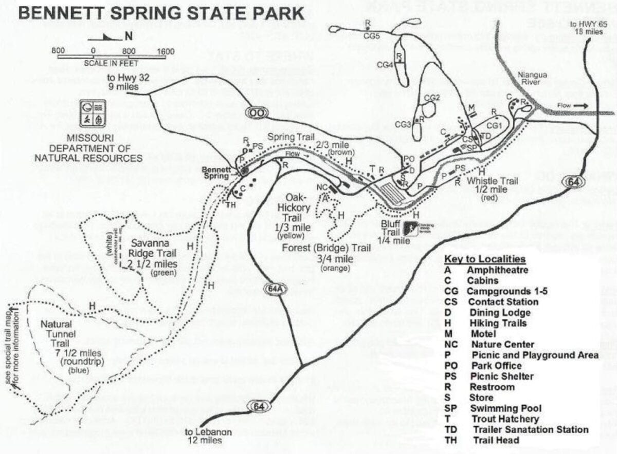
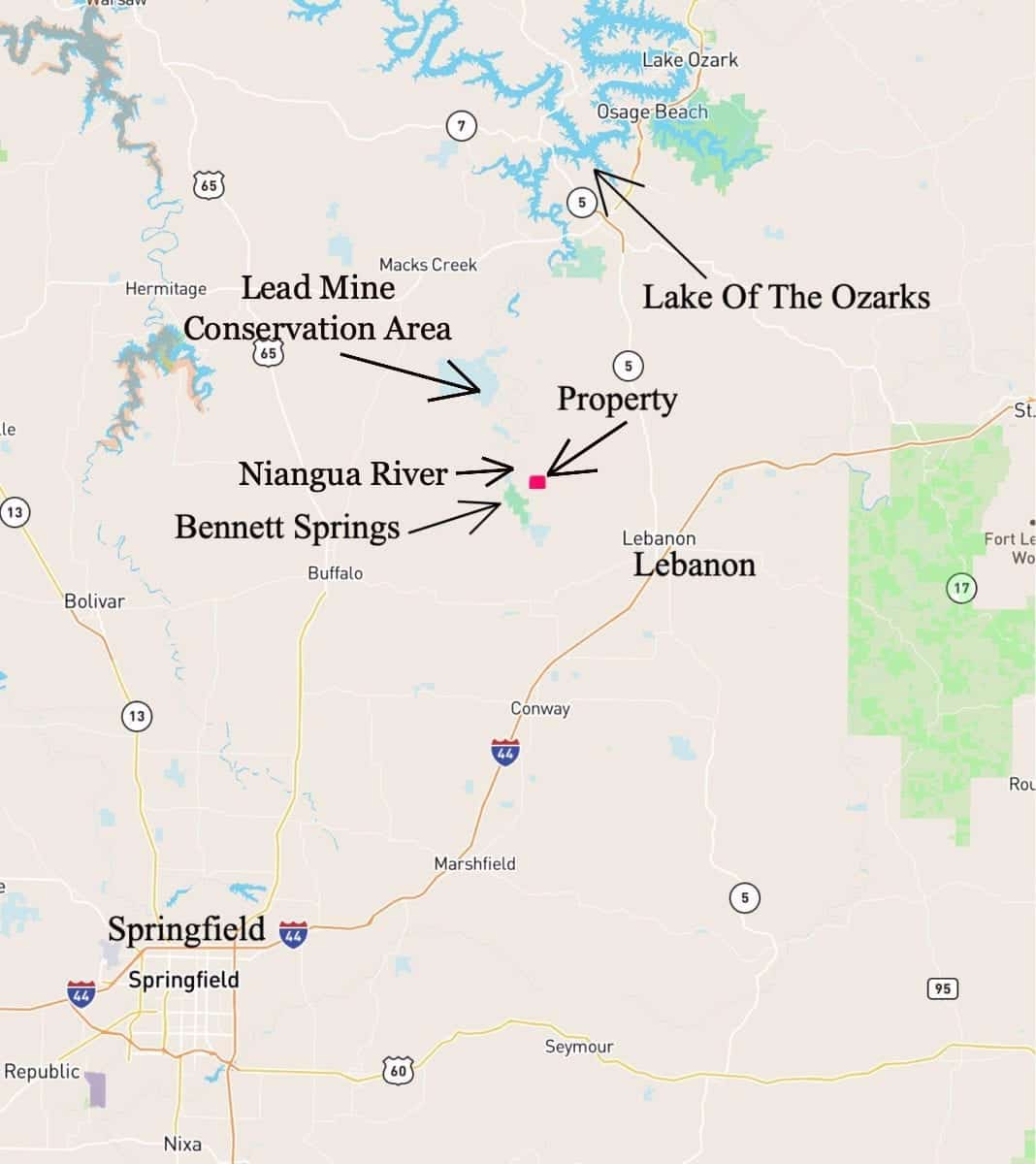
With the property being only a few miles from Bennett Springs State Park it is not only ideal for all sorts of uses but it is in an incredible location for enjoying it all year around. The Niangua River, which flows through Bennett Springs State Park, is rated as one of the best trout fishing rivers in the country! Also, this huge tract is only a few miles from the “Lead Mine Conservation Area” which is a 7,500 acre tract of land that is open for public hunting, fishing, camping, hiking, swimming and horseback riding. The Lead Mine Conservation Area is not labeled on the map below, but it is the large blue shaded area on the map, just to the north of Bennett Spring. The small blue shaded area between Bennett Spring and the Lead Mine Conservation Area is the “Barclay Conservation Area” which is another public area on the Niangua River (and also gives you additional land for hunting, hiking, swimming, fishing and more!

Click Here for more information on Bennett Spring State Park.

The gorgeous and popular Niangua River is ideal fir swimming, fishing, canoeing, kayaking and more! You will find numerous public access points to this beautiful river in this area.
Click Here for some info about the VERY popular Niangua River
The Lead Mine Conservation Area and Barclay Conservation Area offer a total of about 7,500 acres of additional land for hunting and recreation AND they both have excellent access points to the Niangua River.
Click Here for more information on the Lead Mine Conservation Area
Click Here for more information on the Barclay Conservation Area

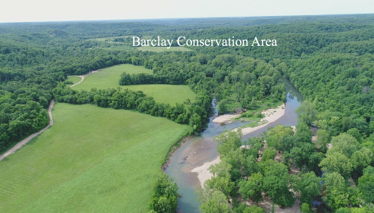
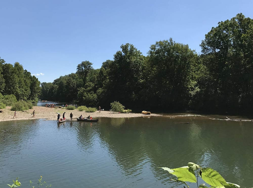
The photo above shows part of the Barclay Conservation Area which is just a few miles from Whitetail Ridge. The Barclay Conservation Area is just one of numerous public access points to the beautiful Niangua River. It has a sandy beach area as well as an excellent boat launch for canoes, kayaks and tubes (not shown in the photo above).
Whitetail Ridge South is the southern section of Whitetail Ridge. These tracts offer the easiest access and are also the closest tracts to power and phone (which are at the south side of Whitetail Ridge). This area is well known for large deer and numerous turkeys and you can expect to find both on or around your property.
Hunting, camping, building and recreation are just a few of the things you can do on your private acreage at Whitetail Ridge!
To watch a short drone video of a part of Whitetail Ridge, please click on the video below:
To see an “Intro Video” for Whitetail Ridge South, please click on the video below:

To watch a “Ground Video” where we drive into the south side of Whitetail Ridge, please click on the video below:
Excellent privacy as well as close to the Niangua River, Bennett Spring and thousands of acres of Public Land for additional hunting, trail riding, fishing and recreation, and all within about 15 miles of Lebanon, Missouri. These are rare tracts!

The hunting and wildlife watching opportunities in this area are EXCELLENT with a large population of white-tailed deer as well as wild turkey. These properties could also be suitable for building, homesteading, camping and recreation. Electric is already at the south end of Whitetail Ridge, should you ever need to have it run to your property (a utility easement is in place along the easement road).
The Tracts at Whitetail Ridge are sold through our partner company which is Regions Land Company. The sales process is the same as you see on the InstantAcres website, but the paperwork will shows Regions Land Company as the “seller”.
This Rural Development is located in one of the most popular areas of the Ozarks. “Whitetail Ridge” is located in western Laclede County, Missouri. This area has for many years been a destination for hunters, fishermen (and fisherwomen) and people who enjoy the privacy found in a rural area!
“Bennett Spring State Park” is located only about 3 miles from Whitetail Ridge and it is an amazing place to explore. You can fish for trout (or other fish), swim, canoe, kayak and more! They even offer camping and RV sites if you want to spend a few days there.


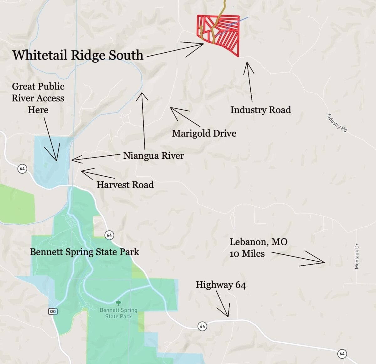
DIRECTIONS: To get to Whitetail Ridge from Lebanon, Missouri just go west on Highway 64 for about 10 miles to Bennett Springs State Park. Just BEFORE you cross the bridge over the Niangua River you go right (north) onto Harvest Road BUT the road sign may say “Marigold Drive”. Go a little over half a mile on Harvest Road/Marigold Drive and you will come to a “Y” in the road. Go left at the “Y” (you are now actually on Marigold Drive). Go north on Marigold Drive for about another 2 1/2 miles and you will come to a “T” in the road. Go right (east) at the “T” and you are now on “Industry Road”. You go a little less than 1/2 a mile on Industry Road and you will see Whitetail Ridge on the left side (north side) of the road. Go north onto the easement road (which should be labeled as “Mauka Drive”) and proceed to whichever tract you plan to visit.
There are actually several different ways to get to this property so feel free to explore!
Please be sure to print out the maps/directions from this listing page when you visit the property. We will be happy to email the maps to you if you would like. Please contact us before making the trip to the property as there may be a locked gate at the start of the easement road. We will be happy to provide you with the combo for the lock when you contact us.
The BEST way to explore the tracts would be to download the free “MapRight” app to your phone or tablet. Then, click on the upper left corner of the interactive map (within this page) that says “View Full Screen”. The map will then open up within the MapRight App and not only will you have the full map but there will ALSO be a colored dot to indicate approximately where you are. It is VERY helpful when driving to Whitetail Ridge the first time and it is VERY VERY helpful when looking at a specific property. For more information on the MapRight App/Link please view the video within the “Frequently Asked Questions” tab on the home page of our website.
Property near a major river or a popular State Park has been a wise investment for many years. As the demand for property in this area continues to grow, the values will continue to rise. Lock in your property now, while you still can!
Although these tracts are only about 10-15 miles from Lebanon, they are NOT subject to the zoning regulations that you will find in the immediate Lebanon area or the Springfield area! These tracts are within a Rural Development and do have basic property covenants BUT almost all of our buyers find that these covenants simply do NOT limit what they plan to do with their property!
Tracts 1-11 at Whitetail Ridge are “Premium Location Tracts” because of their visibility from the County Road. “Premium Location Tracts” can be used for building, camping, hunting and recreation. If you plan to live on your “Premium Location Tract” then your home or cabin must be at least 600 square feet on a continuous concrete foundation (slab, stem wall/crawl space/basement). Many of the people we talk to plan to build some type of home/cabin that would already meet this requirement (if they ever plan to build at all).
Tracts 12-41 are “Homesteader Friendly Tracts” and they can be used for building, camping, hunting and recreation. The difference in these tracts is that you are not required to build a 600 square foot home on a foundation if you plan to use the property as a residence. A portable building, shipping container or tiny home would work as a residence on a “Homesteader Friendly Tract”. Some people we talk to prefer this type of tract as it can give you a less expensive building alternative.
What can you do on your new “Premium Location Tract” at Whitetail Ridge?
On your “Premium Location Tract” (Tracts 1-11) at Whitetail Ridge you can:
- Hunt
- Camp
- Build a cabin or a home (on a “Premium Location Tract” it must have a 600 square foot concrete foundation if it is used as a residence)
- Live “off-grid”
- Have a large garden
- Have animals (no kennels greater than 5 dogs)
- There is no time limit to build (you never have to build)
- You can also camp for up to 90 days in a 12 month period if you choose to do so.
To see the full property covenants for the “Premium Location Tracts” please click on the link below:
Click here to see the Property Covenants for the “Premium Location Tracts” at Whitetail Ridge
What can you do on your new “Homestead Friendly Tract” at Whitetail Ridge?
On your “Homestead Friendly Tract” (Tracts 12-41) at Whitetail Ridge you can:
- Hunt
- Camp
- Build a cabin or a home of any size (no foundation required)
- Homestead
- Live “off-grid”
- Have a large garden
- Have animals (no kennels greater than 5 dogs)
- Although you are welcome to build a “traditional” home or cabin you may also live in a portable building, a tiny home, a shipping container home or even an RV or camper (as long as it is no more than 15 years old when moved onto the property).
- There is no time limit to build (you never have to build)
- You can also camp for up to 90 days in a 12 month period if you choose to do so.
To see the full property covenants for the “Homesteader Friendly Tracts” please click on the link below:
Click here to see the Property Covenants for the “Homesteader Friendly Tracts” at Whitetail Ridge
What can’t you do at Whitetail Ridge?
On your property at Whitetail Ridge you can not:
- No commercial businesses (other than a home business)
- No cutting of the timber until the property has been paid for in full (we can often make written exceptions for clearing a building site or driveway)
- No junkyards of any kind
All of the tracts at Whitetail Ridge have setback distances from the easement road(s) and county road. These setback areas are also designated utility easements so that all owners shall have the option of electric service. All buildings, homesites, parking areas, storage areas, etc. must be at least 100 feet from the center line of the easement road and county road (this area acts as a privacy setback as well as a utility easement).
Fences/gates may not be placed within 50 feet of the center line of the easement road(s) and county road, as this area is a designated road easement area. Although there is a 10 foot setback for building/storage from the sides and rear of each tract you CAN fence directly up to the sides and rear of each tract (so long as all fencing is at least 50 feet off any shared roadway).
These tracts represent an excellent opportunity for building your own home or cabin as there are no building permits required in this area! You and your friends/family can build your own cabin without permits or inspections.

To see an available tract at Whitetail Ridge, please click on one of the links under the map, toward the top of this page.